|
StormPursuit
Forecast Tools:
Pictures/Accounts:
Education:
The Rest:
|
|
2001 Chase Accounts |
|
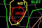
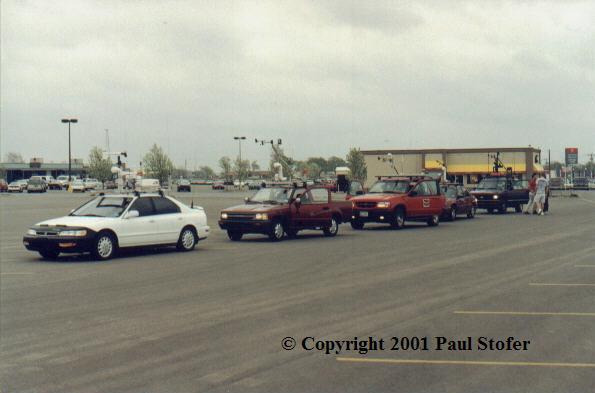
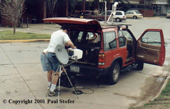
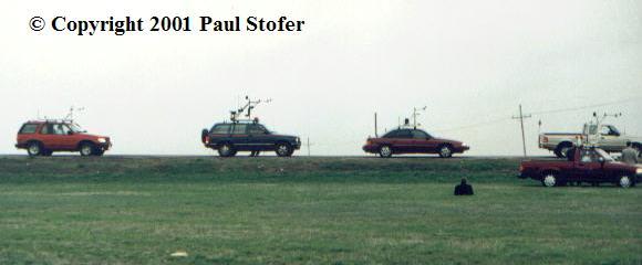
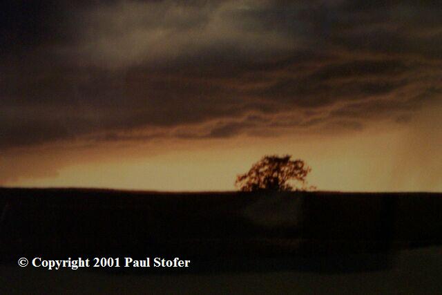
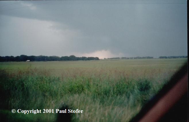
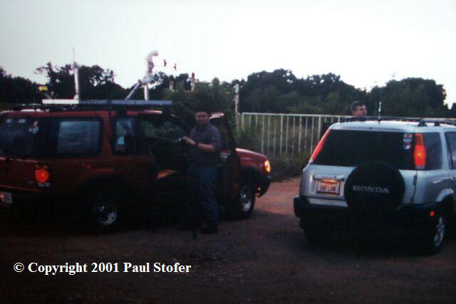
February 29th 2001 Today I went storm spotting in the Dallas area. I stayed local because this is where I live and its easy to just jump in the car as soon as something pops up. I jumped on the toll road and went North up to Collin County/Plano. The visibility was poor because of heavy rain and the car was being rocked around really bad due to strong winds. I think I must have hit a downburst or a really severe squall. I went East on Park road and then North on Preston. I saw some low clouds to my West so I hopped on West Parker Road and as I passed Plano West High School the sirens were set off. The sirens were set off most likely due to people being outside during activities and the straight-line winds. Up to two possible tornadoes were spawned from this storm, however I unfortunately didn't get to see any of them. It was my first preseason chase and it was an awesome one, however I regret to inform that even with the combining efforts of many other great storm spotters I have been told that 7 people in Mississippi had lost their lives due to this storm system. APRIL 6TH 2001 (FIRST ACTUAL CHASE) Well today, April 6, was interesting. The Day 3 outlook from 4 days ago had Oklahoma, Kansas and parts of Nebraska in a Slight Risk. Then on Friday April 6th, while we were heading towards Norman Oklahoma, it was upgraded to a HIGH-RISK situation. Strong winds, large hail and tornadoes were expected for this day. Light storms and rain was forecasted to hit the Dallas area around 00Z, but we figured Dallas wasn't going to get anything. It started out when I woke up from my home in Dallas on Friday the 6th at 5:45AM. I got ready, brushed my teeth, and packed my stuff. I met up 2 other chasers and we headed back to my house to park their truck in my driveway. Then we hit the roads about 7AM. We hopped on I-35 and headed north and proceeded to Norman. Just South of Newcastle OK off of Highway 3, we met up with 5 other chasers at a Loves truck stop. We then hit the roads and headed for Kansas. We went north through Oklahoma City then hit Highway 183 and went through El Reno, Kingfisher, Woodward, and went past the Oklahoma / Kansas border. When we hit Woodward we broke out the Satellite dish in a gas station to receive Weather Channel data. A crowd gathered around and in about 15 minutes it seemed as if the entire town came to pay us a visit. We had 4 police officers, a radio station DJ and many townspeople. Unfortunately the Satellite dish didn't work. We went on our way and headed to Meade county KS. We stopped at a library in Meade where we gathered climatic data. Chris Sokol and James Brinkley gathered most of the data for us while Craig, a chaser from Dallas whom we met on the way to Kansas, looked at the models. The CAPE was shooting out the roof; however, we would unfortunately find out that there was too much sheer which would kill our chances of seeing a tornado. Craig generously gave the library a donation and we went to go get lunch and top off our gas. While topping off, James enthusiastically flirted with local girls who then noticed he was a storm chaser and became ignorant to the upcoming weather event. We stopped at a farm and waited for a tornadic supercell to approach us. The farmer came up and knew who we were. He had a sad look on his face, he felt he was going to lose his farm. We sat and waited and watched the TV radar in James' truck. The storms were forming in a squall line that was moving NNE. We thought the storm wasn't good enough so we headed North and then west on Route 144. We tried to decide if we were going to go east and try to wait at Dodge City or stay in place. We went west to intercept a supercell... We had two supercells, one to the North and one to the South. So, we tried to squeeze between them so we could get to the SW of the cell, which was the South Cell. We stopped on 144 and noticed that the sky was REALLY green so we tried to decide if we were going to continue and chance a major hail event or turn around and race parallel to the supercell. We decided to turn around and we raced it. Unfortunately we got sideswiped by a High Precipitation (HP) supercell and had to slam on our brakes and ride it out. Debris got thrown around us while we got pelted by tumbleweed, quarter inch hail, 67 mile an hour winds, and HEAVY rains. We saw a tin or aluminum roof from a farm or barn get thrown across the street, and somewhat reasonable debris get thrown across the street in front of us. Trees were even bending to where they were almost bending horizontal! The surface winds that day were at a harsh 30-MPH. We tried to creep down the street as Cloud-to-Ground lightning was hitting everywhere. I later noticed that dirt was buried into the paint of my car and I have very little hail damage to my car. I was quite surprised! We finally got out of the storm and stopped at a gas station to grab a bite to eat and then head home. We talked on the hams on the way back to Norman. Wow, I thought to myself. My first chase was a high-risk day. I guess you could consider today a bust because we didn't officially see a tornado; however, it will be a chase that I will never forget. Pictures and Data from the
Chase
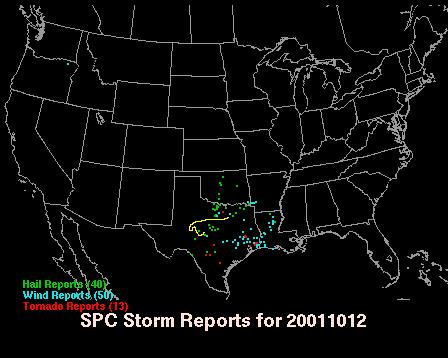
MAY 29TH 2001 Today I chased with Kelley Mantia in the Texas Panhandle. There was a moderate risk out this day and we had expected that a high risk would have been issued within the hatched area. We mostly hung around the Wichita Falls area but we did head about 50 or so miles further West North West of that area. Tornadoes and nice wedges were reported today near the Amarillo area. Some chasers had seen up to 4 tornadoes, at one point up to half a mile wide! We drove for nearly 6 hours and hit some nice rain and got a good CG lightning show, but we busted. Even though we busted, I still had a great time! October 12th,
2001
|