|
StormPursuit
Forecast Tools:
Pictures/Accounts:
Education:
The Rest:
|

|
2003 Chase Accounts |
|
|
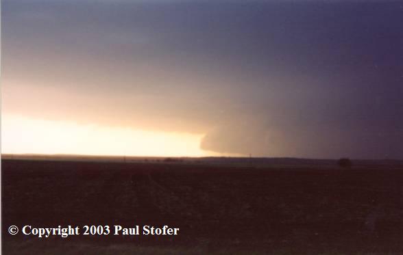
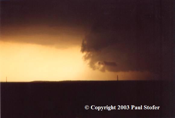
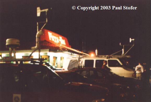
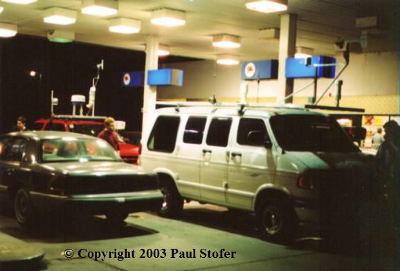
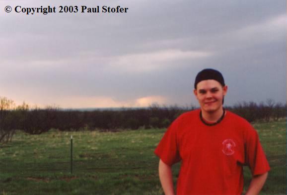
April 5th 2003 It's 11AM and I woke up to take a final look at the Day 1. The SPC had hatched off an area in West Texas. Chances of an F2-F5 tornado were around 20% along with the given chances of large hail and damaging winds. The SPC had also centered its moderate risk around this area. I made the decision that Throckmorton, TX would be my target area. At 11:30AM my chase buddy and navigator Kevin Sims came over. We made final preparations to the car and the camera equipment. At 11:45 we hit the roads and headed towards Throckmorton. We jumped on 635 and headed West, then got on I35 and went South. Eventually we hit I20 and went West. Then we went North and got on 380. About this time the first Tornado Warning had been issued for Fisher County. The storm was Northwest of us and moving East. We were about 10 minutes from the Jones / Haskell line and were hauling North to intercept the storm in time. Finally we hit Haskell just South of Throckmorton when the second Tornado Warning was issued for the Southwest Haskell / Jones county line. With the storm moving due East and us being on the Southeast side of the Haskell County line, we had to decide whether we were going to punch the storm and risk driving into baseball sized hail, or go back South a ways and let the storm pass in front of us. While we were deciding, we were parked on the side of the highway watching the storm move closer. At this time we could see the wall cloud and a possible roping-stage funnel through the rain / hail shaft. We did debate; however, whether we thought it truly was a funnel, or just scud because the "funnel" was at such a far distance. Clocking 25 MPH inflow winds, I decided we should head South a bit. I hoped that we would be able to view some nice structure while being on the "safe side" of the storm. We headed South, and ended up parking on the side of the highway observing the storm with a few other chasers and a couple TV media crews. The structure by now was awesome! While standing in the 43 MPH inflow jet we observed a rock solid wall cloud and updraft. We decided the storm was getting very close so we moved South and watched the wallcloud disorganize and disappear into the hail and rain shaft. Being in communication with the National Weather Service, the group headed East hoping more storms would fire up along the line. Taking 287 East we ran into an area of golf ball to baseball sized hail. The group was talking and hanging back so Kevin and I decided we were going to keep moving. We broke up from the group and took Highway 16 through Graford towards Mineral Wells. Storms never did fire up, but the Dallas area did get the remains of the storms we had chased. On Highway 16, we met up with Eric Nguyen who was observing a large bird; possibly a pelican, that had been hit by hail and fell to it's death. We all ended the day by going to a Pizza Hut for dinner and heading home with some really cool pictures and watching a great lightning show...
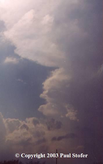
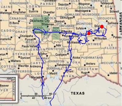
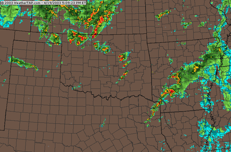
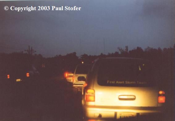
April 19th 2003 Moderate Risk issued for today. Left the house around 12PM with my friend and chase buddy for the day, J.J.. We went North on I35 and really tried to get North fast because I knew we had left a little later than we should have. We passed through Denton, then Ardmore and eventually got up to the Norman area. When we got to Norman we hit Highway 9E and hauled East. We could see an awesome storm exploding just to our East and it had a really nice anvil on it. It looked impressive and quite promising. We drove on 9E for quite awhile, probably close to 45 minutes then hit I69. We finally got to the HP cell and ended up punching it. We went South on 69 thinking maybe it would give us more East options. While on 69 the NWS had issued a Tornado Warning for our county right near where we were. On 69 in McAlester we got hit by what we believe to be RFD. We got some really strong winds, and we ended up driving by 2 motorists who were up in the top of some girders of an overpass for some reason. Since everything was HP we couldn't see what the heck it was, but we turned around and went North on 69 in hopes to catch up with it anyway. We figured the day was over until I checked out the TV and watched the local TV radar. We got back on 9E and went East further towards Haskell County, and thats when the sirens began to go off. In Haskell, we sat on the side of the road and watched a rotating lowering, or the more popular belief of scud to peek it's way through a lowering and rain / hail shaft. Most likely it was the same storm that had hit McAlester earlier, just moving NorthEast. At the time I had thought it was a funnel because of it's nice rotation and rope shape lowering from the cloud. It got real close and we ended up only having 1 escape route...to turn around and go the opposite way being chased by this stuff. We turned around and drove a little further and watched the lowering go back up into the cloud base. Unfortunately I didn't get any pictures, just video. We went through Stigler. About this time it was dark and we couldn't see much. Lightning lit up our second possible wall cloud, which I am sure of because I myself could see a definate wall cloud. It too, had a Tornado Warning issued on it as we started chasing it. We went South on 82, then West on 31 then back North on Highway 2. Then, my parter and the rest of the "EM" guys said they saw debris. So it was either a funnel with a wall cloud, scud, or possible tornado. I began to see power flashes that weren't associated with lightning so I started to wonder. It was night time, so I suppose it could have been anything. Theory is, it too, was scud. I haven't heard of many damage reports from that area, so I wouldn't disagree. It could have very well been scud. I was driving through rain and keeping my eyes on the road, so I unfortunately couldn't get a good look at that storm either. The sirens went off and we went North a little more. Unfortunately, something happened where we ended up in the direct path of another tornado warning. I'm still confused about what the hell happend. All of us wern't even sure if there was a tornado but the NWS seemed confident with their radar and the sirens we're going off and we were in the direct path. So, we all got out of our cars to be safe and attempted to get into a locked building. With that not successful, we stood in the rain trying to figure out what we were going to do. We started to get heavy rain, then small pea-sized hail, and then really strong winds. Suddenly the winds shifted and went the exact opposite direction. It was pretty cool. After that, I felt I had enough for one day! We went West on Highway 9, and back South on I69 through McAlester until we hit I75. Chase day ended, with nothing but scud and a possible wall cloud or possible funnel with a less likely tornado. Remember: Oklahoma EMERGENCY MANAGEMENT claimed it was a tornado. So thats what I base the "tornado" off of. *Possible Video Caps added soon*
CHASE SEASON ENDS:
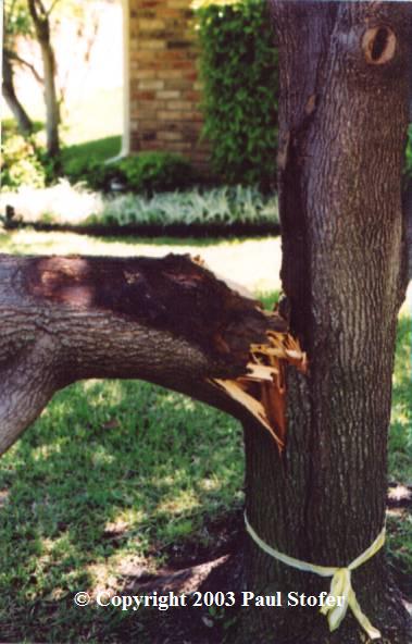
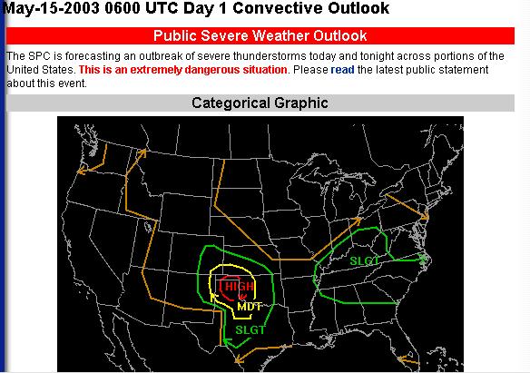
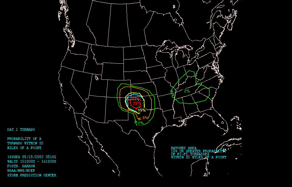
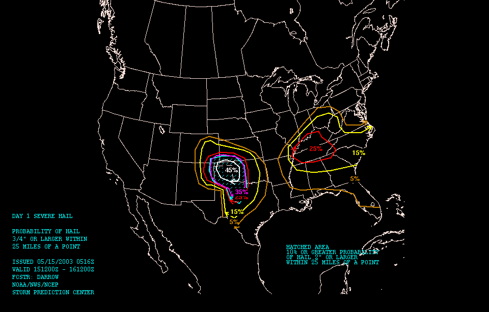
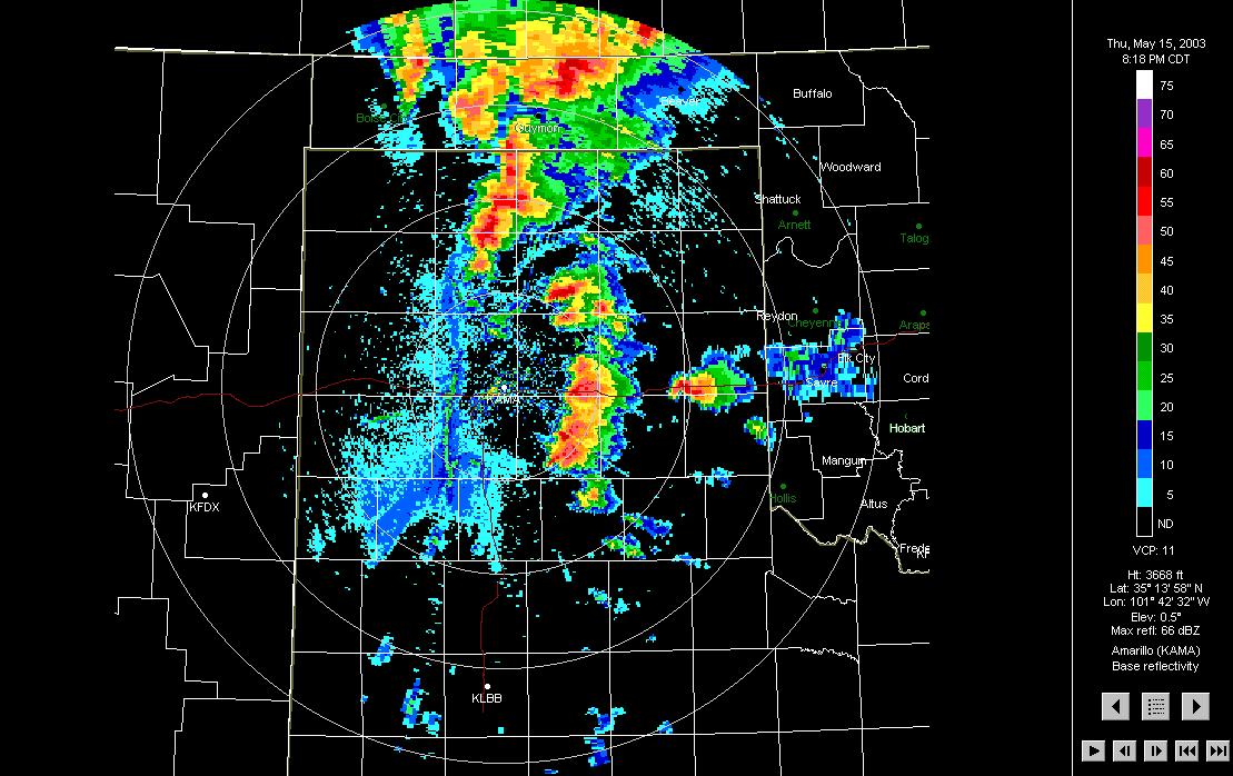
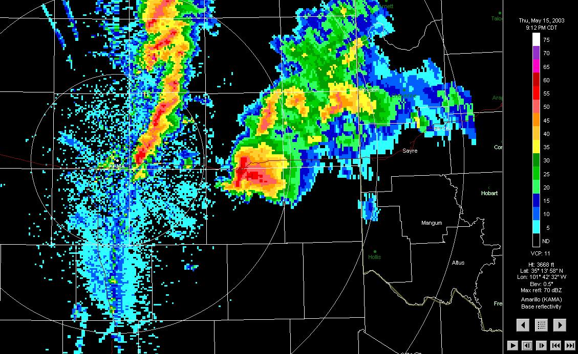
THURSDAY MAY 15TH, 10:30PM CDT
|