|
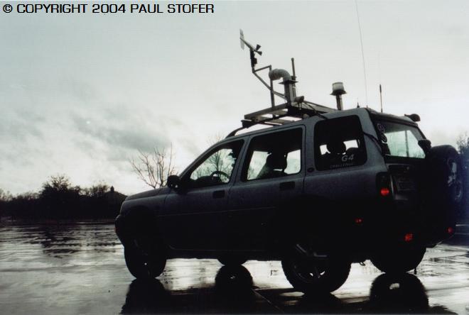
StormPursuit
Forecast Tools:
Pictures/Accounts:
Education:
The Rest:
|

|
2004 Chase Accounts |
|
|
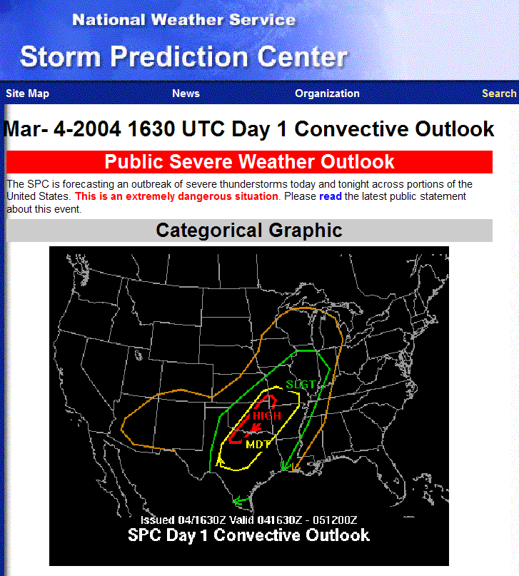
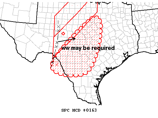
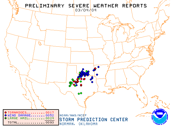
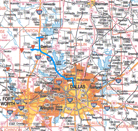
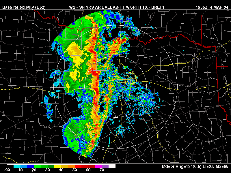
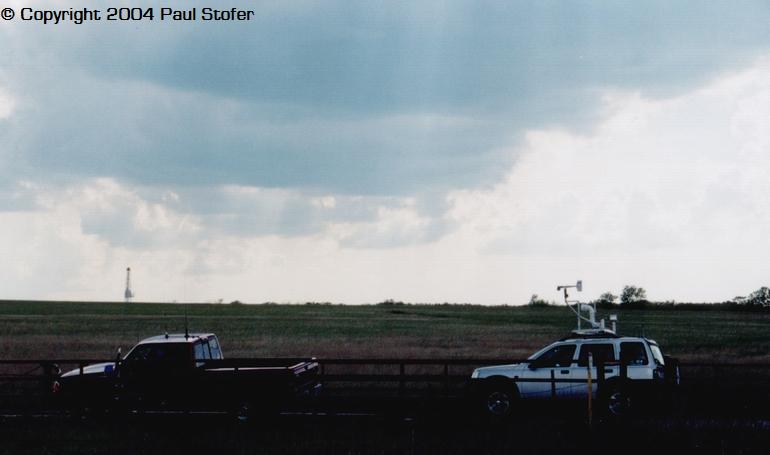
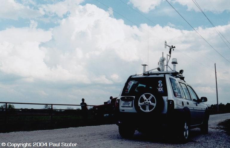
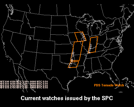
MARCH 4, 2004 Who said storm season had to begin on the first day of spring? Today's pre-spring chase was just a taste of hopefully what a successful season it will be later on this year. Today I woke up around 10AM and saw that the Storm Prediction Center had upgraded today's moderate risk to a HIGH RISK. I figured that it being early March, that the event would probably go linear really quick and the supercell's would mostly be embedded within the squall line. I knew that pretty much any supercell that would develop would quickly go HP. I did some looking at the computer models, radar, and SPC data, then I decided my best spot would be just South of, or on the Southern end of the high risk zone. The SPC had issued a PDS Tornado Watch earlier in the morning and around 11:30AM I put the weather station and equipment on the car and headed North. I jumped on I190 and hustled West to 35. I went North on 35 and continued to check the radar on the computer and figured a good spot to sit would be around the Krum, TX area in Denton County. I got up to Krum and exited the highway and watched the storms move in. I was just about to exit my vehicle and take some pictures when a huge gust of wind hit my car and a Tornado Warning was issued for Denton County. At this time I began clocking 40 mile per hour surface inflow winds and saw the lowering and core just to my West-South-West. With help from a nowcaster and gathering data off the computer I figured I was in what would soon be the damage path so I dove south on I35 and watched the lowering cross the road. About this time I began to get bombarded with strong winds which I would be associated with a downburst or straight line winds and heavy rain. Unfortunately since I was mobile, I was unable to get a wind speed or take any pictures; however, the rain was such I couldn't see 20 feet in front of my car. I had power lines blow and begin to arch in front of my vehicle, so I knew the winds were really bad. At that time I checked into the Dallas County RACES net and began to call in my wind and power line reports. When I got home, I found out that a tornado had dropped right where I was in Krum, and caused a lot of damage to homes and overturned a lot of semi-trailers on the highway. It was a crazy day, and I pretty much expected it to end up the way it did. Today was just HP tornadic storms ahead of the squall line, but hopefully this is just the precursor to an excellent storm season!
Pictures and Computer Data From the Chase
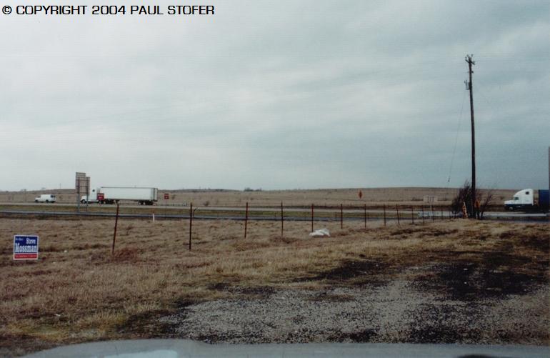
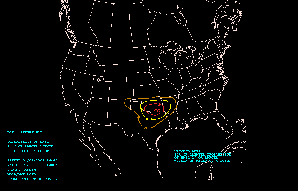
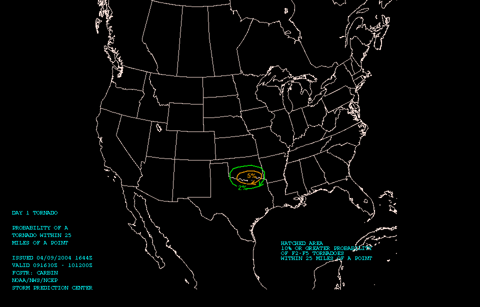
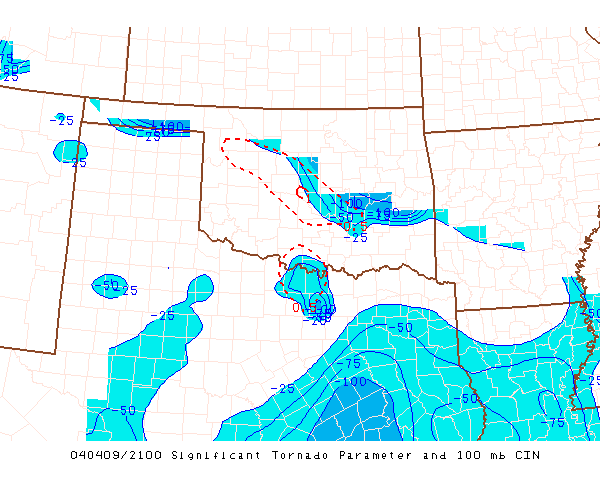
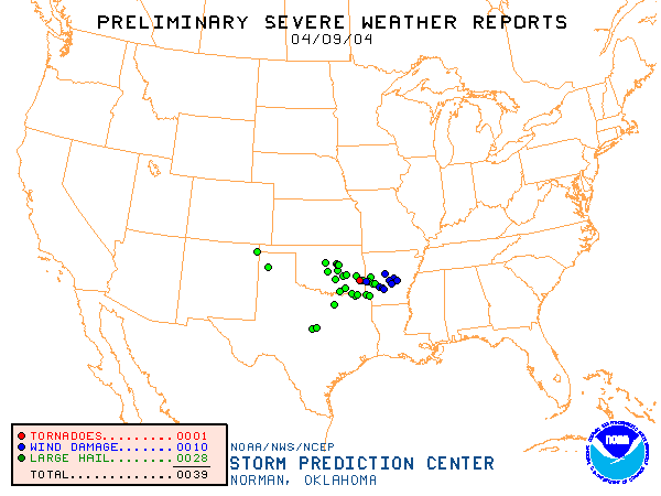
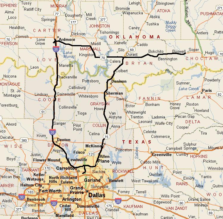
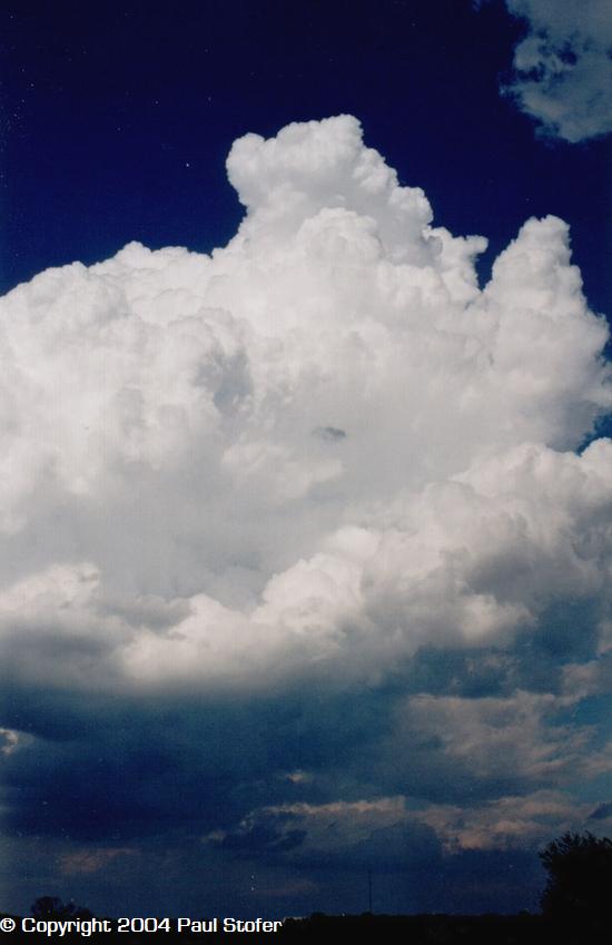
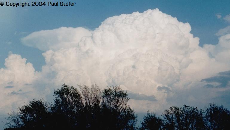
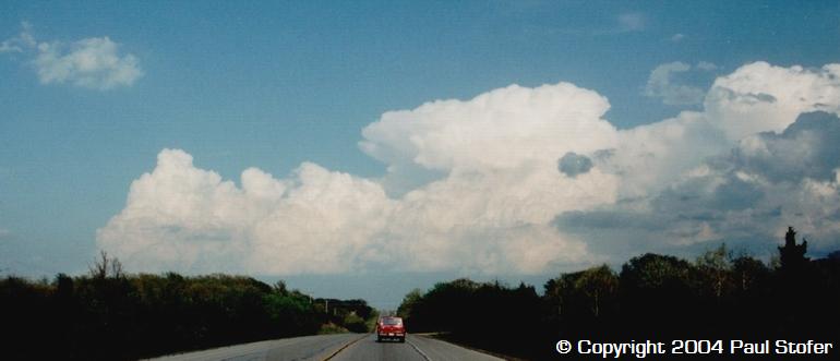
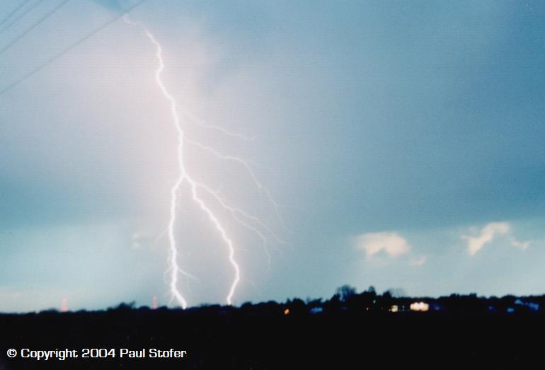
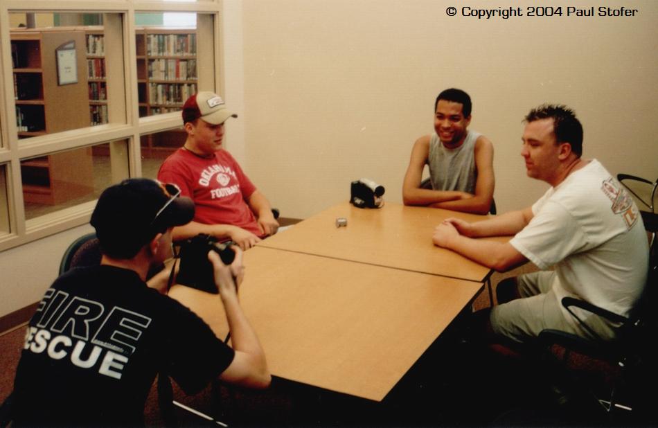
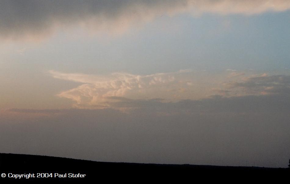
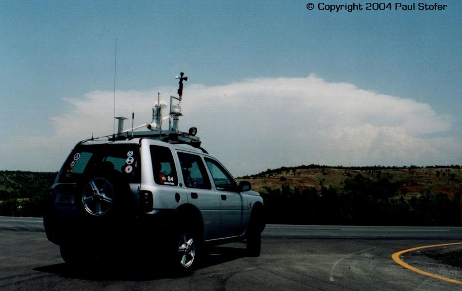
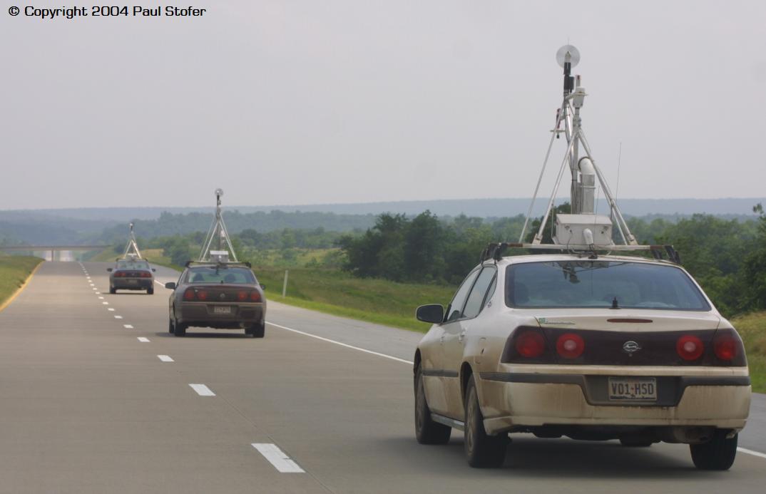
APRIL 9, 2004 Today the models showed that the best action would be in Southern Oklahoma. Today was only a slight risk but most of Southern Oklahoma was hatched in a 5% chance for tornadoes. After debating whether or not the target area was going to be McAllister, OK or Ardmore, OK my chase partner Tim and I finally made up our minds. We left Dallas around 0530Z and headed towards Ardmore, Oklahoma. We jumped on 190 and went West until we got to I35 then drove 35 all the way to Ardmore. When we got to Ardmore we stopped at a Loves truck stop to fuel up and met up with storm chasers Eric Nguyen, Scott Currens, and Charles Edwards. After fueling up Eric and Scott left and went their own way and we stayed and looked at Charles' XM radar. We felt this would be a good spot because we could stay and look at the data while having options on which direction to go. After realizing that today could very well be a bust Charles, Tim and I left and went West on highway 70 to take some cloud / structure pictures and time lapse video. We then noticed that storms were firing up to our East and eventually a Tornado Warning was issued for McAllister, OK. After I kicked myself for not going to McAllister we all jumped in our cars and headed East on 70 viewing some awesome structure as the Supercell in front of us continued to gather strength and gain a corkscrew shape indicating that it did indeed have rotation in it. As we traveled East we passed through Silo, Durant, Bokchito and ended up near Boswell where we saw some lowering and rotating scud / very disorganized funnel. According to other chasers who were in front of us this would later turn into a rapidly rotating funnel; however, our group ended up punching the storm and losing a visual on it trying to get to the other side. While punching we encountered some strong winds, lightning and nickel to quarter sized hail. Realizing that it was getting late, that the storm was losing strength and that the chase-day was over anyway we all chose to head home with some great pictures and some good video. On the way home we encountered rain, an awesome lightning show and some beautiful structure! This was a good day, especially for early April. It is beginning to look like the rest of the season could be great! Pictures and Computer Data From the Chase
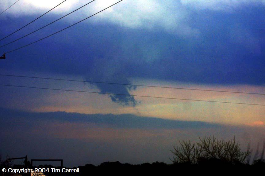
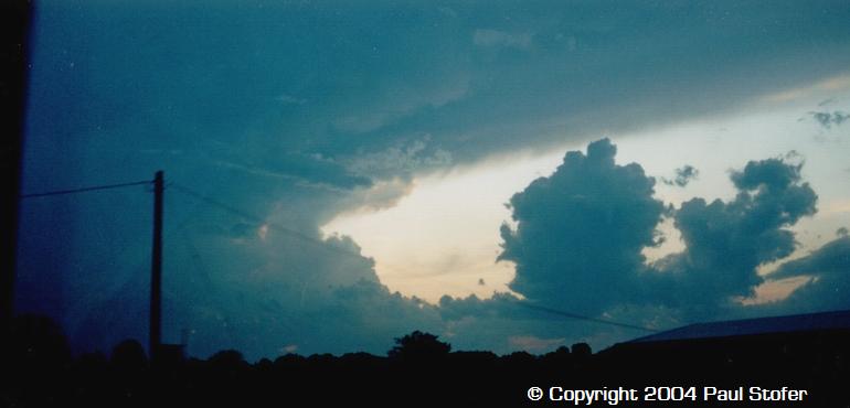
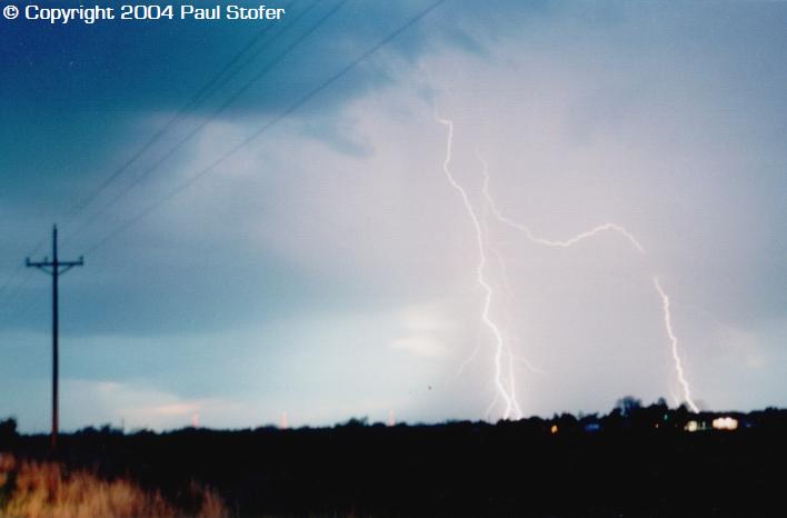
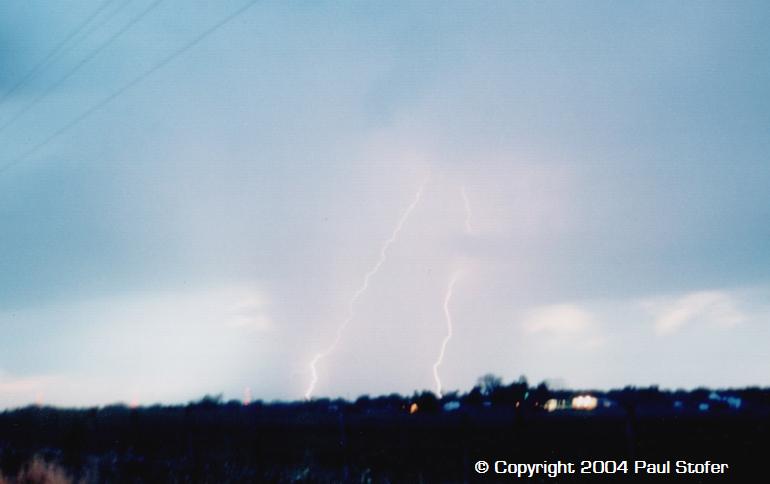
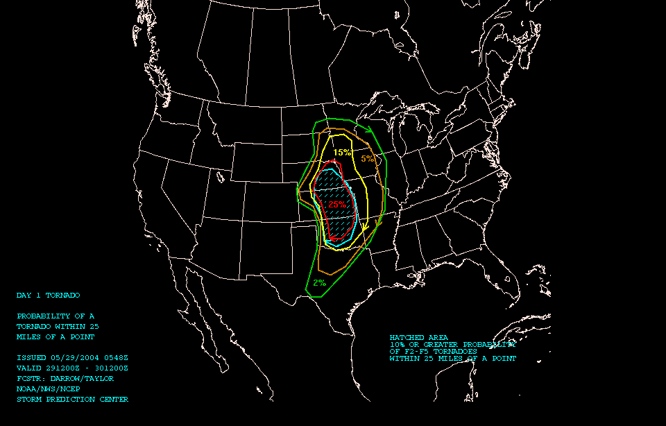
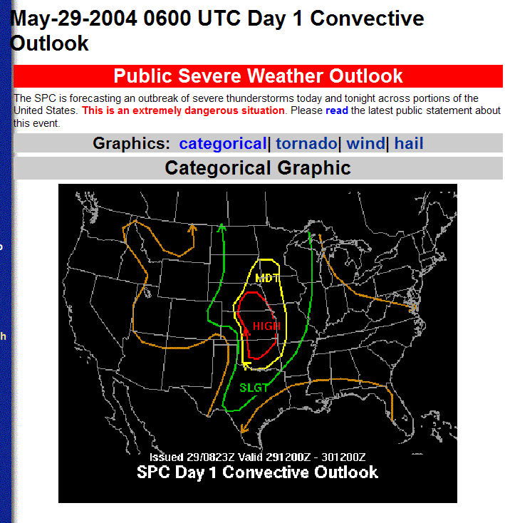
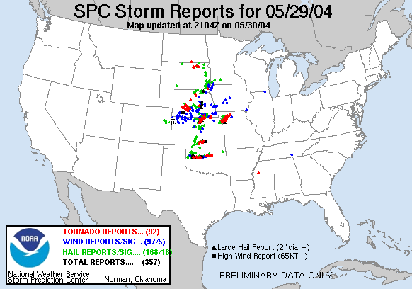
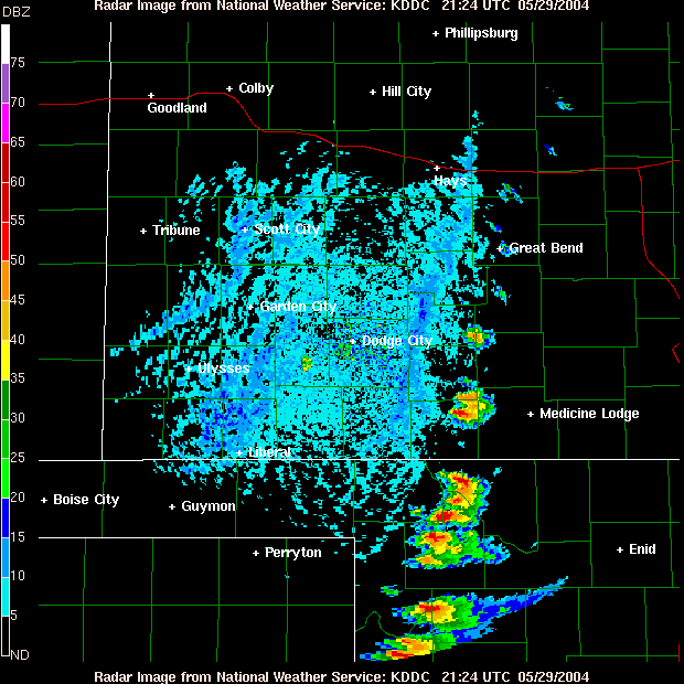
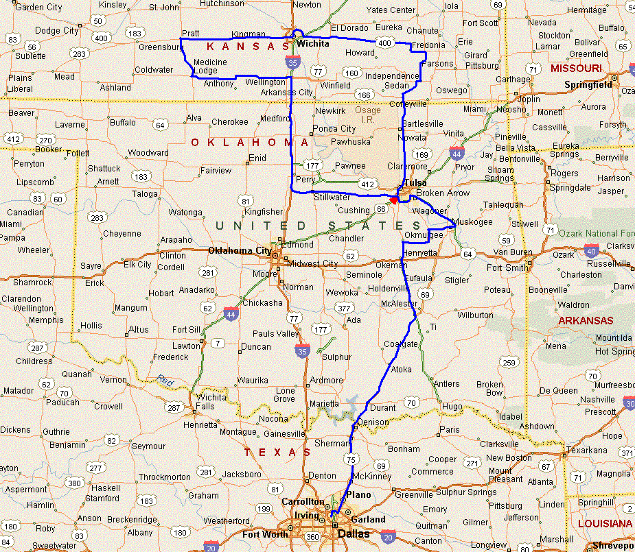
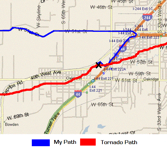
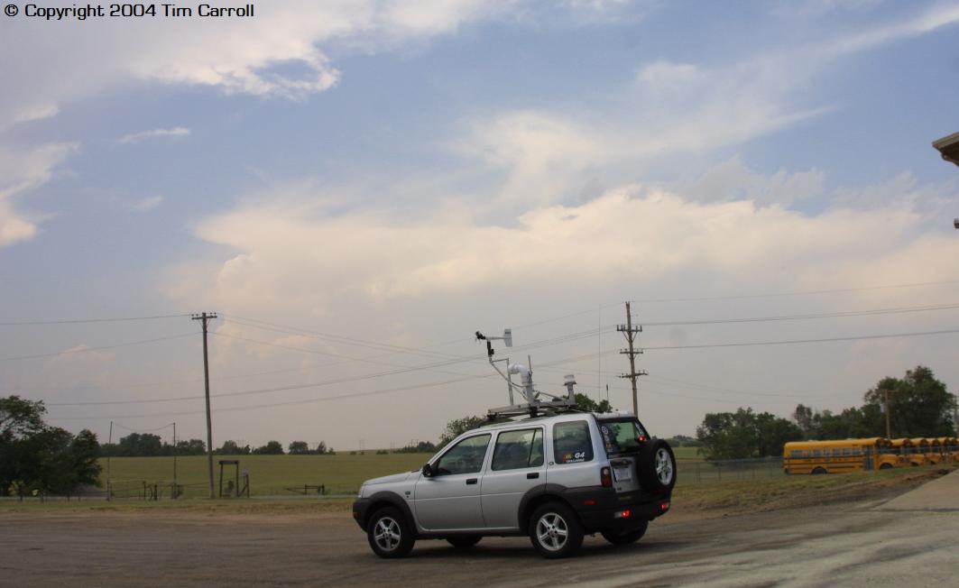
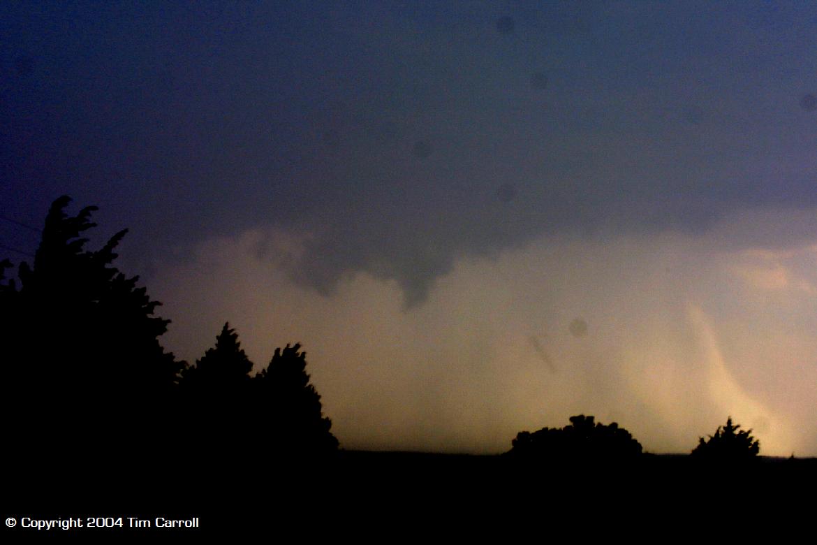
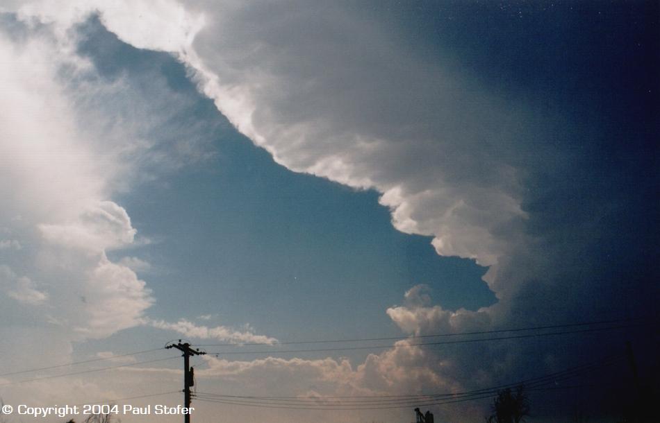
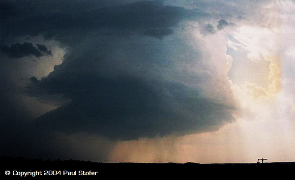
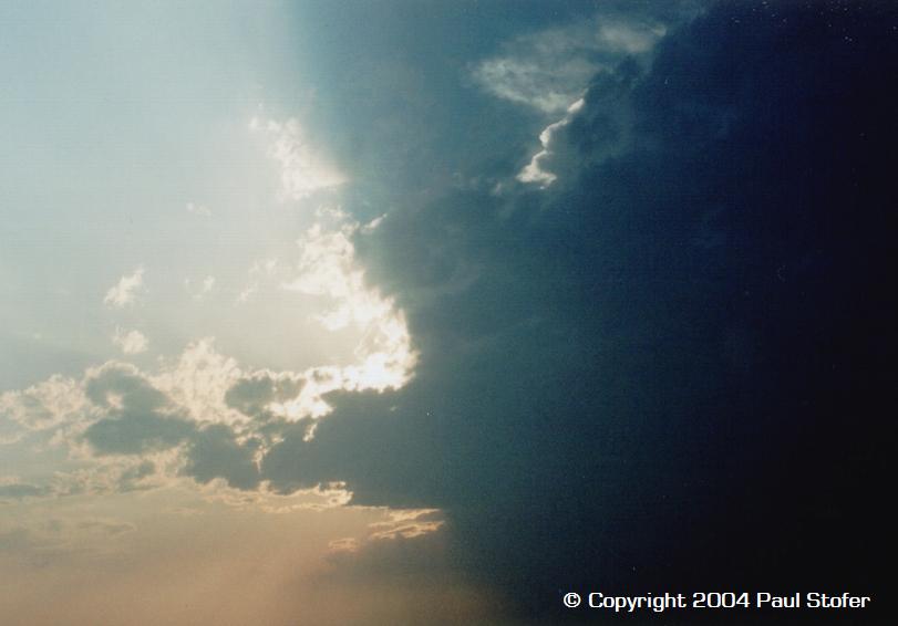
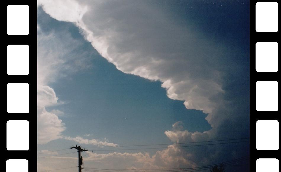
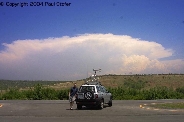
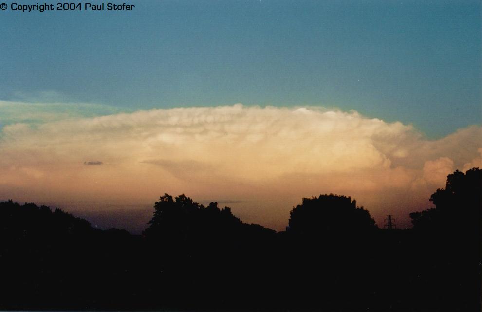
MAY 29, 2004 Today's chase actually somewhat started yesterday, Friday May 28th as we headed to a half-way rest point in Oklahoma. Friday the SPC decided to hatch our target area in a moderate risk. My chase partner Tim and I decided we would head out right after I got off work around 7PM and drive half way to our target area, Pratt Kansas, then stay the night, so our rest spot was Tulsa. We got in Tulsa and stayed up for awhile checking models and stuff when we found out that the SPC had upgraded the risk for Saturday to a high risk. After getting excited, knowing tomorrow would be a big outbreak we eventually got ready for the next day and went to sleep. Tim and I woke up around 6AM, and mounted the video camera to the dash, connected the laptop to the power inverter and got the camcorder / TV display connected and wired. Soon after wiring the car we took some amazing pre-chase sunrise pictures. Finally, At 7AM we headed out to our target area, around Pratt, Kansas. We left the motel and jumped on I44 until we hit 64 and then drove East until we hit 75 on the North part of Downtown Tulsa. We drove 75 North and passed through Bartlesville and eventually crossed the border into Kansas. We took 35 all the way to Wichita where we and a few other chasers stopped at the public library to grab some weather data off their high speed internet connections. Around 2PM we left Wichita and decided to go a little further West until we passed through Kingman and eventually ended up in Pratt. Again, we stopped in Pratt and went to the public library to gather a little more information. While sitting in Pratt, I clocked 40MPH surface winds. Driving down the highway was difficult because we got rocked around pretty good. We got some lunch and sat in Pratt waiting for some clouds to show up. We realized that the dryline had moved a little bit further East than we had thought so we began to consider driving a little further Southeast. Eventually around 4PM we noticed some TCU's starting to form to our South so we drove Southeast. Eventually we ended up in Medicine Lodge, KS in a parking lot watching 3 separate cells intensify. While in the parking lot I jumped on the laptop and grabbed some radar images and 2 of the cells died. The NWS issued a Severe T-Storm warning on one cell so that was the one we went after. We eventually got on 160 and went a little West passing a couple other chasers and we pulled off onto some small "bob's road" dirt hill and took some pictures of an absolutely amazing anti-cyclonic rotating LP supercell with a wall cloud and funnel. Eventually the storm went HP-ish and began to drop some small pea sized hail where we were so we left the area quick. We eventually got some penny sized hail and strong winds and then we drove East on 160 and passed chaser Eric Nguyen who was going to try get around to the other side of the storm. By this time it was 5:30PM and still, not a single tornado warning had been issued. I'm not fond of chasing in the dark, so Tim and I decided we were going to make the 5.5 hour trek back to Tulsa. About halfway back to Tulsa we turned on NOAA which was broadcasting that a "Very large and destructive wedge tornado" was on the ground around Argonia which was right where we left from. After kicking ourselves in the butt, Tim and I exited I35 at 51 and moved East back towards Tulsa. We passed through Stillwater and Yale and about this time NOAA issued a Tornado Warning for Cleveland and Oklahoma county. A tornado was moving through Edmond, Oklahoma moving NE along 44. Tim and I knew that if we didn't hustle this storm would be on us very quick so we raced it all the way to Tulsa. Eventually we made it to our Motel off of 44 and my girlfriend Leslie was waiting for us at the room. Earlier I had called her to tell her to stay there because a possible tornado was heading that way. When we got to the room we looked on TV and the Tornado was about 10 miles away but closing in on our location. I discussed with Tim about us possibly making an escape going South but we agreed that since we were in a building rather than a car, we would rather take our chances in a building compared to a car. About 12:50AM the tornado was very close and rain started to pick up. I went to the backside of the motel and stood on the walkway upstairs (we had an upstairs room) and looked out on the horizon towards the SW. I began to see power flashes in the distance and I began to get a little nervous. I got Leslie and showed her the flashes. Tim was back in the room watching the radar so I ran back to the room. The tornado was now on a direct path to hit us head on. I ran downstairs to ask management what their policy was on tornado preparation and they pretty much had none. I was very disappointed in the lack of care or preparation this place had. One of the employees even said "The tornado is going to pass to our south, your a chaser, you should know that." I told him, I know that this tornado is not moving left or right but progressively getting bigger and the power flashes closer, and the radar is showing that it is getting closer so I know we're in trouble. He blew me off so I walked away. The motel employee's were complete idiots. I ran back upstairs to my room and the tornado was now just a couple miles away. I tried to comfort Leslie as much as I could while Tim stayed fixated listening to the spotters on the radio and watching the radar. I went out and stood on the walkway and looked out to the NE and began to notice that leaves and other little light objects were falling from the sky. There were no trees around and I was on the highest floor, so this was really beginning to get eerie. I walked back to the other side of the motel and looked towards the SW again and noticed that the power flashes were more constant and very bright and very close so I knew we were in trouble. I went back to the room and looked at the radar and it was almost on us. At this time the spotters were saying over the radio that there was debris in the air and it was almost at 49th street and the 44 Turner Turnpike which was the intersection we were at. As soon as they said those words the sirens sounded and I grabbed Leslie's hand and said we need to go, now! I led her downstairs and we found a man who let us take shelter in his downstairs room. We went inside and took shelter in the bathroom; however, me being curious went and watched the radar on his TV. Eventually we noticed that the tornado had jumped over our motel which would have been a direct hit and then dropped back down across the turnpike. We realized how lucky we were and went outside and saw a HUGE, what looked like an almost half-mile wide tornado less than 1/4 of a mile away from us. It was now 1AM and the tornado was being lit up by lightning and power flashes. It was the most eerie thing I have seen in my life because not only of the massive size it was, but because it was rain wrapped and had rain bands getting sucked into it, which gave it a smooth blurry wedge shape while clouds were rotating violently around it. I knew we were safe because the winds had shifted and it was now NE of us moving NE and the rain had stopped. I went to the room we were all taking shelter in and let everyone know if they wanted to see the tornado to come out and look at it. Almost everyone saw it, and they found it to be amazing. We realized that we were incredibly lucky because if it had touched down and passed through our motel, it would have severely damaged if not destroyed it and most likely killed all of us. I've seen the storm reports for this tornado, but have not yet heard about the rating of the tornado. Leslie, Tim and I went back to our room upstairs and looked at the radar and we're very relieved about the close call. Unfortunately I didn't get any video because my camcorder was mounted to the dash of my car, and I didn't get any stills because my camera was in the room and we were more worried about taking shelter than getting photographs. Plus, it was night-time so the still camera probably wouldn't have worked all too great. Afterwards I began to think and hope that the hotel management person who told me the tornado was going to miss us, felt like a complete idiot. After a couple hours, we all got to sleep and the next morning Tim and I went back to Dallas and on our way back we went out and observed storm damage. We saw some trees were uprooted, but that was about it, because it passed through rural Tulsa county. Today we observed at least 2 funnels, an awesome anti-cyclonic LP supercell and 1 tornado! What a crazy day! Pictures and Computer Data From the Chase
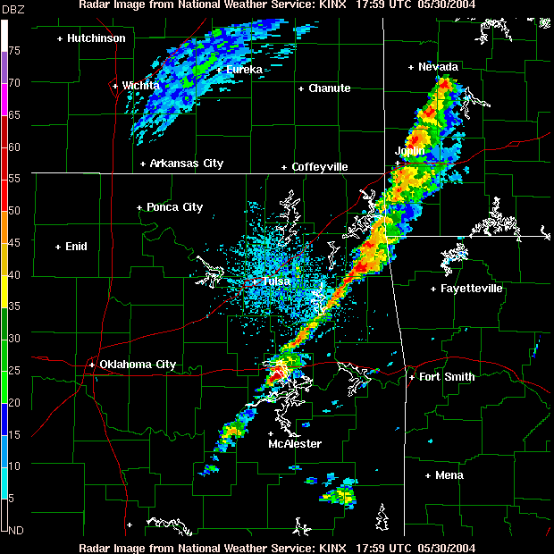
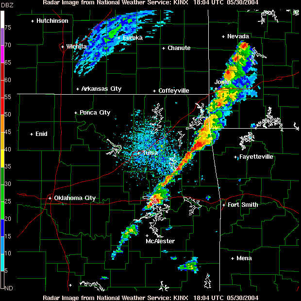
MAY 30, 2004 Today's "chase" was more of a quasi-chase. We left Tulsa around 1:00PM to head back towards the Dallas area. We jumped on the Indian Nation Turnpike and headed South. We began to notice that storms we're rapidly firing in front of us (South). We ended up continuing Southeast into far East Oklahoma / West Arkansas. Yes, the hills get more abundant... About this time we ran into some chasers from Texas Tech. We were watching some amazing structure form so I parked the car and we took some stills real quick. While photographing, NOAA issued a tornado warning for the cell we were shooting so we jumped on it. While heading towards the cell, I got on the internet and looked at the radar and saw a very small couplet. We realized that with the speed the storm was moving and the distance that it was from us, we would not have enough time to intercept it before it decayed. We also noticed that the storms looked like they were forming into a squall. Eventually, it did squall and we came to the conclusion that it wouldn't amount to much. After driving through a brief lightning show, some heavy rain and small pea sized hail we called it an afternoon. We arrived back in the Dallas area around 6:30PM... Pictures and Data from the Chase
This page is the
Copyrighted material of Paul Stofer |