|
StormPursuit
Forecast Tools:
Pictures/Accounts:
Education:
The Rest:
|

|
2005 Chase Accounts |
|||
|
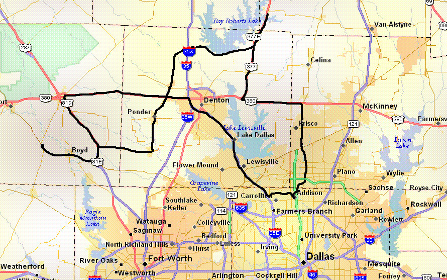
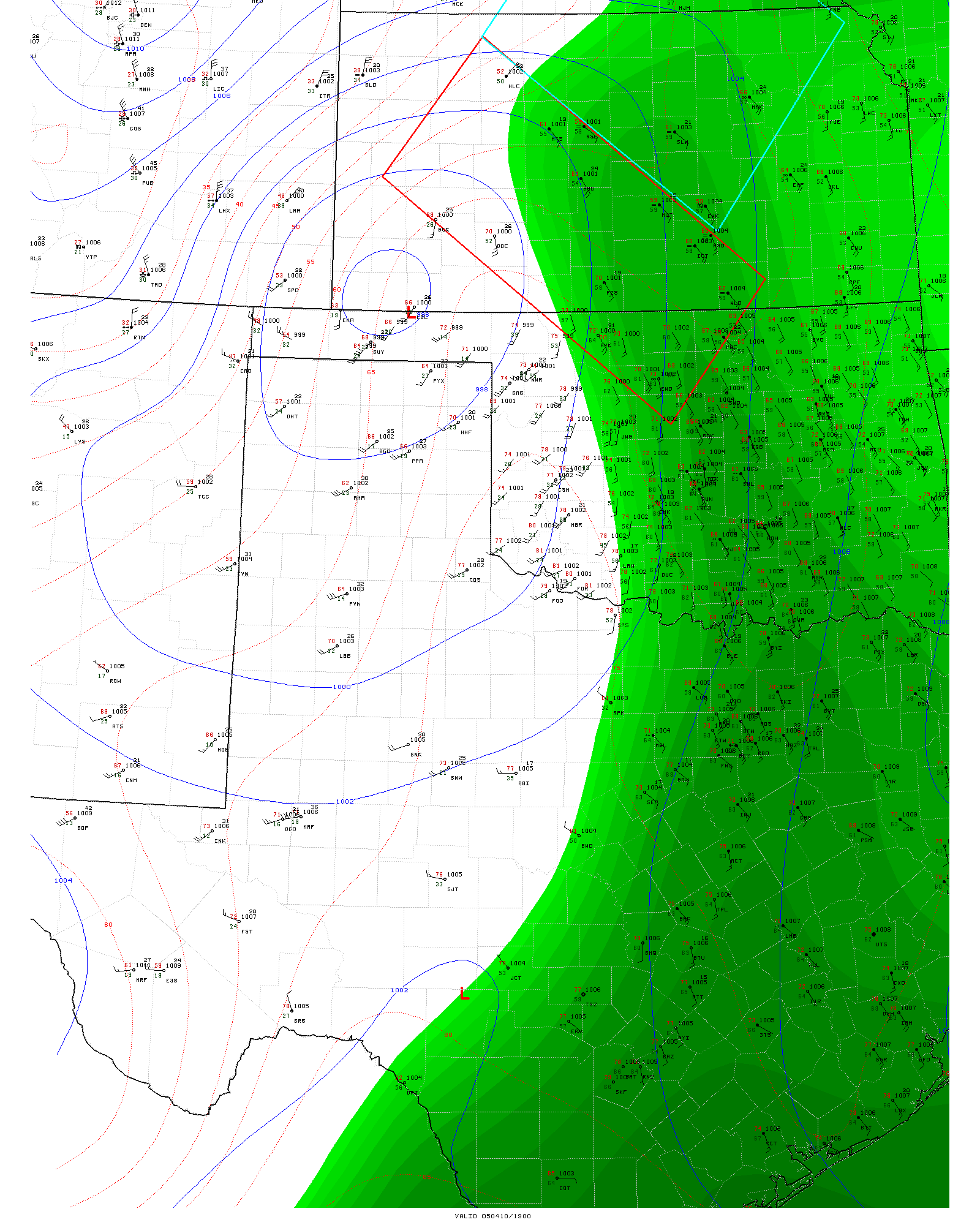
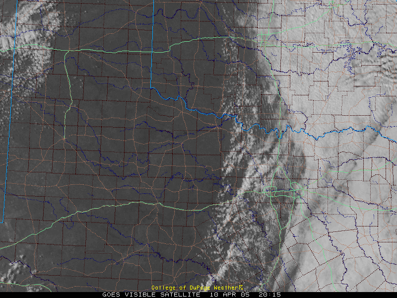
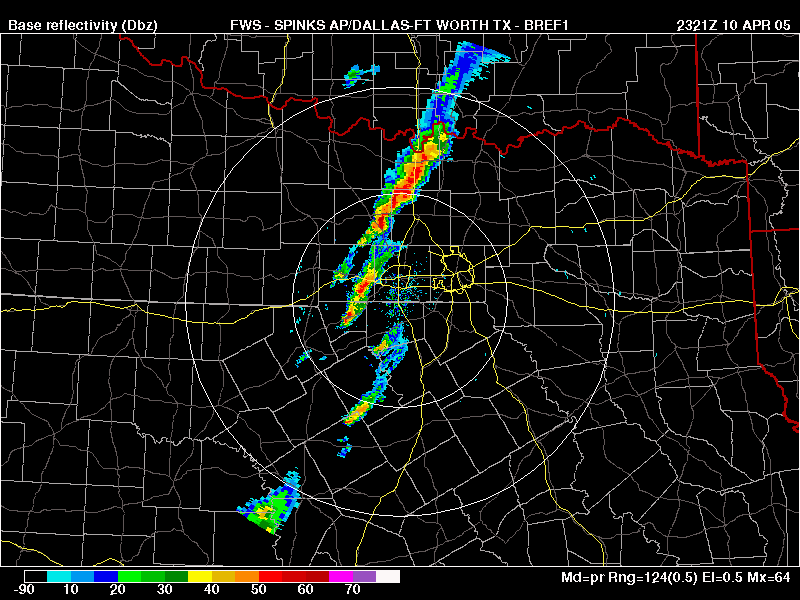
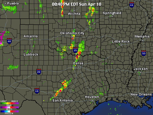
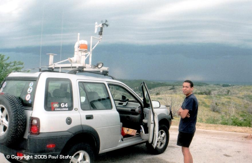
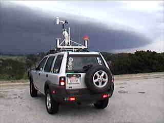
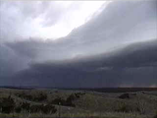
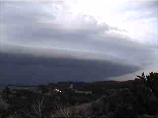
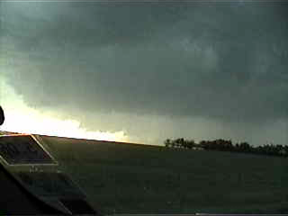
APRIL 10TH, 2005 Today was the first chase of the season. Today I went out alone and ended up meeting with storm chaser Aaron Hughes. I left Addison around 4:15PM and headed West on 190. I then went North on I35 and took the 380 exit in Denton to move West. As I was on 380 I kept looking to my North and saw some cool lower level clouds. There was a lot of scud, which made it look spooky but I didn't see any rotation in it. I called Aaron to find out where he was in proximity to the storm and he said he saw some good lower level motion in the Justin area. I looked to my Southwest where Aaron was and saw some amazingly beautiful TCu (Towering Cumulus). The storm also had a nice lowering below it with some scud rising into it, so I figured I would give it a shot. Passing Shawn Camp and numerous other chasers, I went through Decatur and then I exited 287 and flied South. I then exited 114 and moved further West passing through Aurora and Boyd. Exiting FM407 I met up with Aaron and we flanked the storm so we could get on the South side of it. At this time we saw it begin to look like it was going outflow dominant. We got out of our cars and took some pictures of the rolling outflow. I began getting winds out of the West and chilly air. We weren't sure that it was over yet so we continued to follow it to the Northeast. The storm did intensify prompting a Severe Thunderstorm warning in Northeast Wise County, then moving into Northwest Denton county which was later issued a Severe Thunderstorm Warning as well. We got lucky that we were on the best storm of the day in North Texas. The cell stayed discrete and didn't seem to become any part of the quasi-squall line that was to the Northeast. We went back FM407 to FM156. When on 407 we saw an amazing lowering that did indeed have a little bit of rotation in it. Staying on the Southside of the cell, we past into Denton County and continued to follow it North on 156 through Ponder and Krum. Moving North we got into some rain, luckily we chose to stay out of the rain and hail core. It was probably a good idea because I looked to the Northeast and saw a nice rain foot begin to curl out. Later we got rocked by some pretty mean winds. The winds of this downburst were clocked at 70 miles an hour. There was some great CG lightning coming out of the storm base as we moved Northeast. Unfortunately I didn't have my video camera so all I could get were still photographs. We eventually exited FM455 in Sanger and headed East to continue following the storm around Lake Ray Roberts. While heading east on 455 we drove through the area that had been hit by our downburst really hard. There were large tree limbs on the ground and green leaves everywhere from the trees. We continued on 455 when I spotted golf ball sized hail laying on the ground. We then headed North again to follow our storm on 377, but by this time our cell had become less intense and became part of the larger squall itself. This is when we chose to call the chase off (0230Z.) We pulled off to the side of the road and talked about how our chase went for the day when storm chaser Ken Fugate passed by and decided to stop and talk with us. Ken had stayed further North to catch the action up there. Aaron and I eventually decided to go South on 377 and head home. We stopped at a McDonalds in The Colony and had dinner and then went our separate ways. Today was a great early spring chase. Nothing really TOO exciting and even though we didn't see a tornado today we saw some awesome structure and learned a lot. I tested out my new equipment for this season and it worked great. I'm ready for May and June. Hopefully late April will be busy as well!
Pictures and Computer Data From the Chase
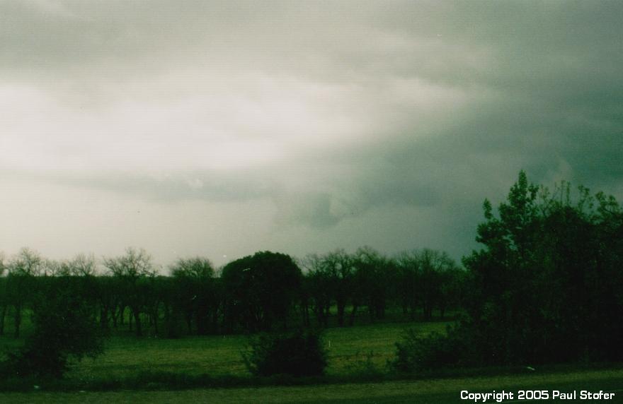
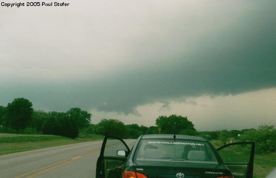
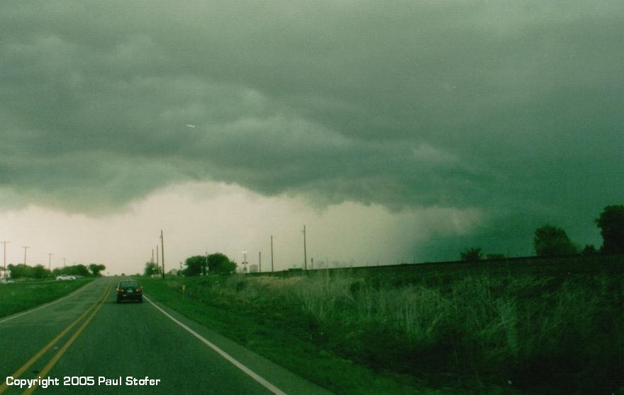
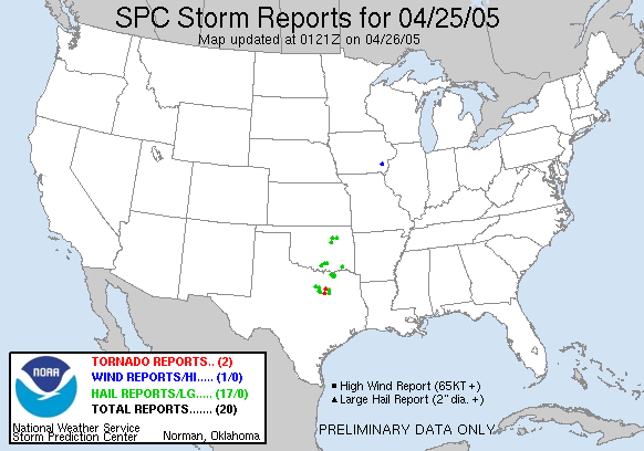
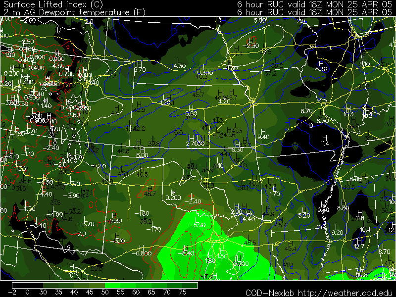
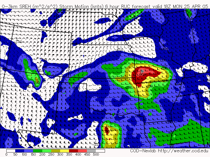
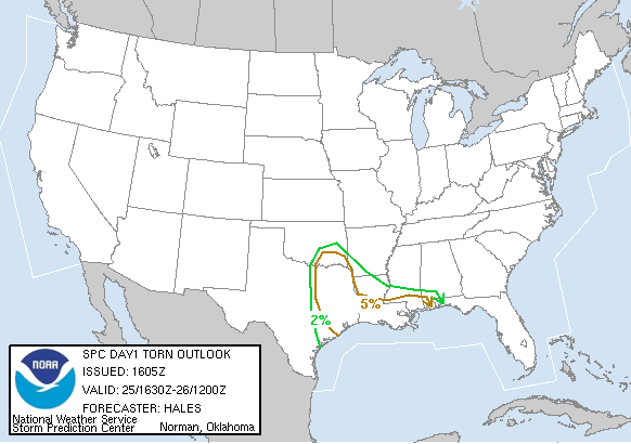
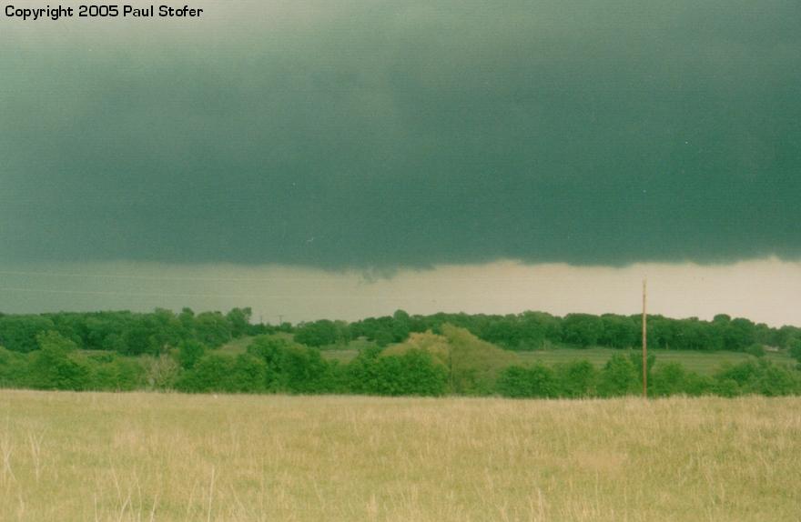
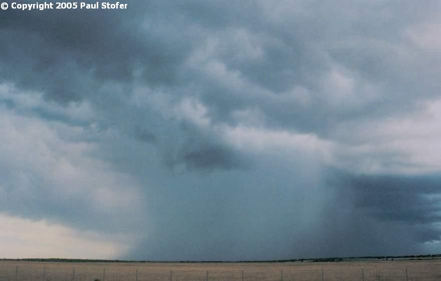
APRIL 25TH, 2005 Well today wasn't as great as we had hoped. I had been looking at the models for the past couple of days and finally decided to call my boss to ask if it was ok to miss work today. He said that it would be fine so I prepared for an eventful day. Today the setup looked alright, but it could have been better. The only problem was that the moisture return wasn't all too great. The moisture did however travel 400 miles North and make it into Oklahoma in one night, it just wasn't as deep as we had hoped. The helicity looked better North of the metroplex and the CAPE gave us a little bit of hope. I left home about 12:30PM and headed towards Denton, Texas. Our target for today was around Gainesville, TX but as the day progressed we figured further South would be better. I stopped at exit 471 in Krum and met up with chase buddies Jeremy Wilson and Aaron Hughes. We met up at a truck stop and chose to wait awhile and gather data. The clouds began to die out and we got a really strong South wind. Around 3PM we noticed that there was an outflow boundary moving West from the previous storm complex that was moving out of the area to the East. As we gathered data we noticed that the SPC had upgraded their risk to a moderate with Dallas as the Bulls Eye. About this same time we noticed storms firing just west of Fort Worth. Then about 15 minutes later a cell began to form just to our Northwest. We figured that when the northern storm hit the outflow boundary it would go nuts. A little later in the afternoon the storms west of Fort Worth started to go severe and enter Tarrant County. We chose the northern storm for a few reasons. 1) Chasing in the city can be extremely hazardous. 2) Visibility in cities are very hard to come by. About the time we jumped on the North storm it began to gather strength pretty good. It had strong inflow and we noticed a ton of shear, which along with the dew points I believe killed our chances of seeing a tornado for this day. We got on 1173 and some other farm roads and ended up in Wise County. Once again we passed Lake Ray Roberts and then followed the storm by jumping on 121 and passing through Sanger and then East into Grayson County. We watched the storm lower and get some better lower level structure. The lower level motion of this storm was incredible, the winds were just rocking. We then noticed some lower level rotation and some rotating scud lowering below the base. The scud didn't look too promising and it was barely noticeable. In the photo below you can barely see what might be a condensation funnel in the top right portion of the photo. It wasn't rotating very strong, and it wasn't all too organized. The scud at the bottom was rotating, but nothing too exciting. I think that if the storms didn't have to deal with so much shear, and the dew points were a little better I think we would have been in business. The rotation and structure didn't last and the storm continued to move. At this time the storms to the South in Tarrant and Dallas counties began to go nuts. Tornado warnings went out for both counties; however, no damage has been located and the tornadoes were never confirmed. We followed the storm East on 121 and met up with Eric Nguyen and Scott Currens. We all followed the storm East a little bit and then Aaron and Jeremy continued on, while Eric, Scott and I chose to pull off to the side of the road and call it a day. We watched the storm slowly move away, and when we could get a peek through the lower level mess we could notice that there really wasn't a strong updraft. Eric and Scott went back to Norman and I headed back home South on 75. I watched our storm from a distance and after I got out from underneath it, it had a really great looking anvil and the structure looked much better. I communicated with Jeremy and Aaron on the phone and they said that the storm dropped a wall cloud and tried to drop a funnel but could never get it's act going. They too gave up on the storm and called it a day. Again, today wasn't as great as we had all hoped but we still had a good time. With 350+ more miles on the odometer and gas as high as it is, it's a bummer that it was such a bad day. However, it's still early in the season and it was a very crappy setup. I think May and June will be great...
Pictures and Computer Data From the Chase
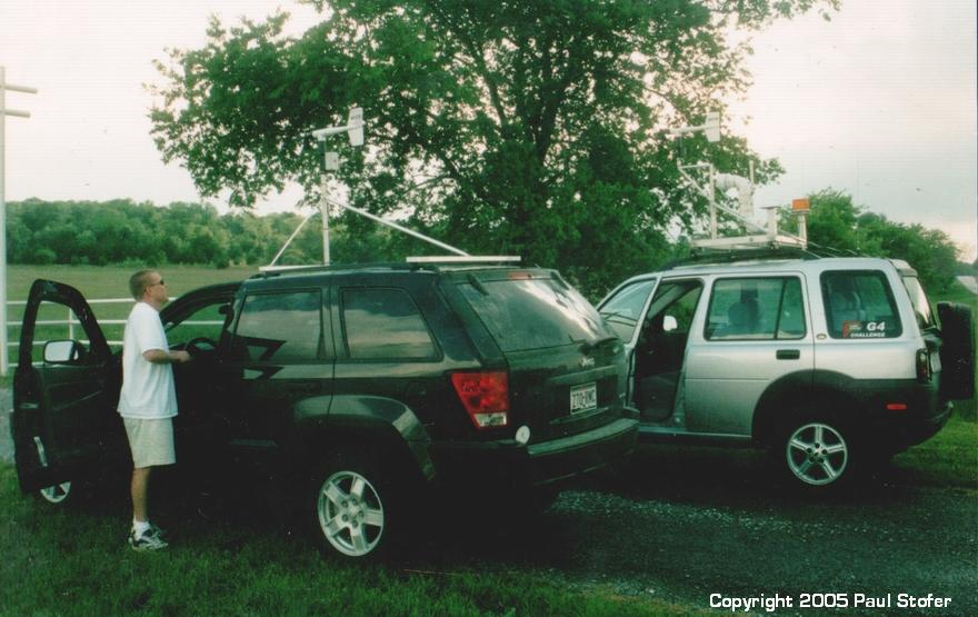
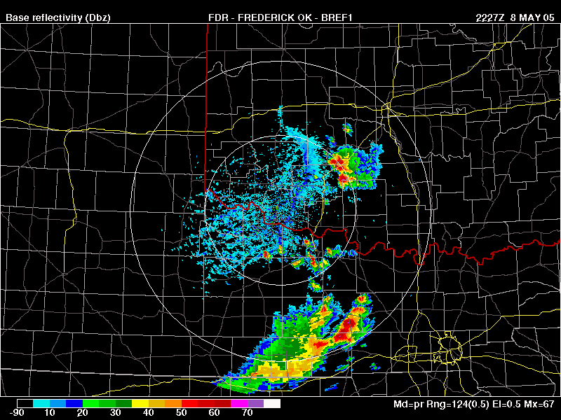
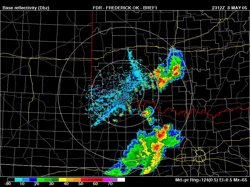
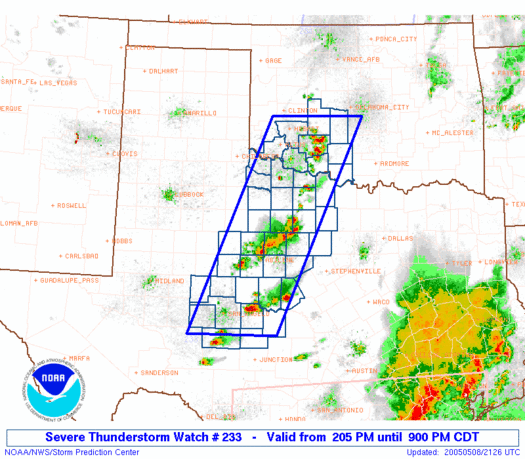
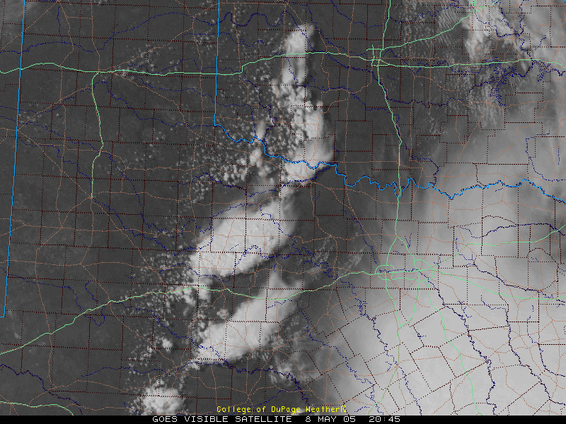
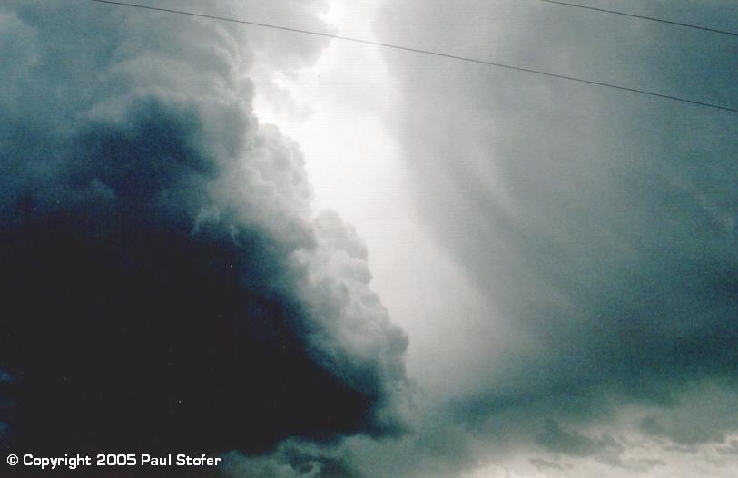
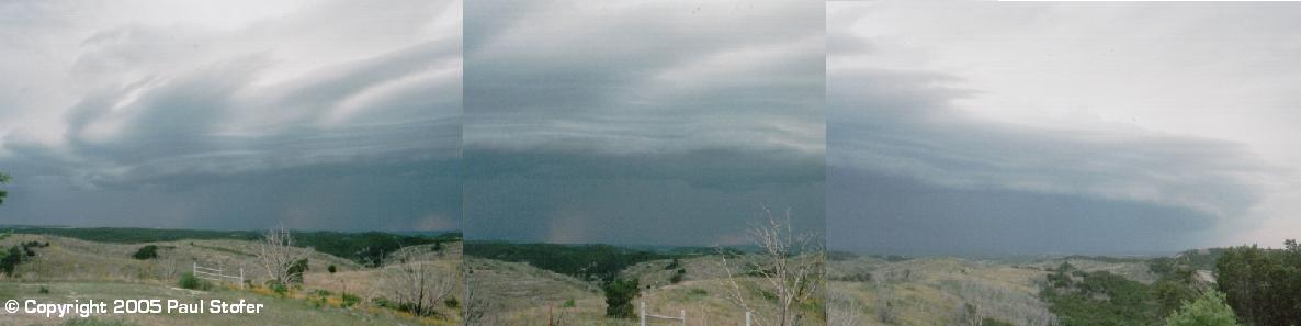
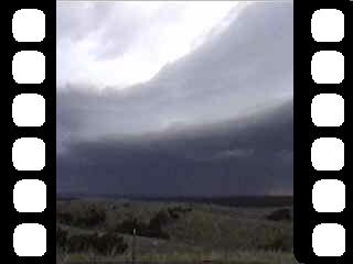
MAY 8TH, 2005 Nothing really noteworthy was observed today except for some small pea sized hail, an intense rain core, some great lightning, and an amazing shelf cloud. The structure today was great, and we had pursued the best storm of the day that had formed in Oklahoma. Today I chased with Aaron Hughes and we left the Dallas area around 1:15PM CDT. Our original target was between Wichita Falls, TX and Lawton, OK. We headed North on I35 and took that all the way to 82. We passed through Nocona, Ringgold, Jolly and then we made our way into Wichita Falls. We sat in Wichita Falls for awhile and kept an eye on the radar. We observed some beautiful mammatus and then noticed a tower to our WSW that looked pretty good with a good radar return. We compared that with the surface maps. We also saw some little storms firing to the North and realized that the storm we were watching would die out and the storms to the North would get into some better moisture. We left our fairly organized storm for some storms that at the time weren't looking quite as well on radar, but eventually paid off. We jumped on 287 then went North on 44. After we had crossed into Oklahoma and got closer to Lawton the storms we had assumed would get into better moisture went crazy and the storm we were previously on looked pretty bad. The weather service issued a Severe Thunderstorm Warning on our storm so we followed it East through Elgin, Fletcher, and North towards Chickasha. The storm had hail reports of up to golf balls. We tried to decide whether we wanted to punch the storm and check out the hail or just sit back and watch the show. We weren't too worried about the storm tornadoing so we chose to punch it and observe the hail. Right before we entered the core we looked to our South and realized that there was another updraft skyrocketing. The Southern storm started taking away the juice from the Northern one, so we decided to forget about the punching and go after the southern updraft. We booked it south on a dirt road and then hit SR17. We took SR17 and followed the storm East a bit. We got into some pea sized hail and saw that there were numerous rain cores. The storms started to form into a line and we gave up on it. We made our way back East towards 35 through massive chaser convergence. We went south on 35 and exited at a scenic turnout and observed an amazing shelf cloud. The striations were absolutely beautiful. It was a fairly disappointing day and there was no tornado, but we didn't really expect much to happen anyways. Pictures and Data from Chase
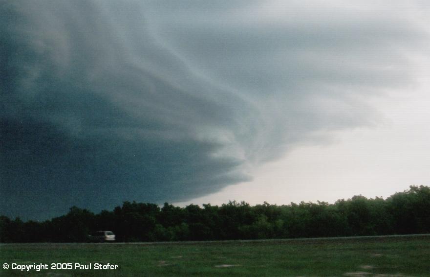
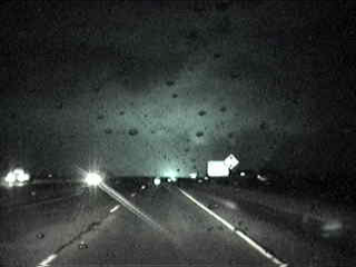
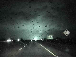
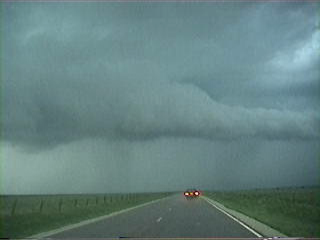
MAY 31ST, 2005 Today I chased with Aaron Hughes. Unfortunately this turned out to be a night-time chase but that didn't bother us very much. Tonight we didn't expect to see much as the storm would be mainly linear by the time it reached us. We planned on intercepting the storm near Decatur, TX in Wise county and observing some strong straight line winds, hail and an amazing lightning show. We left Dallas around 11:30PM and we went North on I35 and exited 380. We went west on 380 all the way to Decatur, then took 287 North to reposition a little bit better. At this time we had a meso just to our NW and the storm was quite strong. We observed some lightning and continuously watched the radar in the car. The cell we were keeping an eye on seemed to be moving further south and getting stronger. The velocities showed better storm rotation and the reflectivity showed stronger returns. We went south on 287 all the way south to 114 just North of Rhome, south of Decatur. The storm had a very broad area of rotation, but not enough to warrant a Tornado Warning, but enough to convince the weather service of issuing a Severe Thunderstorm warning. We observed a very low hanging base, with lowering scud below it. A few minutes later, brilliant power flashes were observed directly below this lowering. I am fairly confident this was a weak F0-F1 tornado, as the power flashes only lasted 1-2 minutes, and were in a very confined location. In a downburst the power flashes are more frequent and are more linear and spread out. The structure was amazing, and tornadoes can form from severe thunderstorms with little or no warning. I'm convinced this was a tornado, as we were in the core just north of the meso. We followed the core all the way back to Dallas and the chase ended around 2:30AM. Awesome night time chase... Pictures From the Chase... Video might be possible soon...
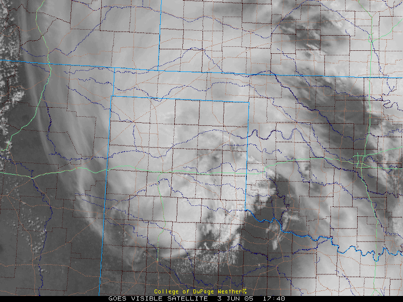
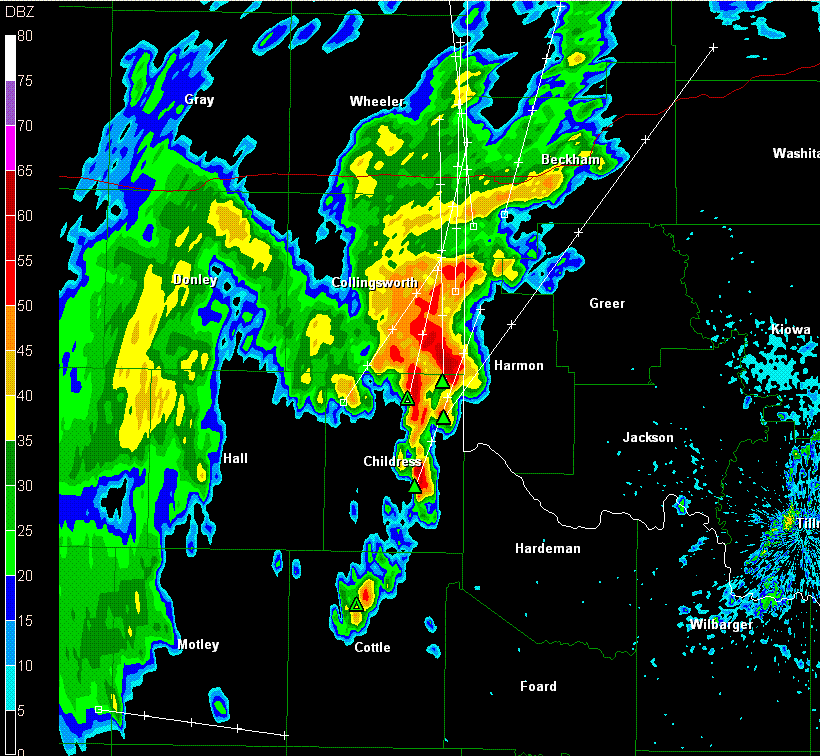
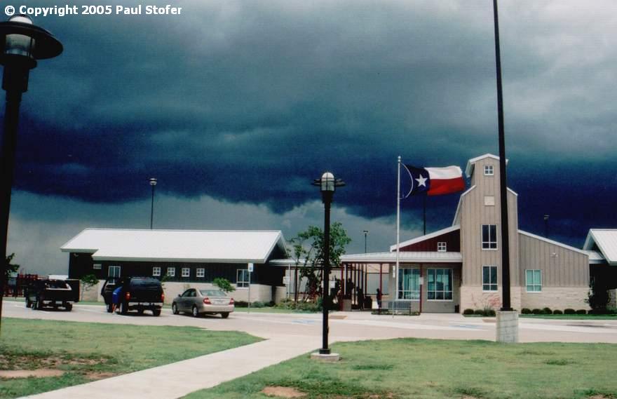
JUNE 3RD, 2005 Today's chase was pretty disappointing. We didn't expect much because the setup was highly marginal; however, I had already asked for work off and everyone could chase so we went. I left Dallas last night to stay in Oklahoma overnight so I wouldn't have to drive quite as much today. I met up with chase buddies Aaron Hughes and Jeremy Wilson. We left Thackerville, OK around 9AM and decided to make our target the Texas Panhandle around Altus OK. We went through Muenster, Wichita Falls and Vernon. We then went north and stopped at an absolutely amazing rest stop in Quanah, TX. We sat in Quanah for awhile in between a previous squall line and some upper level clouds right in a nice clear slot. The heating was great and the winds were rocking up to 40MPH! We watched some storms begin to form off a boundary, probably the Vortmax. This was awesome structure! We saw the hail core, 2 seperate rain feet from downbursts and some amazing TCu. We chose to head further North and East and ended up in Lawton, OK. We saw an amazing storm firing up to our North with 1 inch hail and a beautiful updraft and anvil. The storm looked great on GRLVL3 radar. By this time a Tornado Watch had been issued for our location and this was the only storm in the area. We went after it. The storm was moving really quick, and we jumped on I44 to follow it North. Unfortunately, the storm started to dissipate and was moving away very quick. We experienced some rain and 39MPH wind today with higher gusts but that was pretty much it. After tacking 591 miles on the car today, and seeing patchy skies all day we called it a bust. Hanging out with my friends was great, but I wish the setup had turned out better. Nothing significant was observed... Pictures and Data from Chase
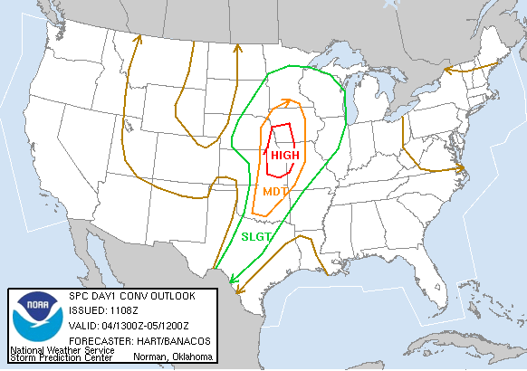
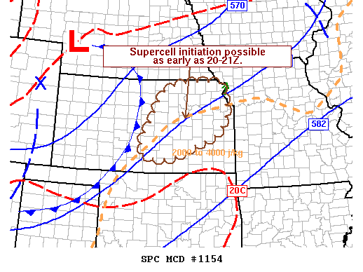
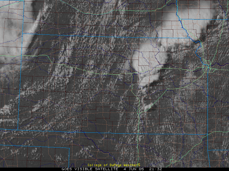
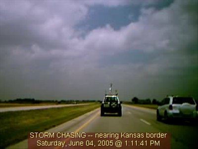
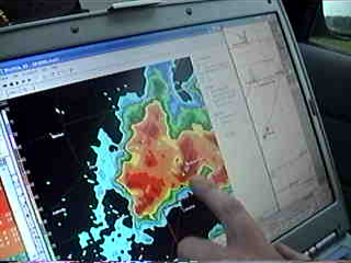
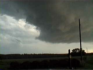
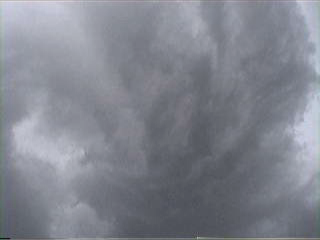
JUNE 4TH, 2005 Another day in the central plains. I stayed in Oklahoma overnight and traveled to Wichita, Kansas today with Jeremy Wilson. We convoyed in 2 vehicles, the other vehicle occupied by Aaron Hughes and his girlfriend Holly. Our target today was Wichita, KS inside of the HIGH RISK zone. While en-route to Wichita, we ran into Jim Leonard, Blake Naftel and their tour group. We conversed with them for awhile then continued into Kansas. When we got to Wichita we sat around for an hour or so at a hotel watching models, radar data, etc. Storms began to fire just north of our location around McPherson, KS so we headed that way. The storm quickly went tornado warned and then died out before we could get to it. Storms started popping up all over KS and we went to fuel up right before we were going to head after another newly forming storm in the Northeast portion of our county. As we were filling up in El Dorado another storm quickly fired and grew a wall cloud and started dropping funnels. We had almost no time to react as the storm came out of the trees and passed right over us allowing us to observe rotation right underneath. It was absolutely fascinating. the rotation wasn't very strong and we were not that worried that the storm would tornado. The storm popped up out of nowhere and formed rapidly, as almost every other storm of the day. We followed the storms North and passed Gene Rhoden, then we got rocked pretty good by some RFD from the storm which began to decay after 30-45 minutes or so. The complex quickly went linear and a grunge fest ensued. Multiple wall clouds were observed today as well as some small hail, great structure and some good scenery. Another 600+ mile chase day ended my 1,200 mile chase weekend with nothing in return but a few wall clouds and amazing structure. We drove to Emporia, KS and stayed there overnight. The next day we drove back to Oklahoma, then back on into Texas. It was great to chase with my friends; however, I think this horrible season for almost everyone is quickly coming to a close. Maybe I'll venture to the coast and observe a Hurricane this year...
Pictures and
Data From the Chase...
|