|
StormPursuit
Forecast Tools:
Pictures/Accounts:
Education:
The Rest:
|

|
2006 Chase Accounts |
||||
|
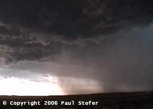
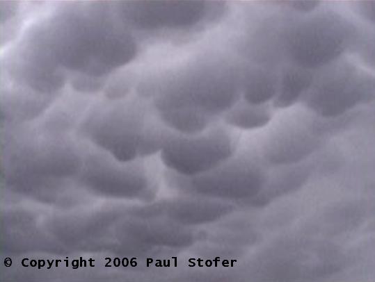
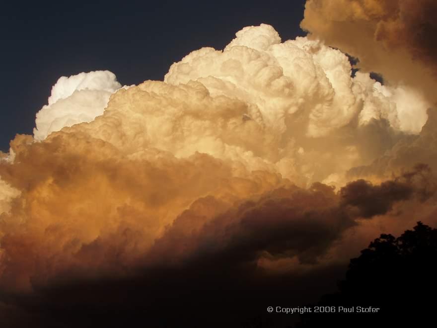
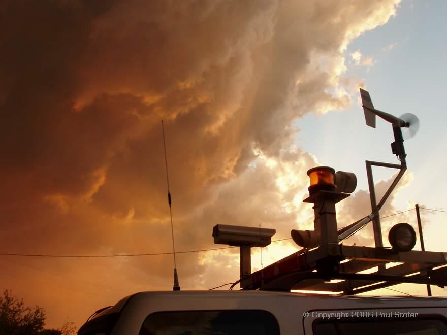
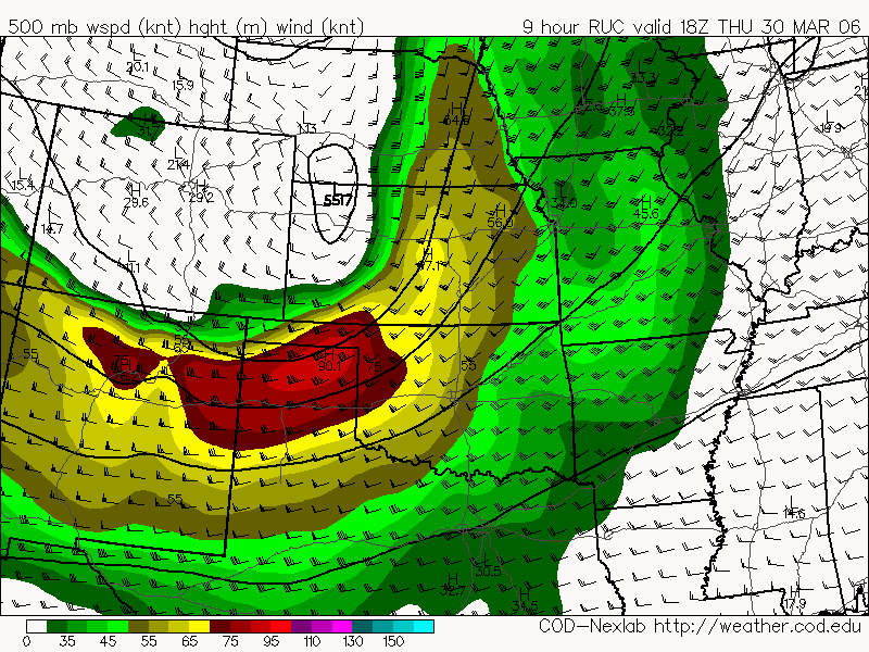
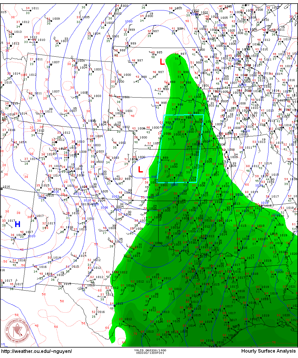
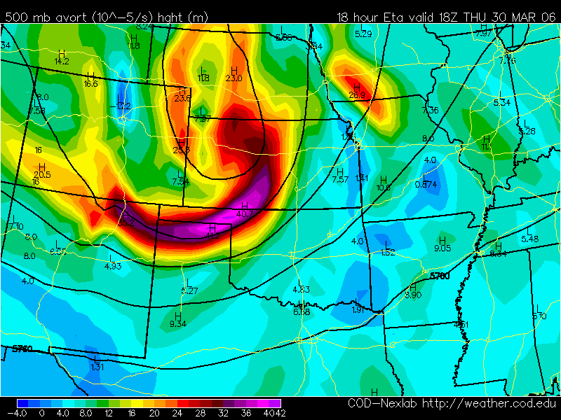
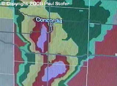
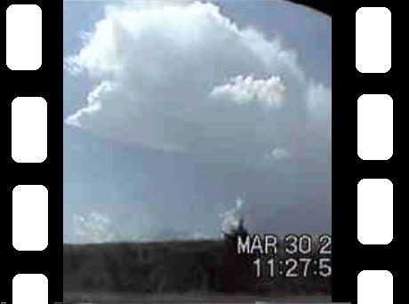
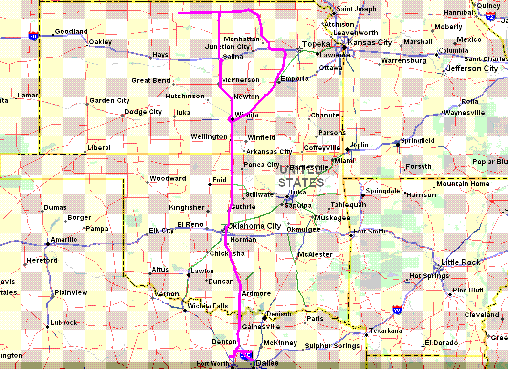
March 30th, 2006 Today didn’t turn out to be all that we had hoped for, but it did turn out to be a fun first chase of the season. Today I chased with Eric Nguyen and Bob Fritchie. Eric and I left the Dallas area around 6:30PM on the 29th and headed for Norman, OK where we picked up Bob. We arrived in Salina, KS around 1AM where we got a little bit of sleep and then woke up at 8AM to look at data. The SPC had put out a moderate risk, and all the models seemed to look pretty good. We focused on the cold core / surface low which appeared that it was going to ride the Nebraska / Kansas border. We left Salina at 9:30AM right as a Tornado Watch was issued for Eastern Kansas, Oklahoma and SE Nebraska. We drove North on 81 until we hit Belleville and we parked just West of the Republican River keeping an eye on the radar and watching the conditions. Storms began firing around 11:30AM. We went a little further West on Highway 36 to Mankato and then saw a storm firing near Concordia. We blasted South to intercept this storm and ended up driving through a good amount of nickel sized hail and torrential rains. By this time the cluster storms began to gather and go more linear. We looked to our South and saw a very dense core (Which by this time was now Tornado Warned) so we went to check it out. We began to get about egg sized hail and saw some interesting, tight, organized rotation just to our South. We stopped and let it cross the road right in front of us. The rain and winds on the surface were pretty strong, so even if there was a tornado it would have been extremely difficult to see any type of movement on the ground. The rain bands were getting sucked into the rotation. We followed the storm a little until everything began to go linear. At this time we were just West of Topeka and we began to head South to get dinner before heading home. Right before we went in to eat we noticed there was a lot of convection on the tail end of this storm / outflowish boundary. The winds picked up from the NW which could have been some sort of RFD and we noticed a good amount of lower level rotation. The rotation then slowed down dramatically and disappeared. We went and ate underneath some bubbling mammatus and ran into Amos Magliocco just outside of El Dorado. We all drove home talking on the radio, and to make such a day complete, Amos ended up with a flat tire. The day could have been a lot better, especially if we had some sort of forcing mechanism like the surface low push through. It was still a lot of fun, and it is just the beginning of what looks to be an active season...
ONLY VIDEO CAPTURES AND VIDEO AVAILABLE FOR NOW...
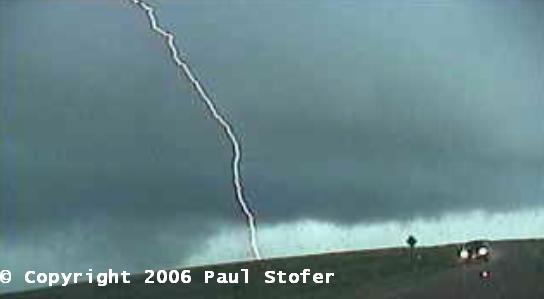
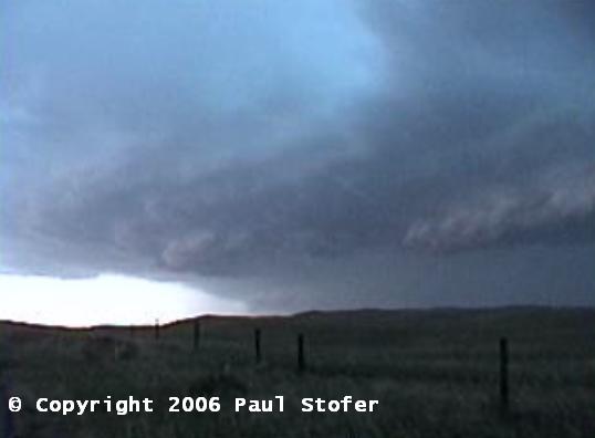
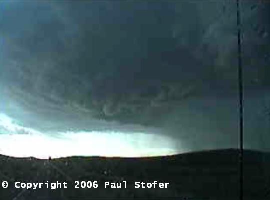
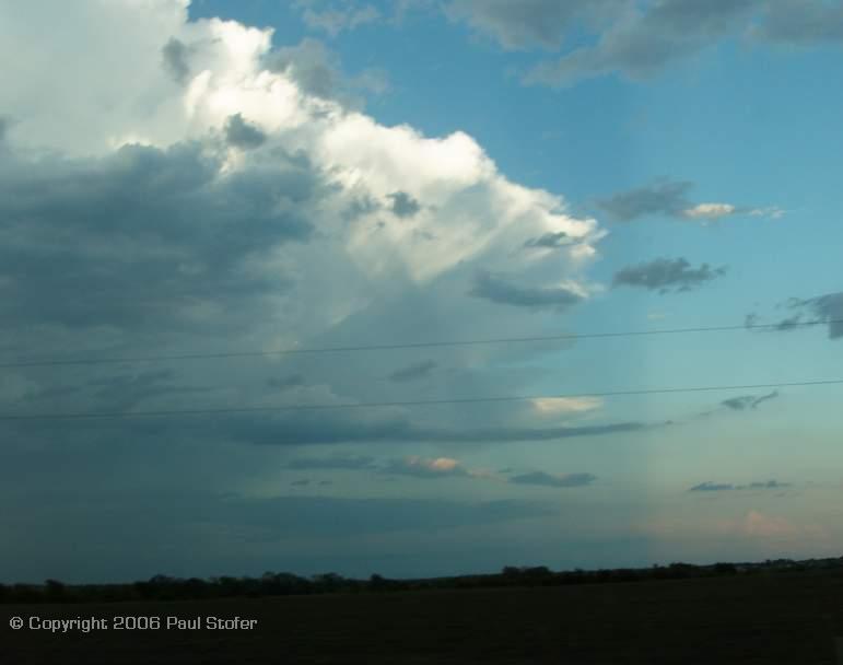
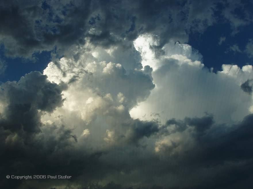
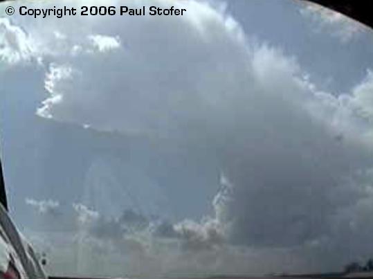
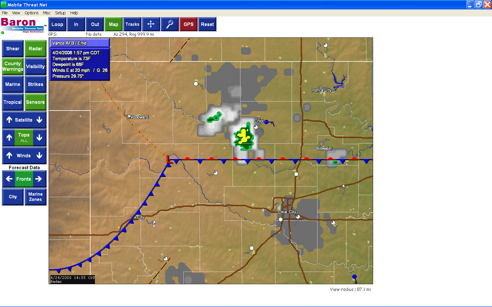
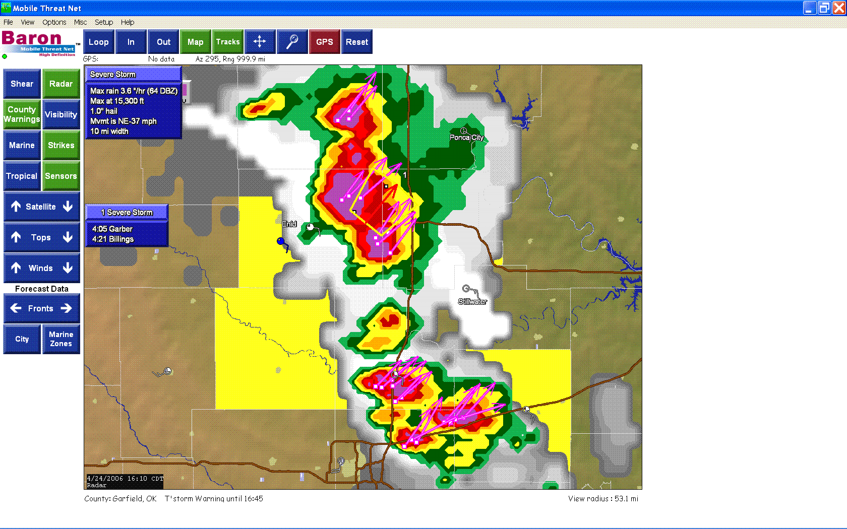
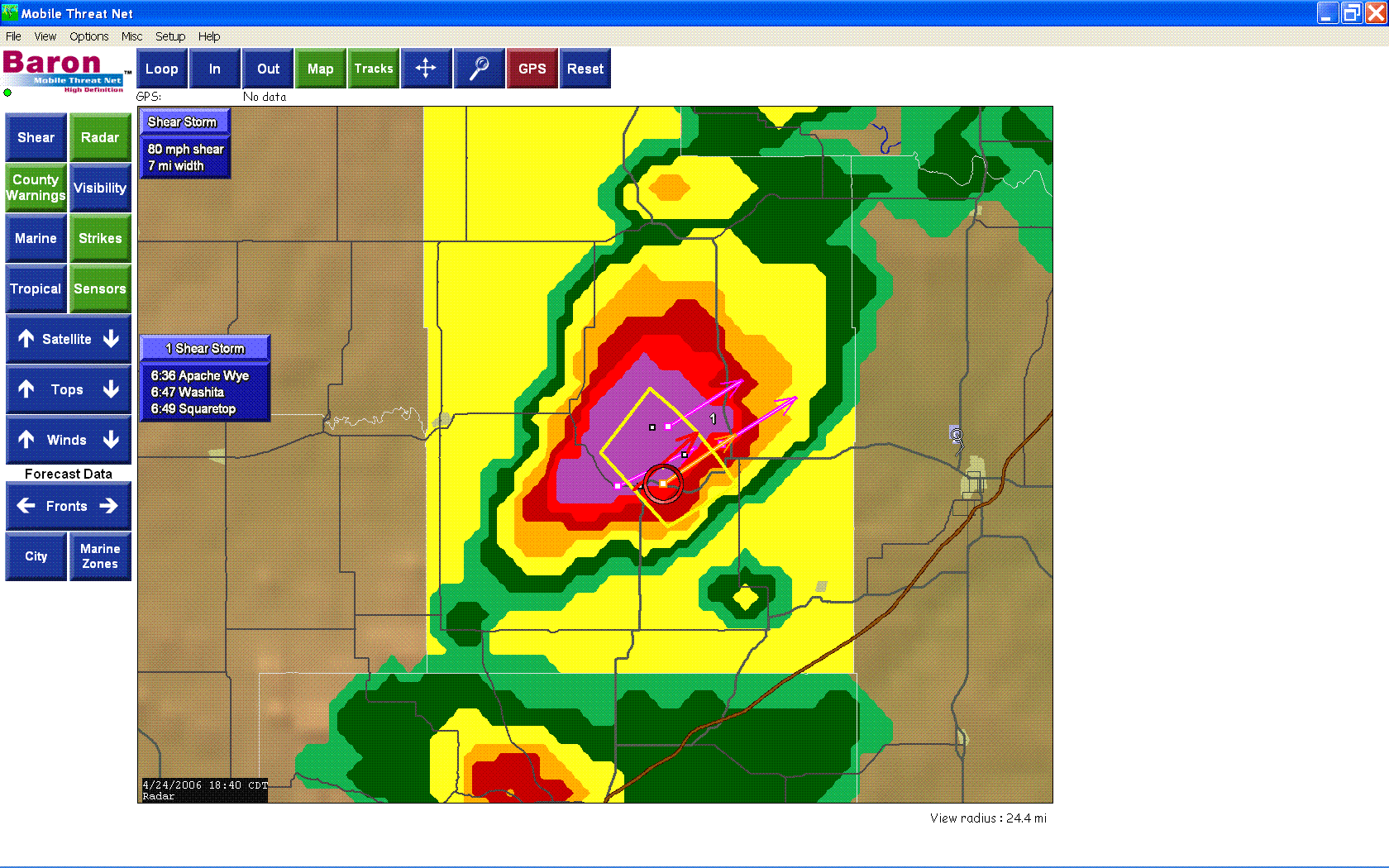
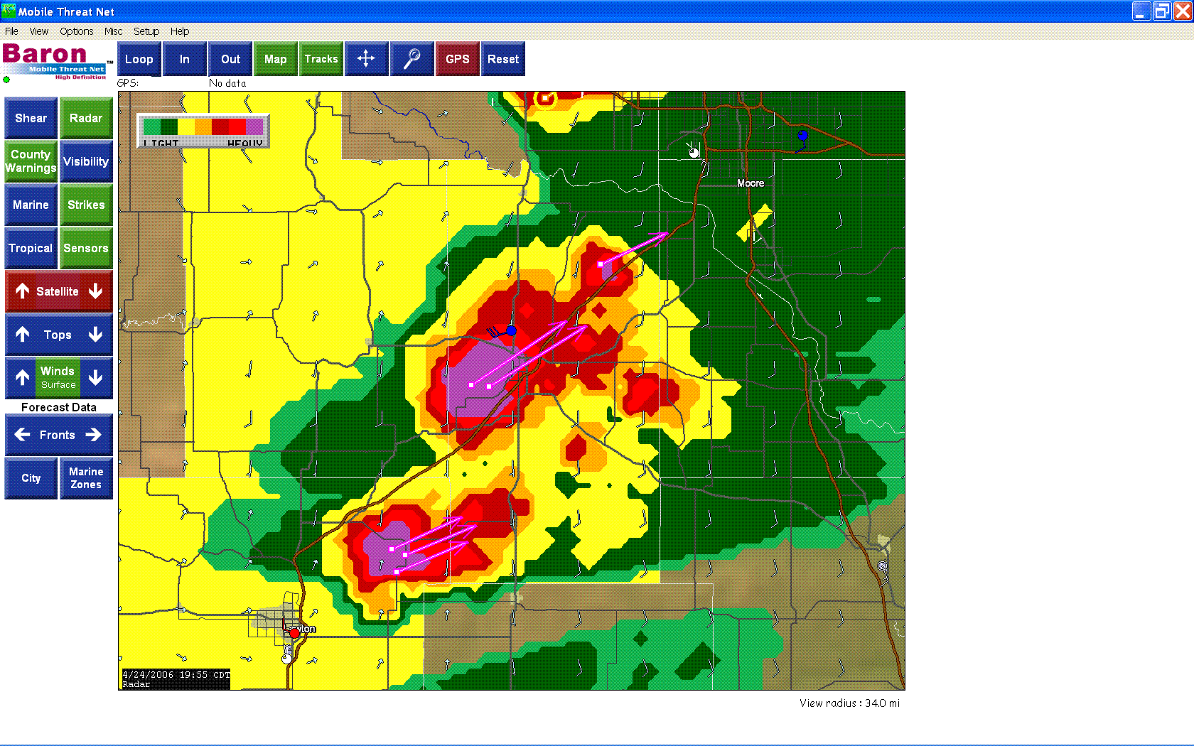
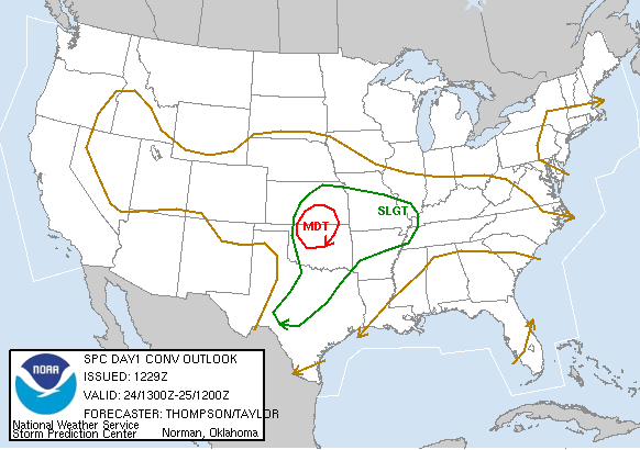
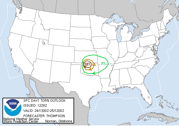
April 24th, 2006 Today's setup looked pretty good. Aaron Hughes, Leslie Giles and I started our 600 mile expedition by leaving the Dallas Metroplex and heading North towards Oklahoma around 6:30AM. We arrived in Thackerville, OK around 8:30AM and picked up Jeremy Wilson. Today we had 2 different targets; the first was Kingfisher, the other was in Lawton, Oklahoma. We arrived in Oklahoma City around 11:30AM and got lunch and looked at data. At this time, we fired up the Mobile Threat Net and started looking at winds, dewpoint, surface observations, and other data. Around 12:30PM we chose to head towards Kingfisher. We went West on I40, then North on 81 passing through El Reno. We stopped in Okarche and waited for about an hour gathering more data. We watched satellite and TV trucks pass us by heading towards Kingfisher. Echo tops and radar began to show storms firing North, near Hennessey and moving to the East towards Stillwater. We raced North into Hennessey and went East on 51 where we intercepted the storm with some small hail and weak low level rotation. We ran into Chris Caldwell and sat on 51 watching the storm move East around 20MPH. The storm really didn't produce much and we decided to race to our second target in Lawton. The TV stations were reporting that storms would fire within the next couple of hours just South West of Oklahoma City. We passed through El Reno again (which would later to turn out to be the hot spot of the day), and then through Chickasha where we topped off with gas. As we left Chickasha storms began to explode in Lawton with golf ball size hail shortly after initiation. We continued South West on the I44 turnpike into Lawton where we intercepted a beautiful supercell. At this time tornadoes were being reported in El Reno and our storm was just beginning to get its act together. The storm had an amazing lowering with a little rotation. We sat on a hill on highway 18 and began to shoot video and stills towards the North West. The lightning began to pick up, with one bolt hitting less than a mile away sounding like a cannon being fired while the camera was recording. The storm had a beautiful wall cloud, which began to organize and rotate quite well. The storm dropped a couple of needle funnels, but never did produce before getting undercut and decaying. Scott Peake passed us and we followed storms that were forming to our South. The storm went outflow dominant and all of the action shifted further to the North East and far South near Wichita Falls, Texas. As we tracked the storm to our South we began to get some amazing night time lightning shots. There was still a little bit of lower storm rotation, but nothing too exciting. We ran into Eric Nguyen and took some night-time lightning photography and videography. We all then headed back South on I35 to head home talking on the radios. Long day, no tornado, lots of miles, but it was fun to hang out with friends, meet new ones, and at times exciting to share our passion for severe weather and nature itself.
STILL PICTURES WILL BE ADDED SOON WHEN AVAILABLE....
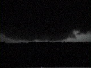
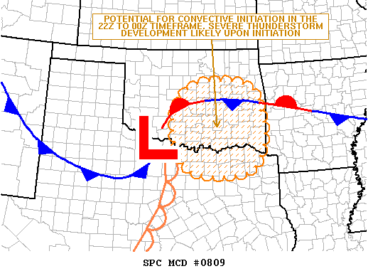
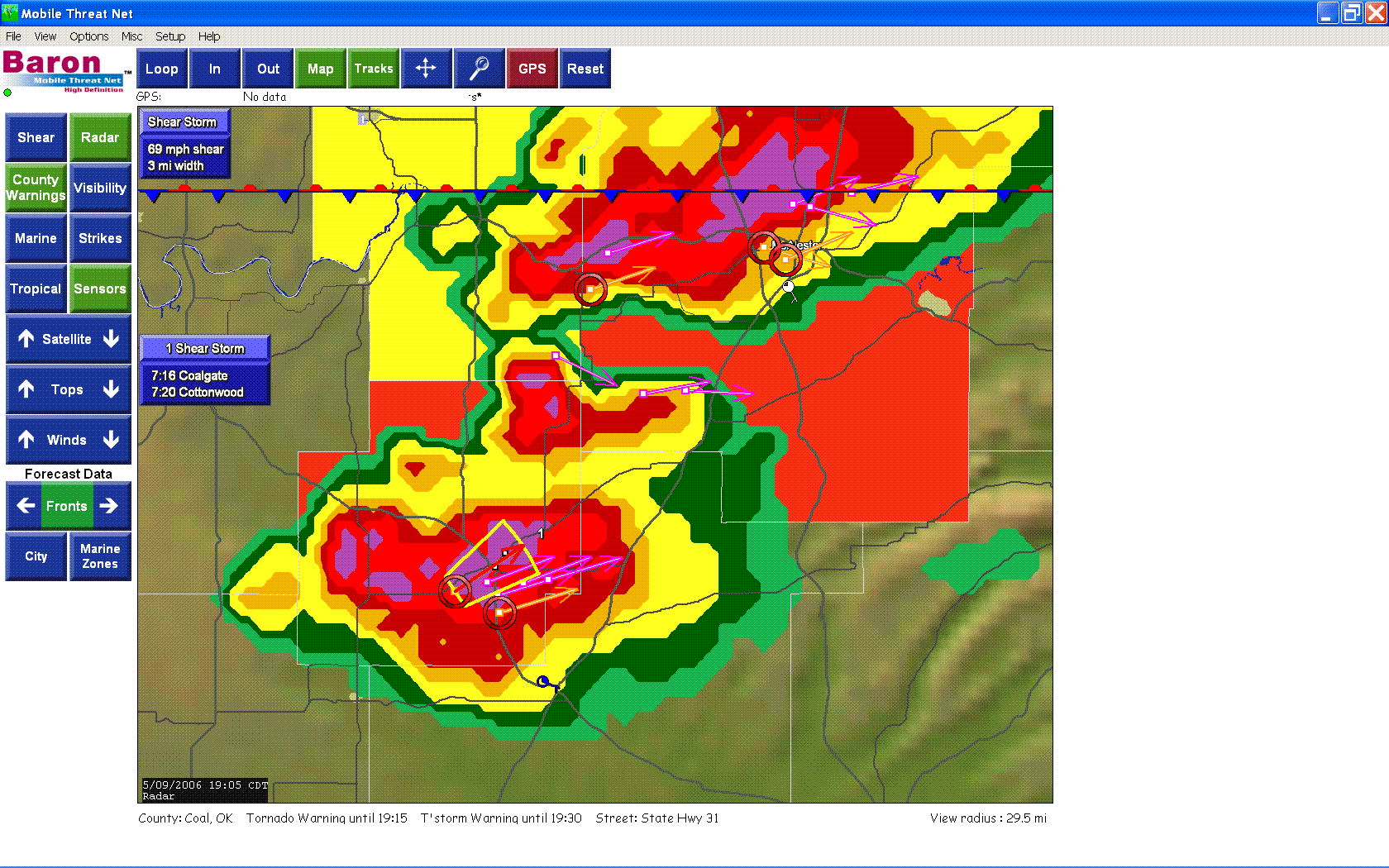
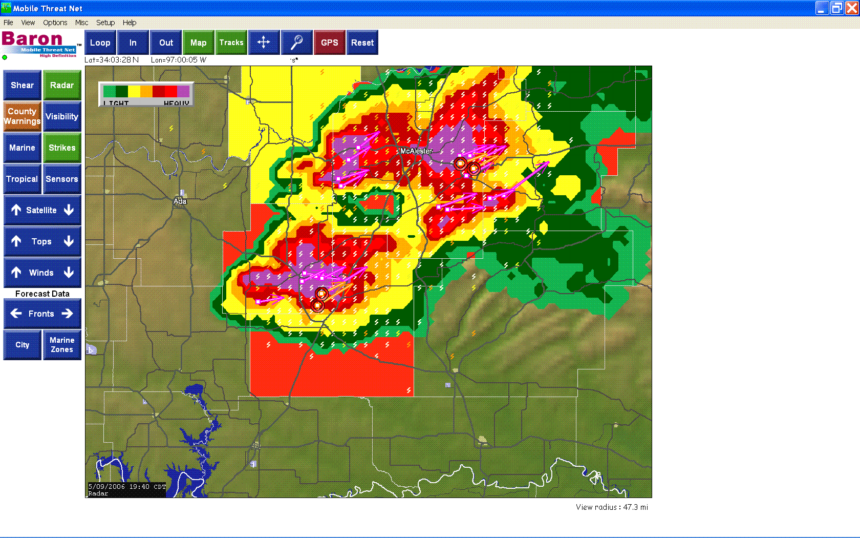
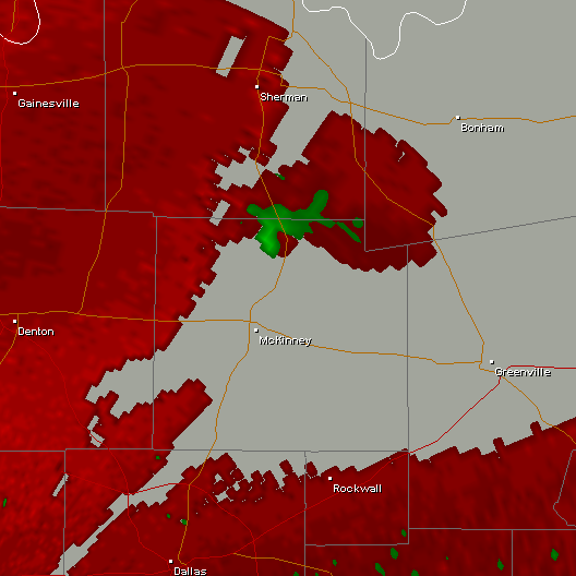
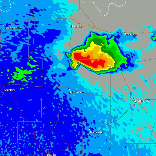
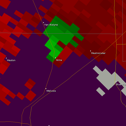
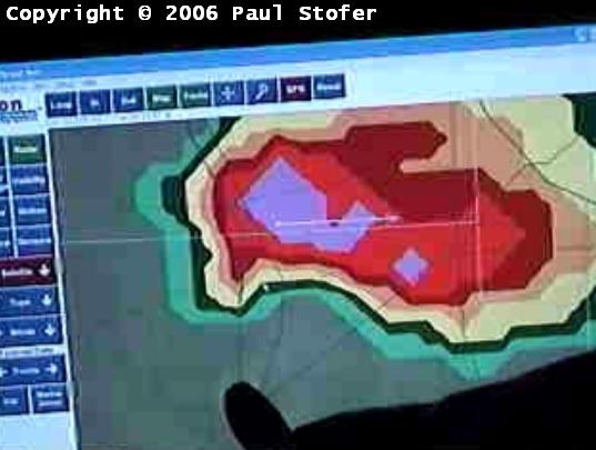
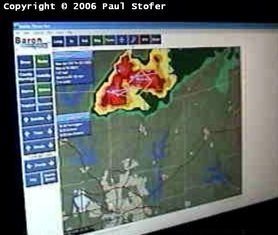
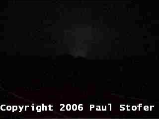
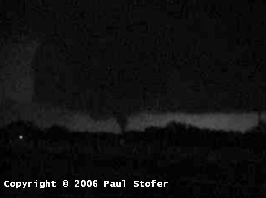
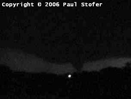
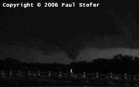
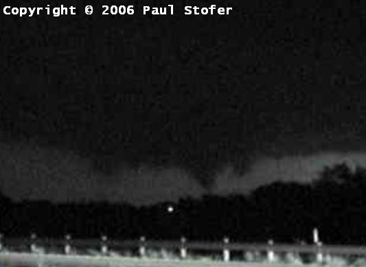
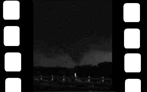
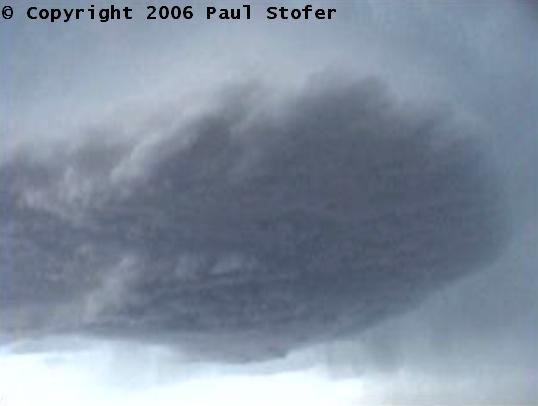
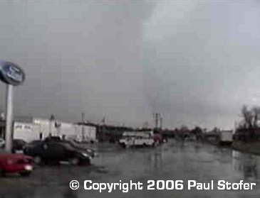
May 9th, 2006 Today looked very marginal and the probability of busting and not seeing anything was very high; however, I would end up intercepting the best night-time tornado I have ever seen. Tim Carroll, Leslie Giles, and I left Dallas at 10AM and headed for Central Oklahoma. When we arrived at the Oklahoma border, we fired up the Threat Net and downloaded some data off the internet to redefine our target area. We were worried that the cap wasn't going to break, however there were -14LI's with 4000 CAPE in SE Oklahoma so we decided that just South of McAlester, Oklahoma would be a good target. We took 82E to 75N and stopped in Atoka. At this time it looked like the cap was eroding and we noticed some TCu forming to our West. After some nowcasting help, since we were out of internet range, we traveled a little further to the North West into Ada, OK. The threat net radar showed storms exploding just North of McAlester riding along I40. We raced North on 75 and saw some amazing rotation. The storm went Tornado Warned and the rotation would strengthen, then die as we let it pass the highway behind us. We took a South option so we could jump on another highway and follow it East. While following it East we got hit with some quarter sized hail and very strong surface winds, possibly RFD. By this time it was around 8:30PM, so we headed back South towards Dallas. About 9:30PM the radar began to show precipitation breaking out in North Texas, where conditions for tornadoes were looking really good. We raced back South as fast as we legally could and got to Van Alstyne in Grayson County about 10PM. I fueled up, and began to get quarter sized hail as this now very intense supercell gained strength and roared towards Anna, Texas. I reported the hail to the National Weather Service, and then continued South and approached the intersection of FM455 and 75 at about 10:10PM. At this time the National Weather Service had issued a Tornado Warning for the storm. I pulled over South of FM455 and watched the rotation pass behind us and off to the North East. The wall cloud was absolutely beautiful, and the storm structure was amazing. As the storm approached Anna, we noticed power flashes on the ground. I reported this on the Collin County SKYWARN net, and a few lightning flashes later there was a very nice tube tornado on the ground. At my location, the wind was completely still, dry and no precipitation was falling whatsoever. This tornado grew into a large elephant trunk tornado before weakening and lifting back up into the wall cloud. Moments later the tornado dropped once again, this time in the town of Westminster, Texas. The tornado was now a very large cone tornado doing extensive F3 damage to the local communities. There was major damage in the Town of Westminster, as well as many injuries and fatalities. Unfortunately the town was unaware of the ongoing severe weather and did not have warning sirens, therefore very few citizens were aware of the dangerous night-time storm that was approaching. Today had a very large bust potential, but I managed to get to the right spot at the right time and intercept this very large tornado. It was a great chase; however, later learning about the fatalities and the number of injuries and the extensive damage makes enjoying today extremely difficult. As with many others, this will be a day I will never forget and my heart goes out to those who were effected by this storm....
STILL PICTURES WILL BE ADDED SOON....
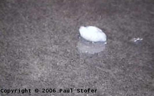
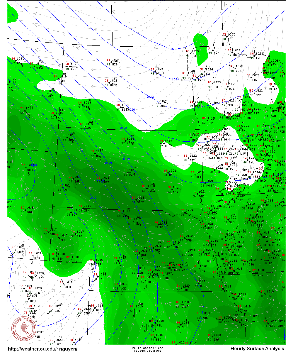
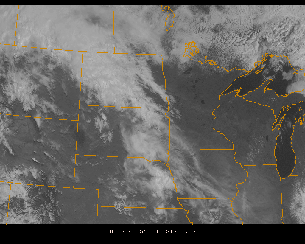
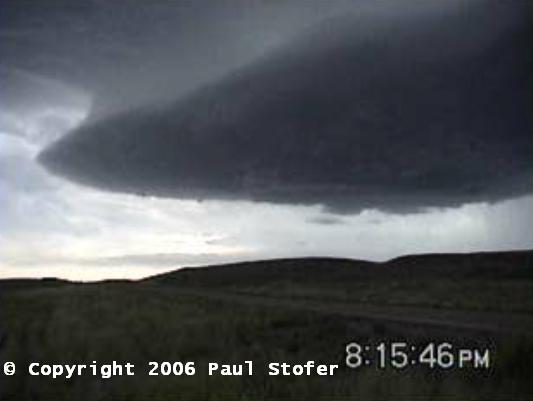
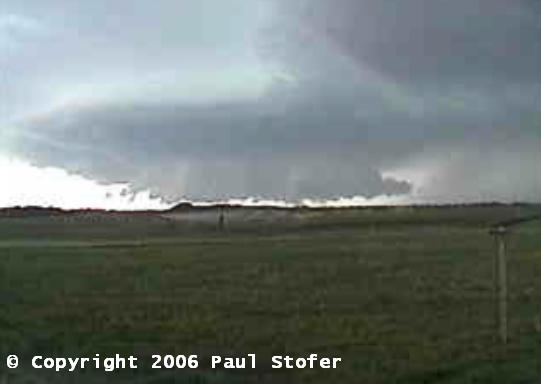
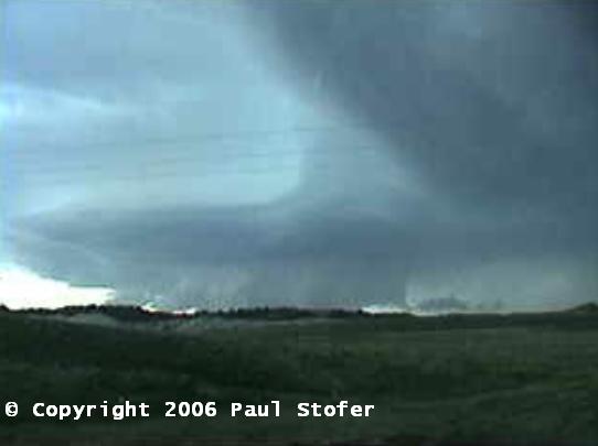
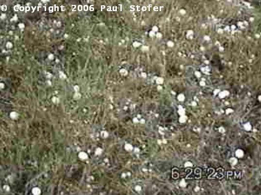
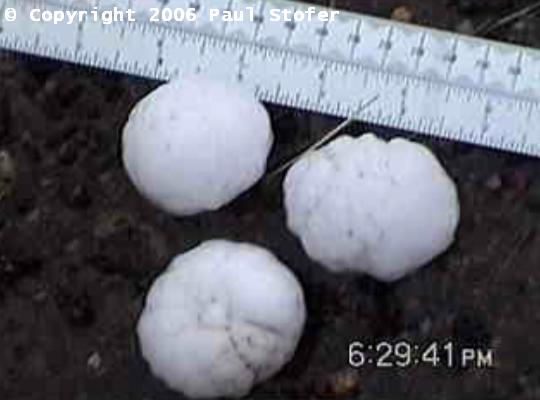
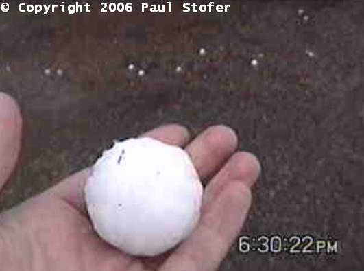
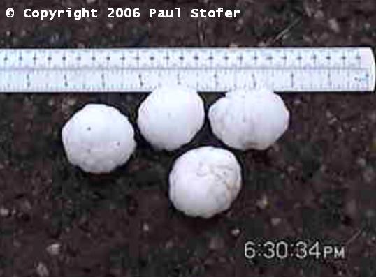
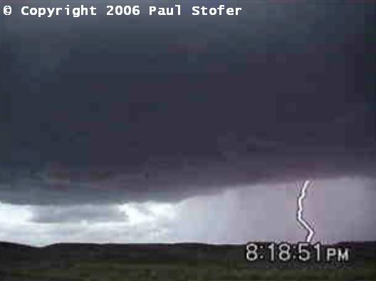
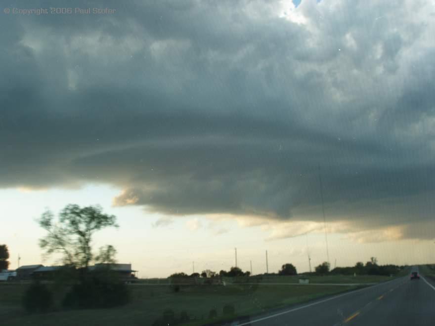
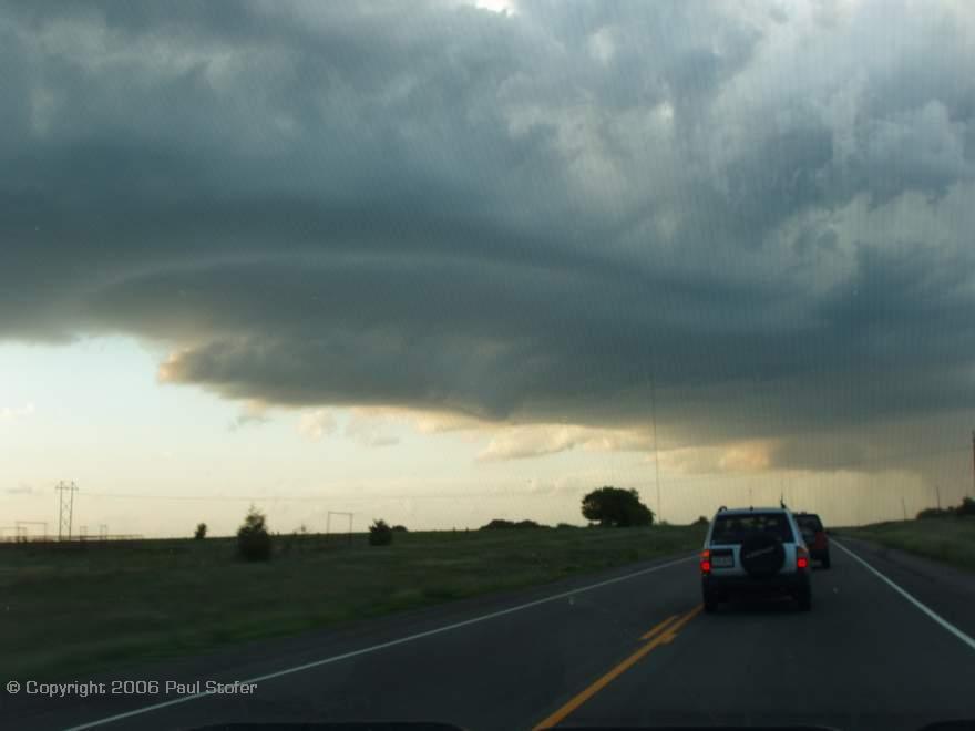
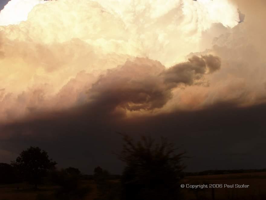
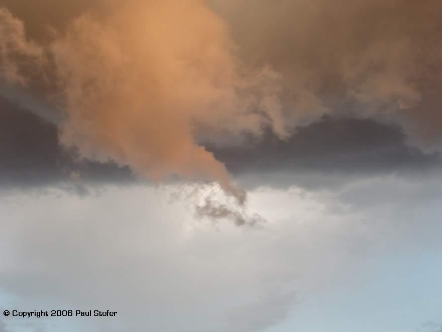
June 7th, 2006 Today's target was Southeast Wyoming. Nothing significant was observed. June 8th, 2006 Today Eric Nguyen, Scott Blair, his fiancé and I left our hotel in Gillette, Wyoming to head towards our target area around Broadus and Miles City Montana. When we got to Broadus we stopped to get data and look for souvenirs. After getting some data we headed West on Interstate 212 towards Crown Agency. We passed through Ashland, Lame Deer and Busby. We had some amazing views of the countryside as we passed through Custer National Forest and the Northern Cheyenne Indian Reservation. At this time an awesome supercell had formed just to our South West. The structure was amazing. The rotation in the cell got stronger and it grew beautiful striations. The storm attempted to form a wall cloud a few different times and was rotating anti-cyclonically. The storm was moving to the NNE and eventually crossed I212 and approached Colstrip. We chose to follow it so we shot back East on I212. We came to the conclusion that in all likelihood we probably wouldn't catch up to it. We found a dirt road that would cut off about 30 minutes of our drive-time so we took it. We passed many deer, elk and cattle as we took this one lane dirt road towards Volberg. After we got back to civilization and paved roads the Mobile Threat Net showed that the storm had decayed; however, supercell number 2 was just to its South West and intensifying. We went North in Highway 59 and pulled into the town of Beebe. We fueled up and then shot back South to find a hill as the storm approached. The storm was absolutely beautiful as the storm passed over the hills and rocky landscape. The storm had amazing structure and scud formed and began to approach the storm base. This formed a rock solid wall cloud and began to rotate. We watched this lowering for about 15 minutes before the rotation lost strength and the storm got undercut. The hail core on the storm looked fairly intense so we dove South and ventured into the core. We began to get some heavy rainfall and then the hail started. The hail grew to 2.5 inches in diameter. This over golf ball sized hail pelted the cars and sounded like tennis balls hitting the roof. The hail just got larger and for a moment we felt we would lose or crack the windshield. It began to cover the ground and you could feel the impact in your chest as it hit the vehicle. The hail was white and soft, so we didn't lose the windshield but any larger and harder probably would have taken the windshield. One stone shattered as it came through the window and landed in my lap. After the hail ceased and the rain grew less intense we went outside the vehicles to measure the hail size and take photographs. We then went North towards Miles City, Montana to stay the night. As we were heading north Supercell number 3 formed right behind us. Other than storm number 1, storm 3 was really impressive. It was a beautiful rotating LP supercell with gorgeous striations. The storm base was amazing and from a distance this storm had to have been absolutely amazing. We noticed some scud rising and rotating around the base, but the storm didn't produce more than that. We sat through pea to marble sized hail and intense rain then made our way towards Miles City to stay the night. After we arrived at our hotel I edited some video for the Network and local TV stations while Scott called in our hail reports to the National Weather Service. We ended the night watching video and preparing for tomorrows chase in Wyoming. Amazing day...
STILL PICTURES WILL BE ADDED SOON...
June 9th, 2006 Eric Nguyen, Scott Blair, his fiancé and I observed a few strong cells in Southeast Wyoming into Northwest Nebraska. We observed small hail, 52 MPH outflow wind gusts and brief weak storm circulation. The initial storm bowed out and produced some nice shelf clouds, strong winds, dangerous lightning, and heavy downpours. The storms eventually became clustered. Nothing significant was observed.
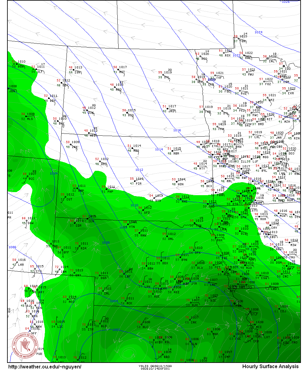
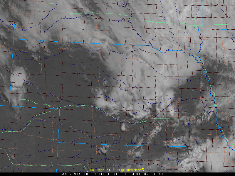
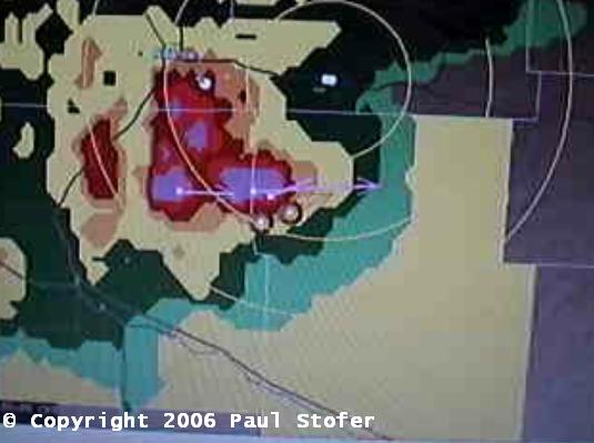
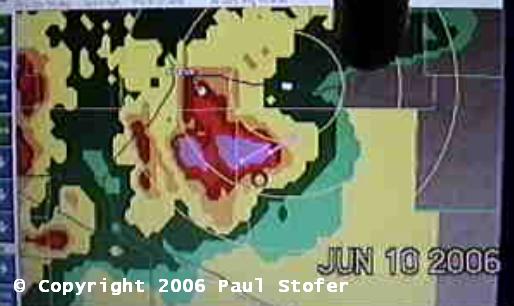
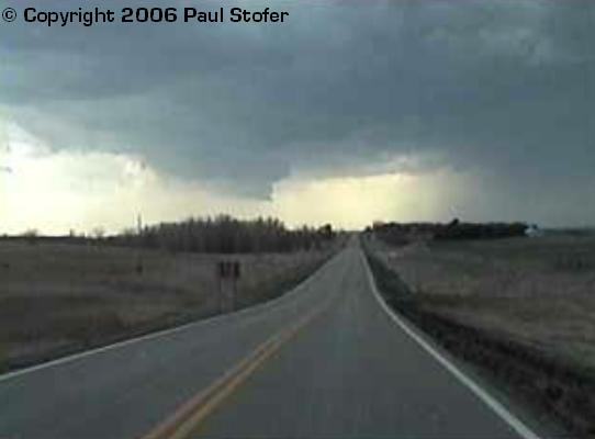
June 10th, 2006 Scott Blair, his fiancé, Eric Nguyen and I observed a couple high based funnel clouds as well as a few wall clouds today. We started the day in Scotts Bluff, Nebraska. We ate breakfast / lunch and noticed a nice cell with a beautiful anvil just to our Southwest by 30 miles. We headed that way and observed some amazing storm structure. The road network was pretty bad and we ended up getting tuck on multiple dead end and closed roads. We ended up sitting on a dirt road waiting for the storm to get closer to us. The storm began rotating and formed a wall cloud while the vault shot straight up. The storm attempted to form a couple funnels before it lost its intensity. We tried to race back East through Scotts Bluff to observe the structure better; however, traffic in town prevented us from doing so. We took CR L East into Baxter staying ahead of the storm hoping it would get its act back together. We went North on Highland and then back East again on CR A and then took US 385 North. By this time another storm with 68 DBZ was forming and had a Tornado Warning on it. According to Mobile Threat Net, the storm had strong shear on it and was moving to the Northeast. We then went East running parallel to the storm on State Road 2 through Alliance, Lakeside, Ellsworth and Bingham. We began to see a rotating wall cloud through the core on the Southern end of the storm. To try to get better position we dove South from Ashby on a small one lane farm road. We managed to get to the far Southern part of the core as the high based wall cloud attempted to drop down a couple of funnels. The wall cloud passed right in front of us and then we got hit by the storm core. We observed copious amounts of rain and 54 MPH winds but we didn't receive any hail. We tried to continue South to US 26; however, our chase came to an abrupt end when the farm road turned into a one lane muddy, sandy mess. The structure today was amazing, and even though there wasn't a visible tornado I can settle for great Nebraska structure to be the end of my season. Hopefully there will be a good late spring setup or good fall setup.
STILL PICTURES WILL BE ADDED SOON...
|
||||
|
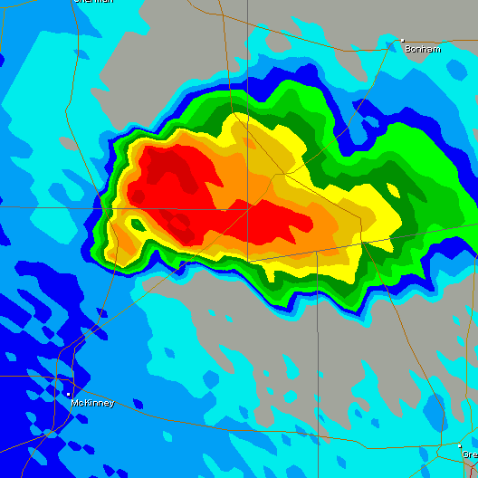
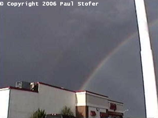
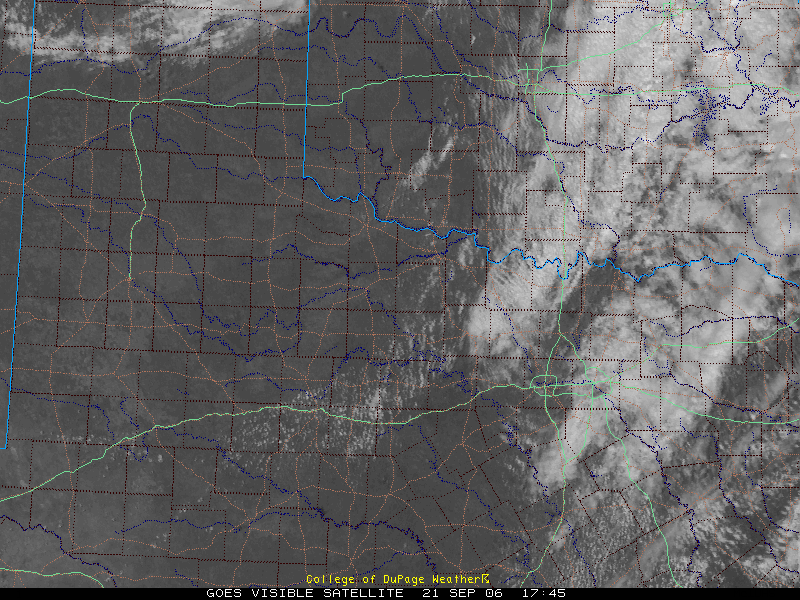
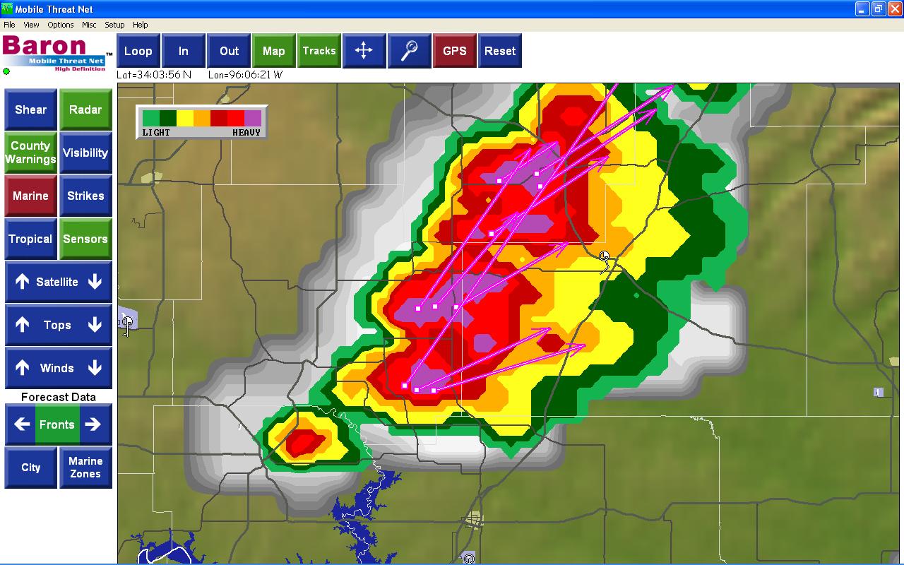
September 21st, 2006 Today looked to be a good fall chase day. I woke up at 6AM planning on heading to the Kansas / Nebraska border but after checking the models and the Forecast Discussion by the Wichita Weather Service I was fairly disappointed. I fell back asleep and woke up around noon to a moderate risk just to my Northeast. I looked at some models and decided that it wouldn't be a bad idea to head North. Tim Carroll and I left Dallas around 2PM and headed for our Target around Whitesboro, Texas. Going North on I75 I monitored the mobile threat net as well as staying in phone contact with chaser Jeremy Wilson and gathering data on the internet. After arriving in McKinney, we shifted our target a little bit and chose to go West on 380 to Denton and meet up with Jeremy on 82 just West of Gainesville, Texas. We sat in a parking lot waiting for initiation for a little over an hour when Brian Fant, Eric Nguyen, Rob Hall and Amos Magliocco showed up. We had excellent daytime heating with blue skies and I was measuring 63F dew points with strong winds out of the Southwest. Storms suddenly started to fire just to our Northeast so we jumped on 82 and went back East and then North to focus our new target around Tishomingo and Durant, Oklahoma. The storm very quickly got its act together and had some beautiful striations along with some tight circulation. We pulled over and took some photos and video as the area of rotation passed right in front of us. The storm started to become linear, but had more development on the tail end. The cell on the Southern end became independent and gained strength very quickly. By this time it was getting dark and we were chasing a night storm into the woods of Eastern Oklahoma near Atoka. At this point the road options became very poor and the rain was making our routes muddy. As we followed the storm East towards Antlers, OK we noticed an area of rotation on the ground with power flashes. 911 was notified and was asked to forward the information to the National Weather Service. The storm had excellent shear on it and was looking very impressive. With this information, the National Weather Service issued a Tornado Warning on the storm. Unfortunately, with the lack of road options and the storm moving at 46MPH, we were unable to pursue the storm any further and the chase was ended at the Indian Nation Turnpike in Antlers, OK. Today was a fun, exciting, fast paced chase with what was probably a tornado on the ground doing damage just West of Antlers. Some great structure was observed and I feel it is a good end to the fall chase season.
|
 VIDEO
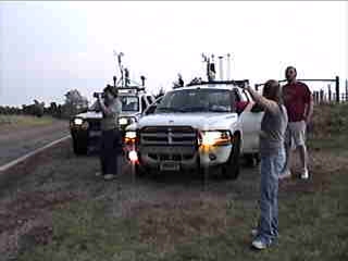
GRABS: Left: Us with Chris Caldwell, Right: Chris
Caldwell's Chase Durango
VIDEO
GRABS: Left: Us with Chris Caldwell, Right: Chris
Caldwell's Chase Durango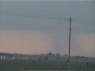
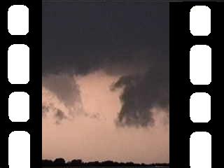
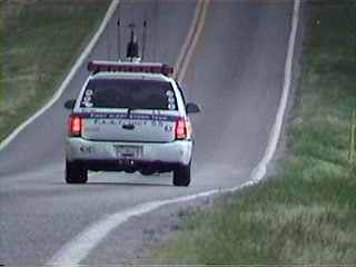
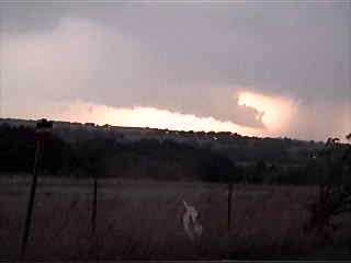 VIDEO GRABS: Left: SW of El Reno a wannabe rain wrapped
tornado , Right: Wall Cloud
VIDEO GRABS: Left: SW of El Reno a wannabe rain wrapped
tornado , Right: Wall Cloud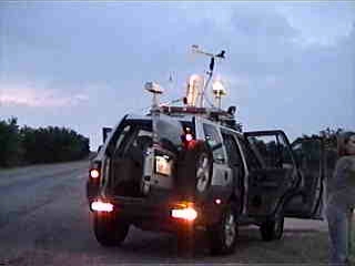
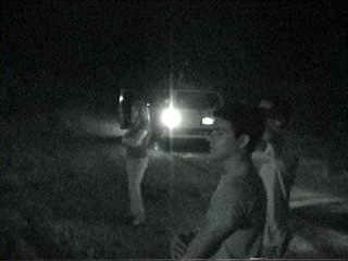 VIDEO GRABS: Left: Sitting on a hill, Right: Scott, Leslie
and Aaron observing lightning
VIDEO GRABS: Left: Sitting on a hill, Right: Scott, Leslie
and Aaron observing lightning