StormPursuit
Menu Bar

Forecast Tools:
Radar
Satellite

Map Room
Forecast Page
Lightning Activity

Storm Outlooks 
Hurricane Center
Mesoscale Outlook

Pictures/Accounts:
Chase Accounts
StormTracker Cam
People
Tornadic
Structure
Sunrise/Sunsets
Winter
FireFighting
Instruments
Hail / Lightning
Miscellaneous

Chase Vehicles
Storm Damage
SCUBA Pictures

My Off-Road Page!
My Vehicle!

Education:
Data Archives
Education Page

The Rest:
What's New

My Biography

Media Services
Affiliations
Contact Me
Guestbook
Disclaimer
Links

RACES Civil Defense


2007 Chase Accounts


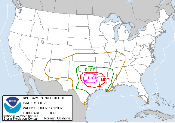
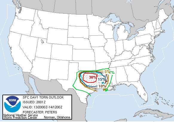
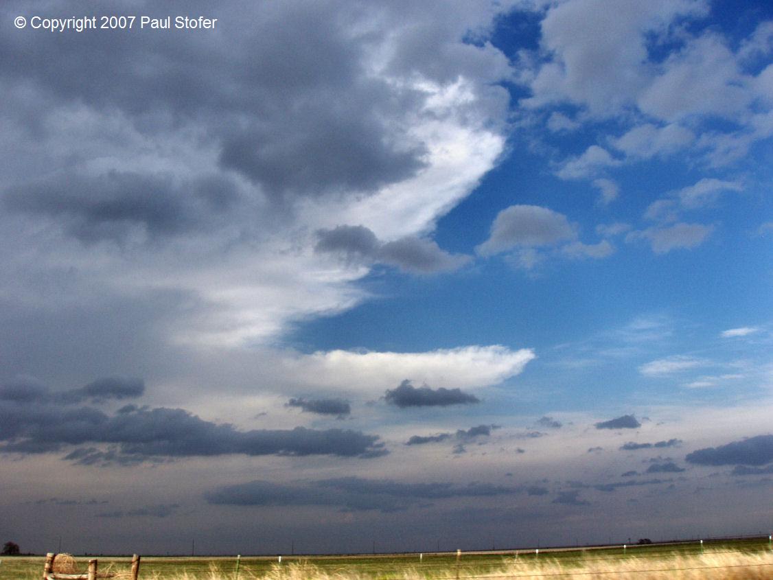
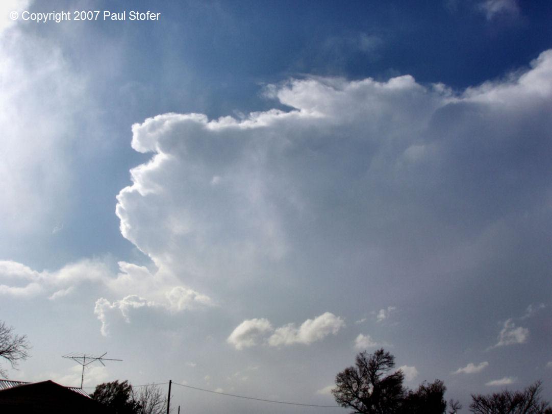
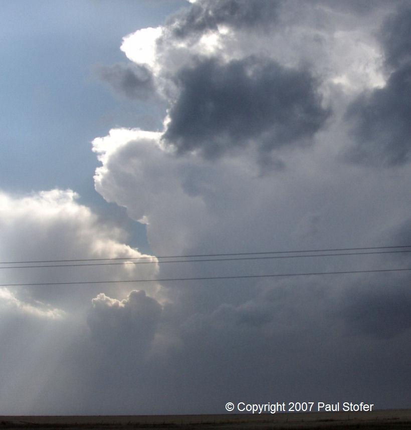
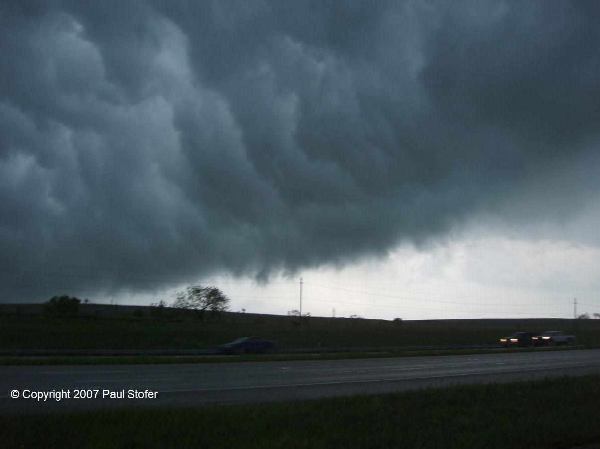
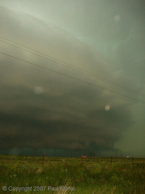
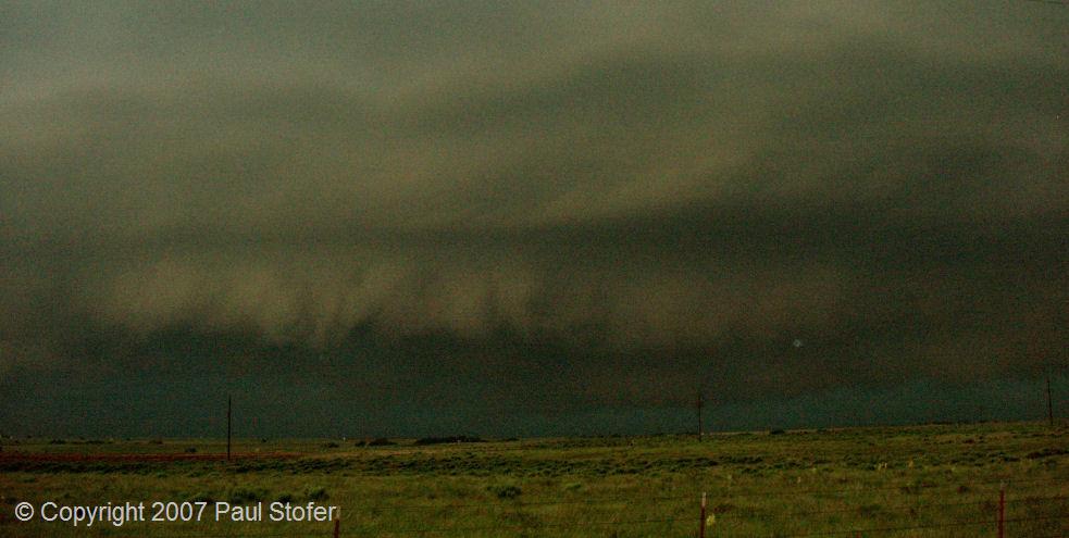
April 13th, 2007

The first big chase of the season began today in Northwest Texas. The day started off as a moderate risk, but around 2pm it was upgraded to a high risk. I met up with chase partner Jeremy Wilson and left Denton and went West on 380. We started the afternoon in Bridgeport TX, watching a few cells start to organize and move from SW to ENE. I was interested in the furthest Southern Cell which was getting the most inflow and energy. I called and talked with Mike Burger, meteorologist with CBS11, about what his thoughts were and my current observations at my location. After looking at the radar, surface maps and getting a little bit of nowcasting from Mike, we went South on 114 through Boyd. At this time the storm SW of Boyd and Rhome TX went Tornado warned and began to pick up incredible speed and started to shoot due East. Our road options got very limited so we continued to have the storm race us SE on 114 and then South on 287. The storm motion was incredible and the rotation and movement on the front of the line was amazing. The leading edge of the line looked very much like a shelf until a wall cloud dropped and began to rotate. We continued East, letting the storm follow us and approached Texas Motor Speedway and began to see quarter to golf ball hail. The storm had decayed significantly and appeared to just be a shelf again with a mean looking core behind the gust front. At this time the sirens were sounding at the race track. I feel they probably set them off because of the possibility of straight line winds and large hail. The core just to our West, according to NOAA, was producing Orange sized hail. We continued North on 377 and East on 1171 knowing that the core to our due South was on the verge, if not already, producing a rain-wrapped tornado along with gorilla size hail. We continued East looking due South at a rain and hail core which at this time was producing baseball hail. On the other side of this core was an EF1 Tornado doing damage in Haltom City. We couldn't see the tornado due to the core, but were about 5-7 miles North of the tornado. We chased the now linear storm system East all the way to I35. We went South on 35 then East on 30 to get the Rockwall tornado but we kept playing the catch-up game. With some new equipment, a new vehicle, and an early starting season it was a great way to test all of the new tools and get prepared for the 2007 Spring tornado season.

ONLY VIDEO CAPTURES ARE AVAILABLE FOR THIS CHASE...
STORM MOTION WAS TOO FAST TO ALLOW US TO STOP TO TAKE STILL PHOTOGRAPHS.
VIDEO CAPTURES WILL BE UPLOADED SOON...

CHASE PHOTOS AND DATA

Day 1    Day 1 Tornado Risk Left and Right: Day 1 and Day 1 Tornado Outlook

Radar     Left: Radar Animation


April 21st, 2007

Today I left Dallas around 8:30AM and headed for my initial target around Lubbock, Texas. I went West on I-20 past Abilene and then North towards Lubbock on 84. I arrived in Lubbock around 1:30PM and gathered data while grabbing a quick bite to eat. I shifted my target a little and continued North on 27 towards Plainview. I traveled North and eventually got to 
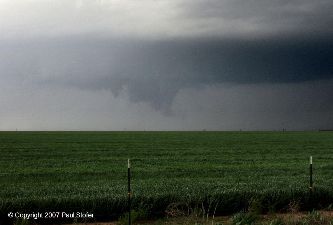
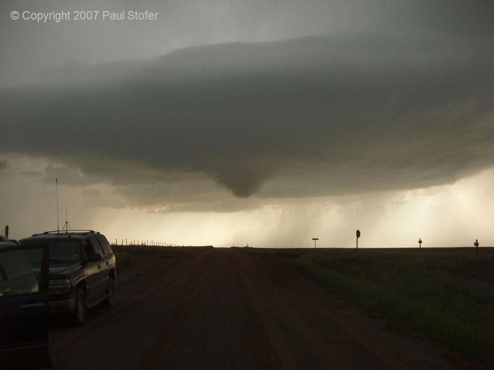
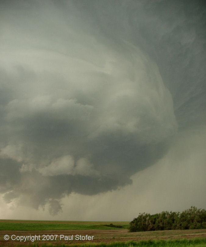
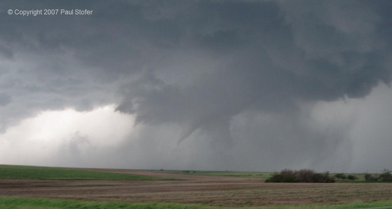
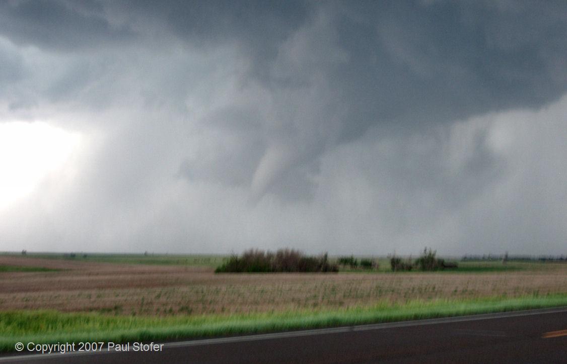
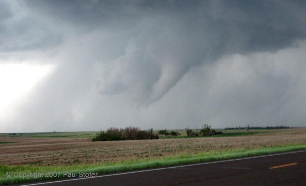
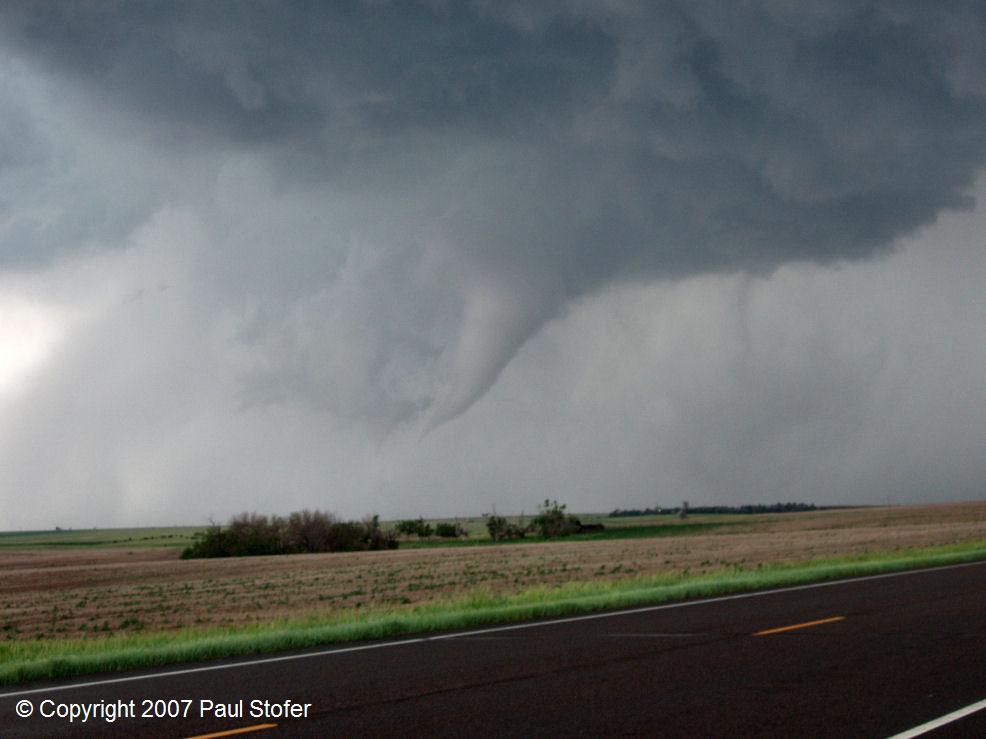
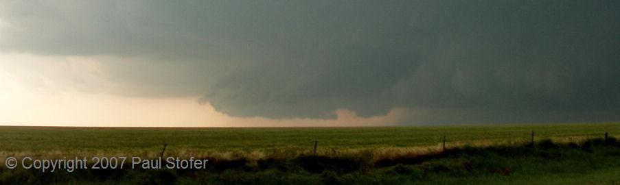
Tulia, Texas. I met with a few other chasers and sat on the Western side of Tulia watching the dryline move East. While watching the dryline, I poured over some data and got some nowcasting from my Friends Jeremy Wilson and Aaron Hughes. Storms began to fire to our Southwest so I, along with a female friend we met at our observation point, blasted West on 86 towards Dimmit to try to intercept the now rotating storm. As we passed through Nazareth, Mobile Threat Net radar was showing incredible shear on our storm. We went North on 385 and intercepted the storm near Hereford, TX. The storm now had a Tornado Warning on it and had great structure. We pulled to the side of the road and watched the storm develop a wall cloud. About a minute later a very 
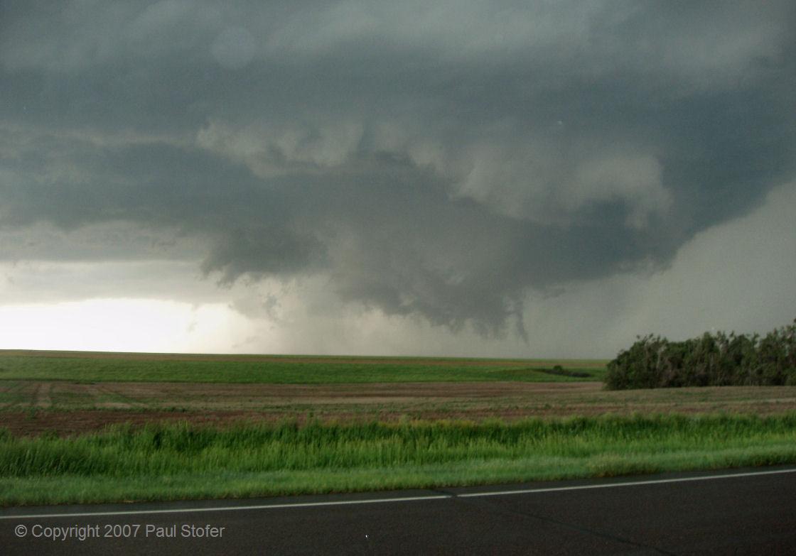
raggedy looking funnel dropped, and we watched Tornado number 1 for the day move slowly to our North. We took some photos and video, then continued to chase the tornado until it disappeared into a rain and hail core. We began to get quarter sized hail, and our route to follow the storm turned into a very muddy 1 lane road. Before we got stuck, I kicked on the 4x4 and we turned around and got back to paved road. 
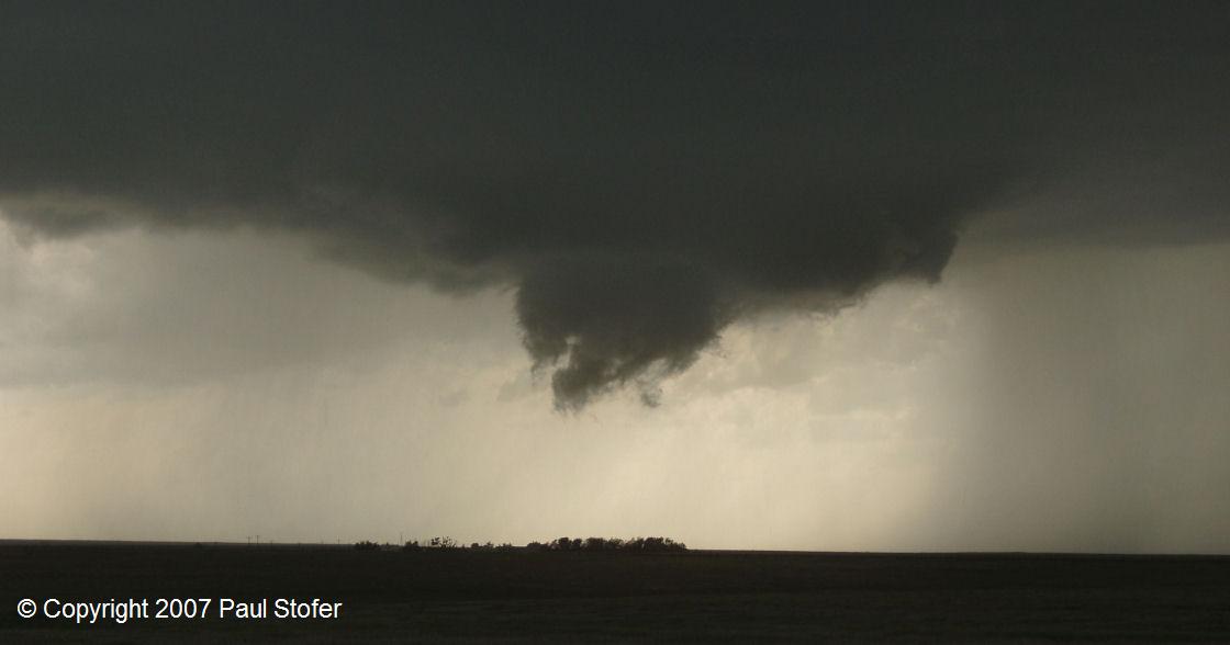
At this time the tornado turned into a very large cone, but we were blinded by the core and had no road options. We went back North and eventually made it to US60 and made our way towards Canyon, Texas. At this time a very large "wedge" tornado was being reported near Tulia. We raced Southeast and made it to Ranch Road 2698, which is a few minutes north of downtown Tulia, as the Tulia tornado and its core passed in front of us through town. We parked near an overpass in the grass while golf ball hail fell and the tornado passed in front of us. The core of the storm passed to our East and we got back onto the highway and continued South to attempt to find an exit to turn around and go back North on 27. We found the exit and went back Northbound where we passed the tornado debris path. We exited 2698 and went East past Tulia after the Tornado had hit town. On 2698, our route was once again blocked by power lines and poles crossing the road. At this time it was getting dark, and we would be unable to keep up with the Tulia tornado. We turned around and went 
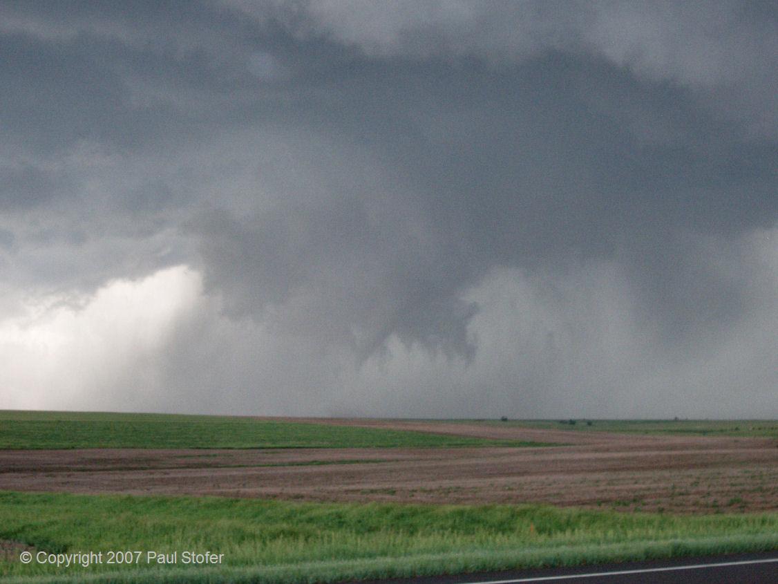
back South on 27 out of Tulia. A new area of rotation formed to the Southwest of Tulia, just to our West. We pulled over and watched it for a few minutes. The storm went tornado warned as it went to our Northwest and dropped a cone tornado. This storm had a very well defined hook on radar. We observed tornado number 2 just NW of Plainview for about 10 minutes before it disappeared as well. At this time we called it the end of the day and got dinner in Plainview before heading back towards Dallas.
 

CHASE PHOTOS

Hereford, Texas Structure    Hereford, Texas Structure Left and Right: Hereford, Texas anvils

Hereford, Texas Tornado    Hereford, Texas Storm Base Left: Hereford updraft, Right: Hereford storm base

Hereford, Texas Tornado    Hereford, Texas Tornado Left: Hereford, TX Clear slot, Right: Hereford, TX tornado


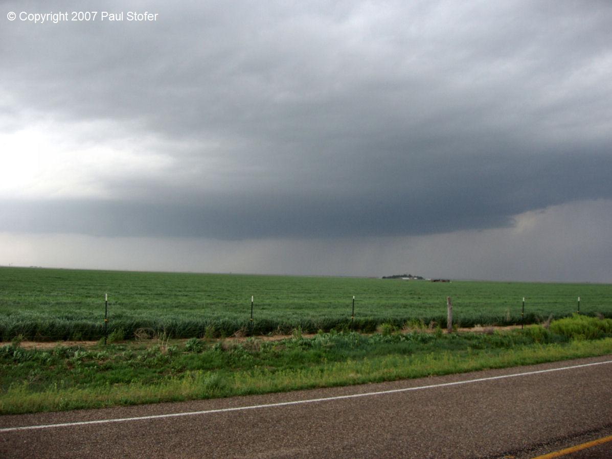
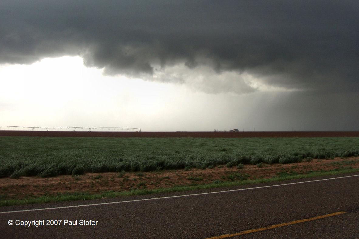
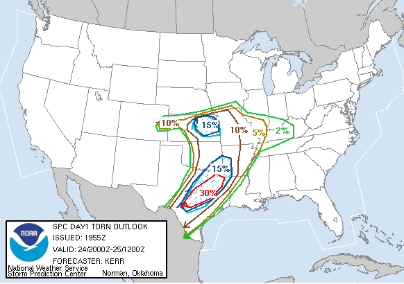
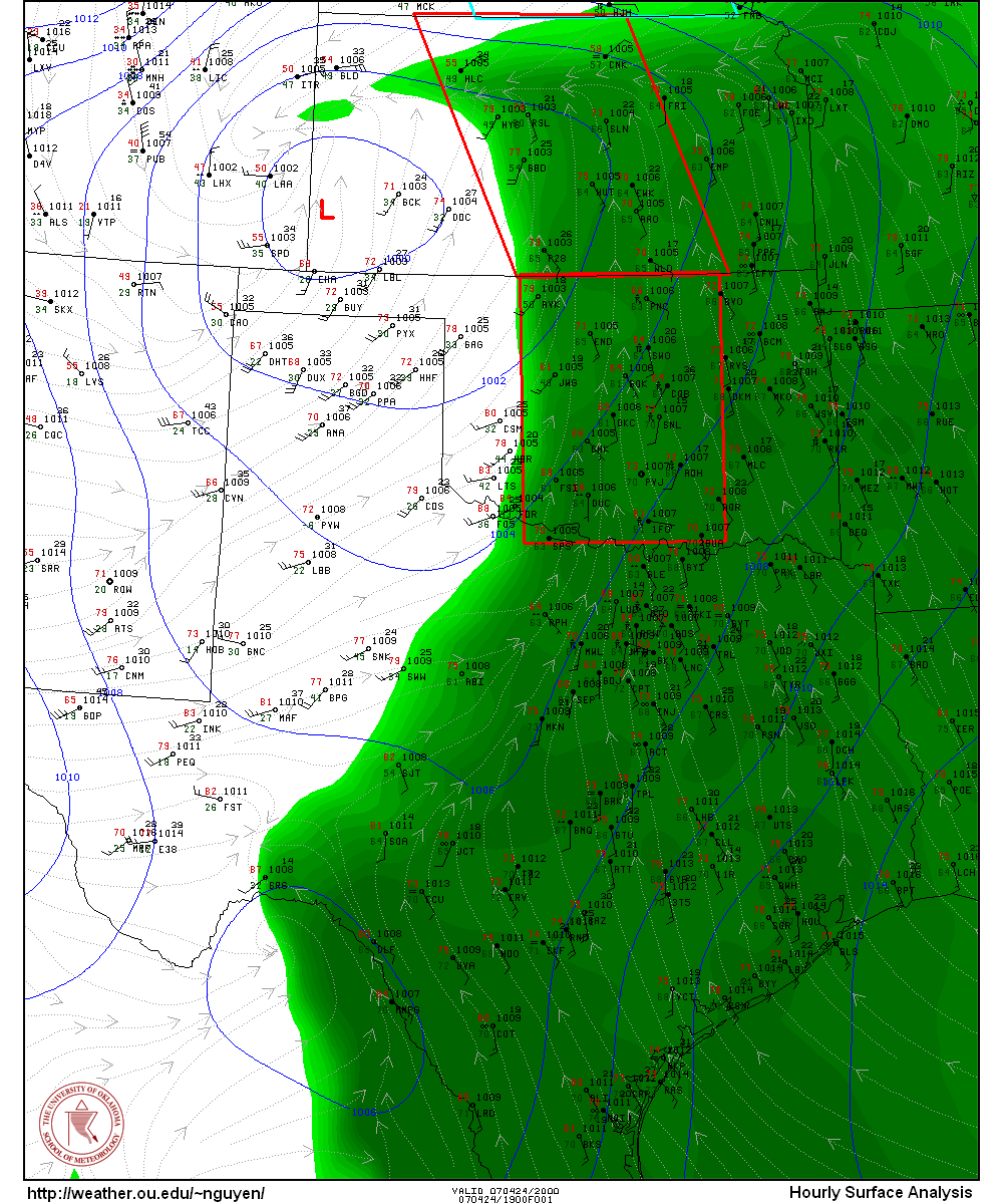
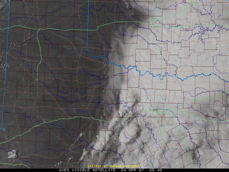
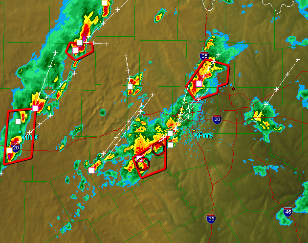
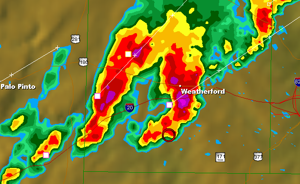
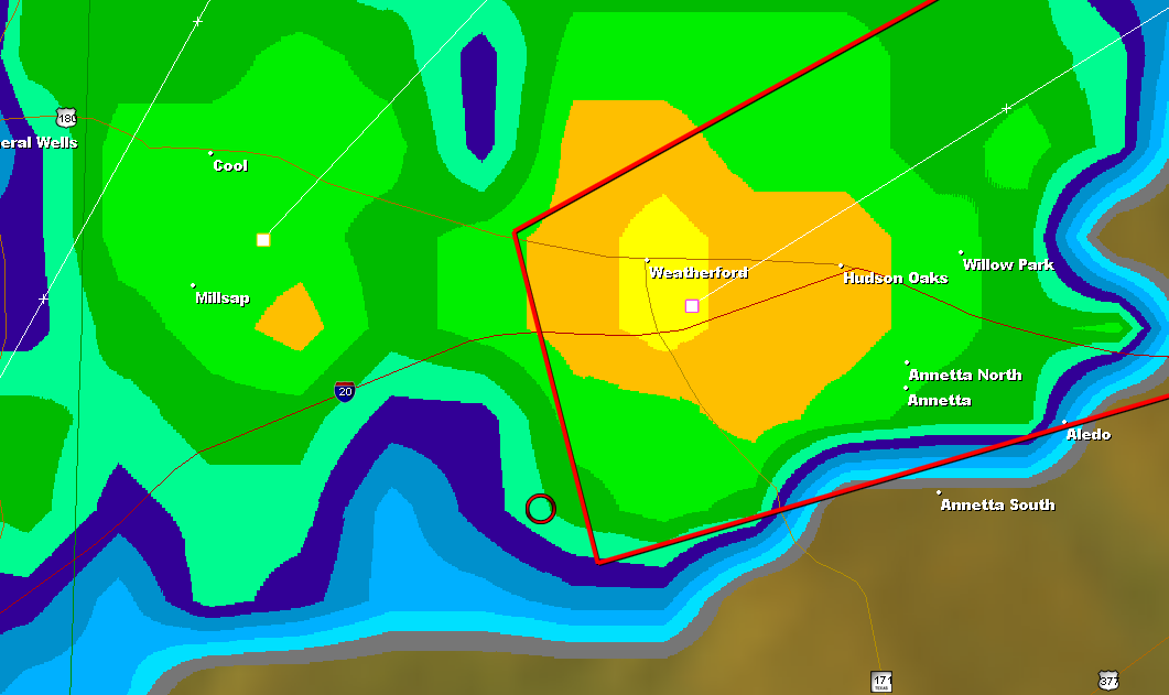
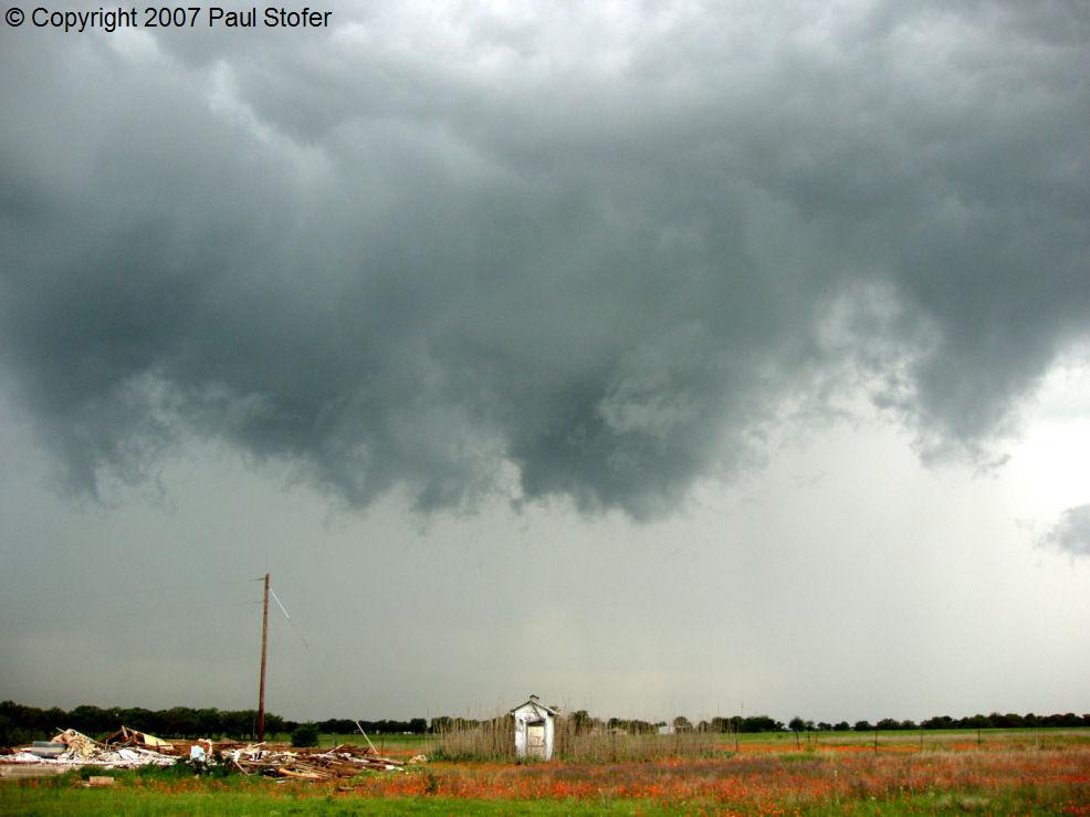
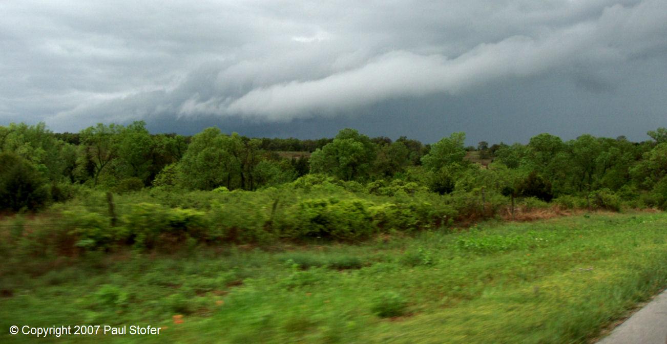
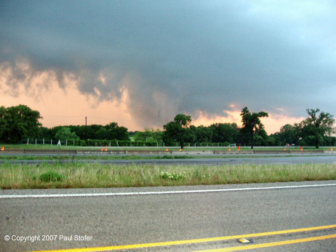
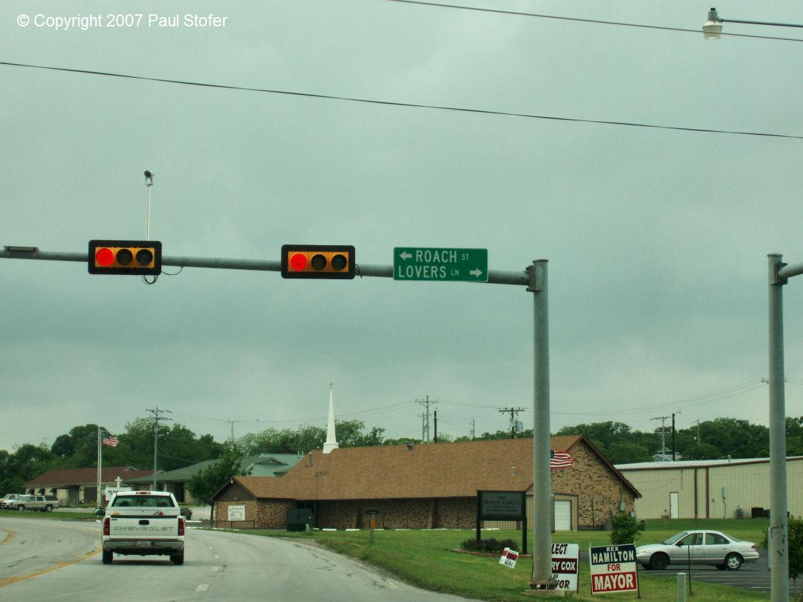
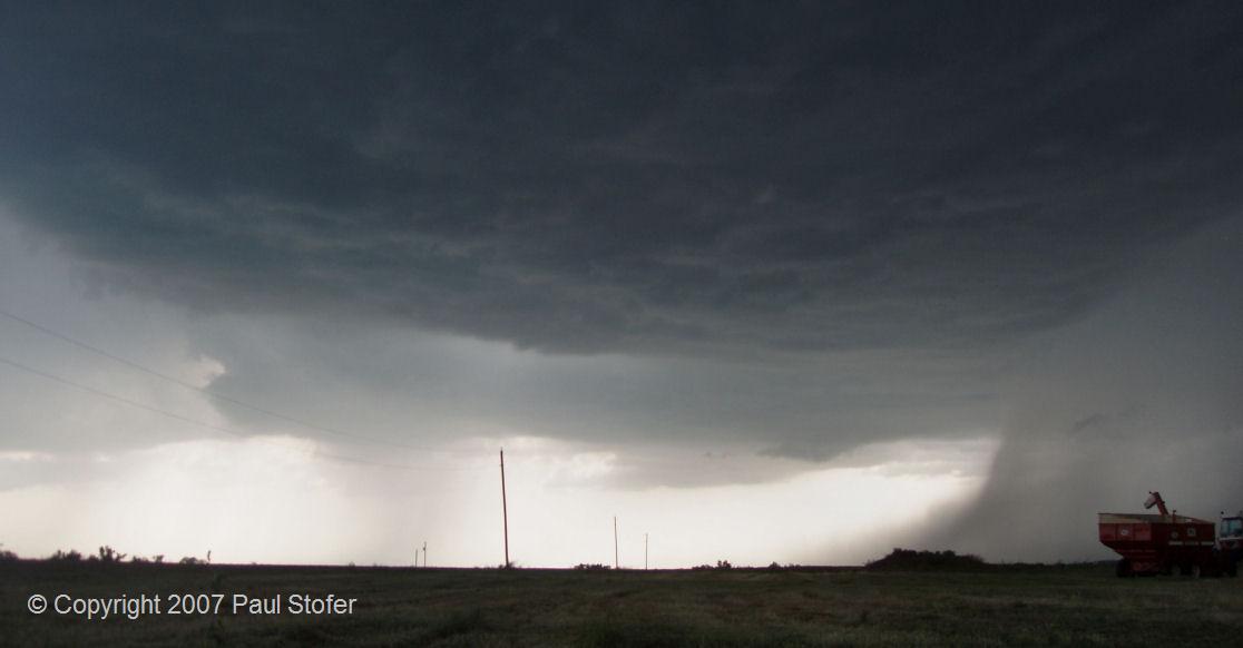
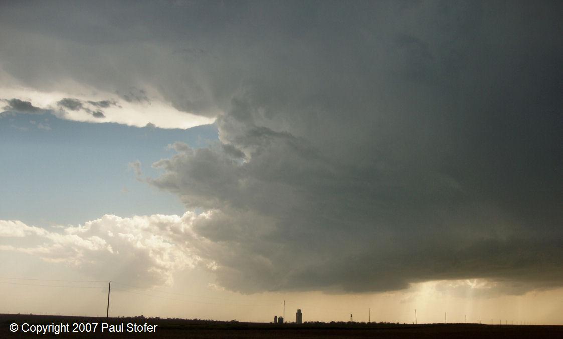
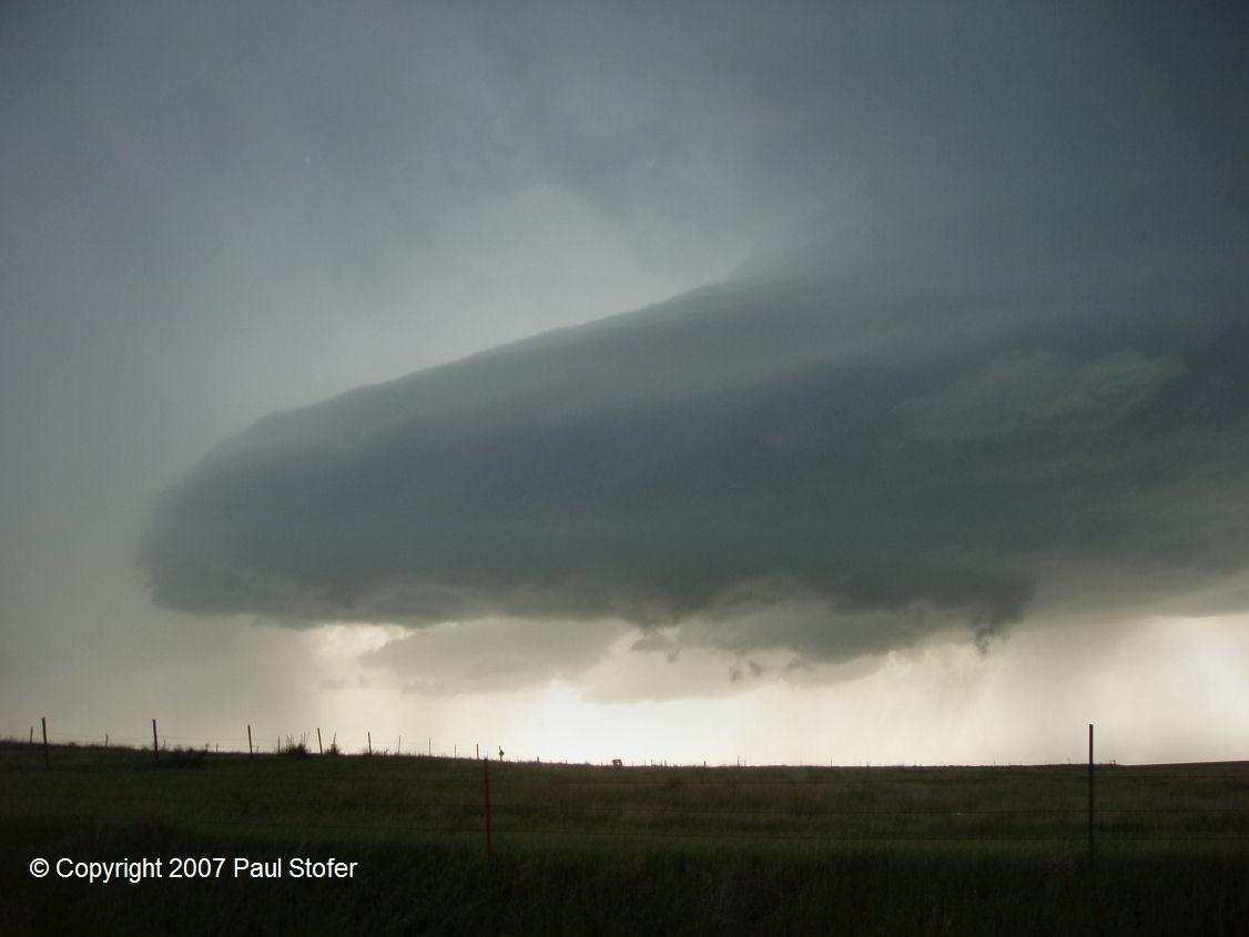
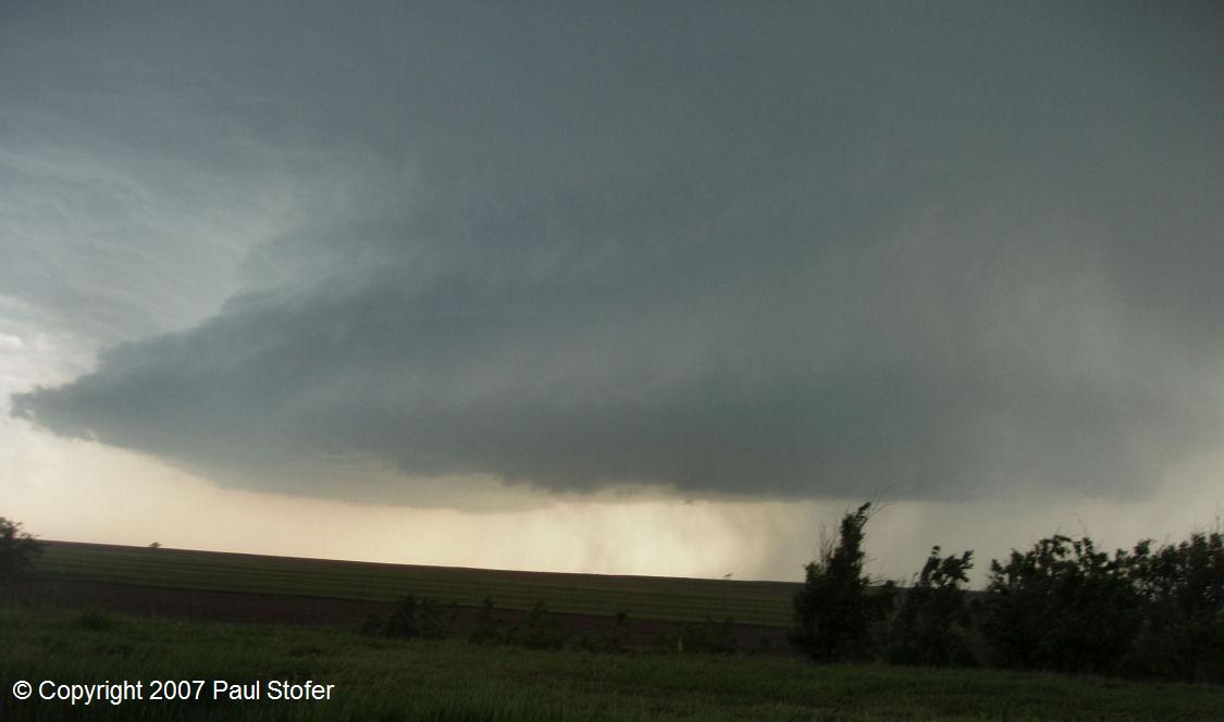
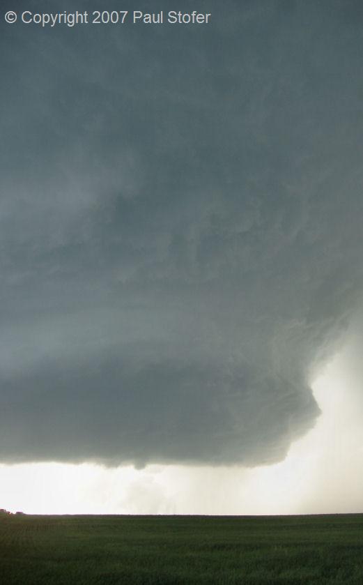
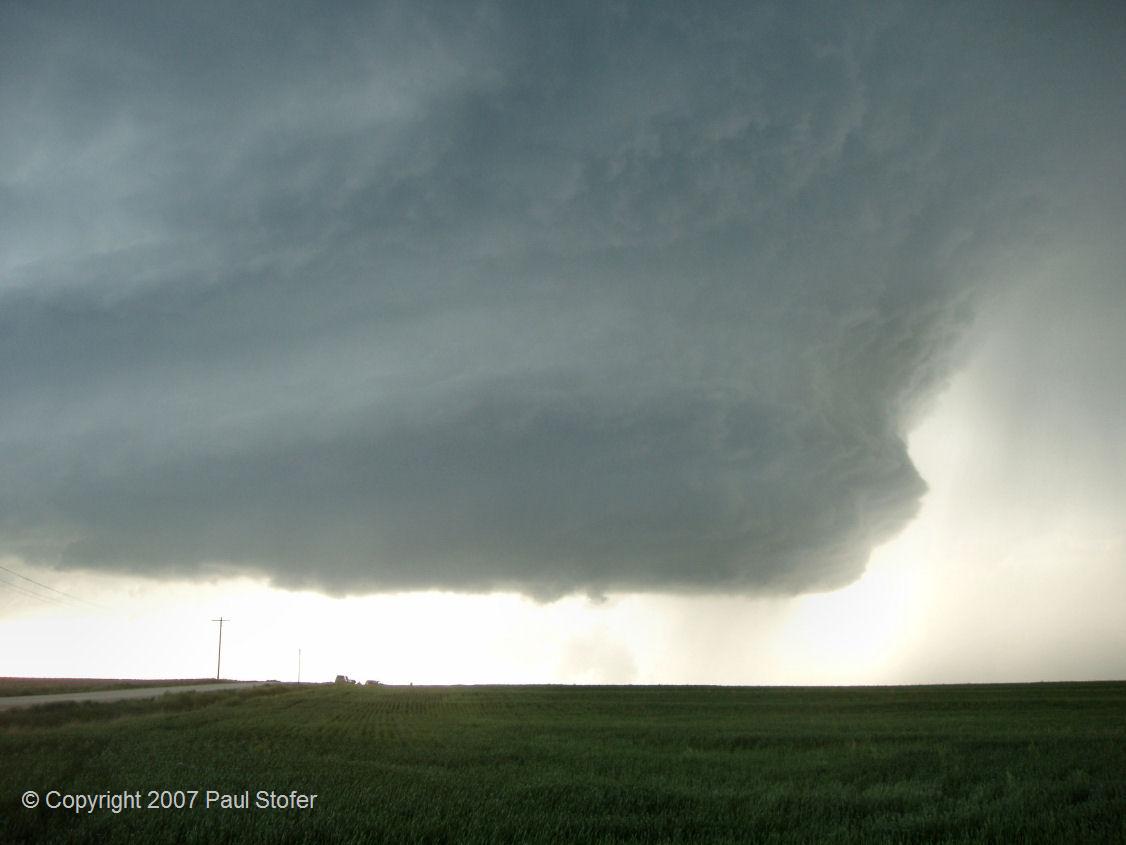
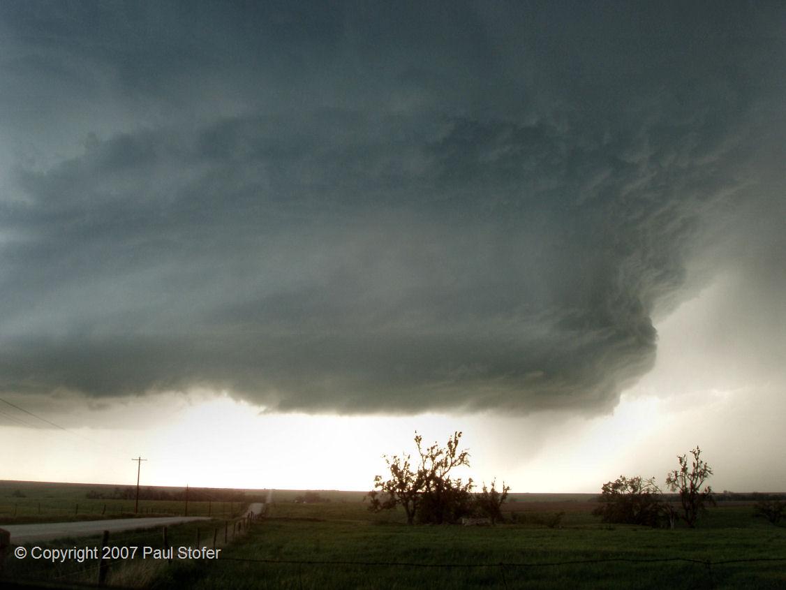
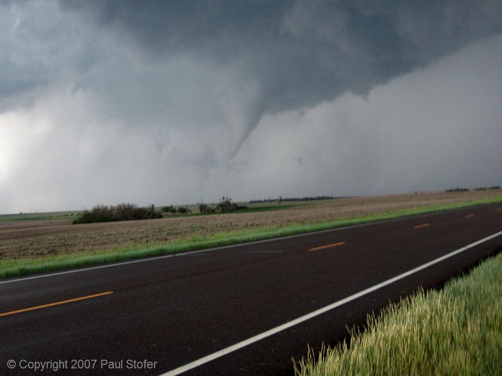
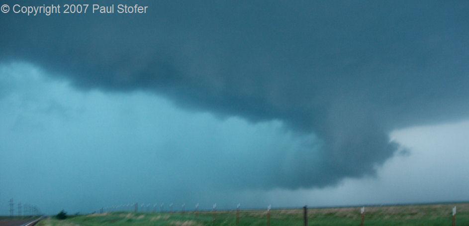
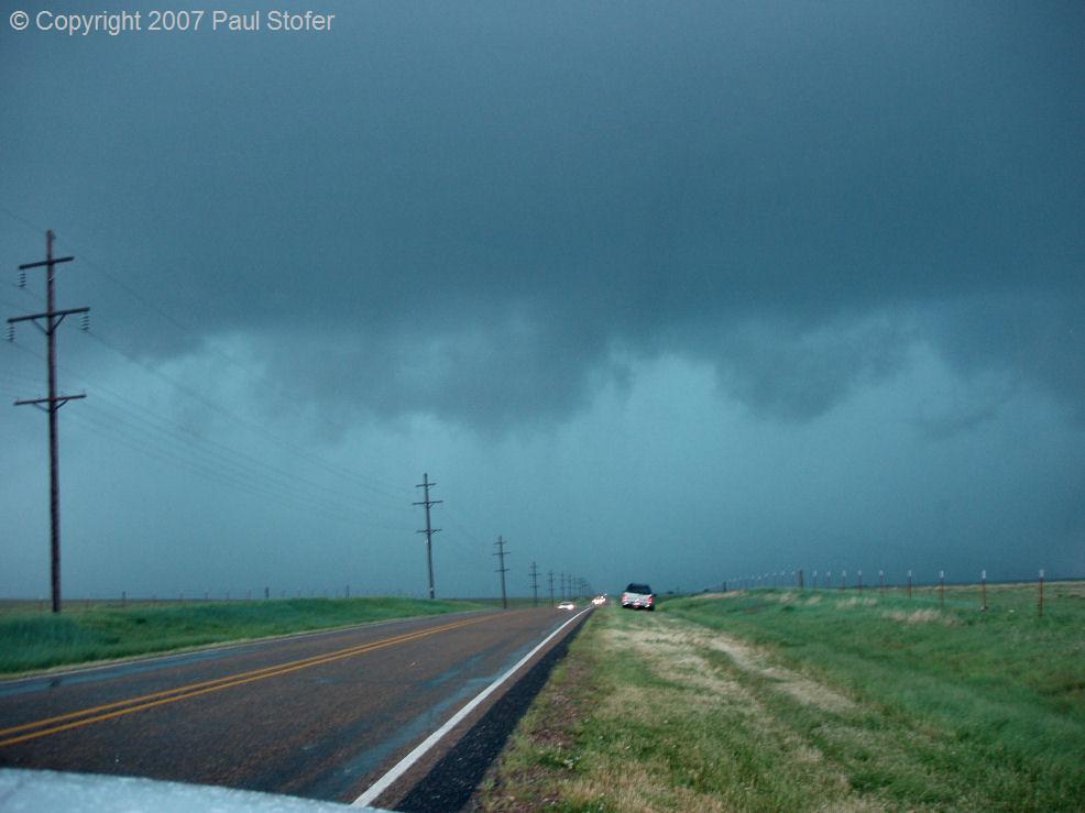
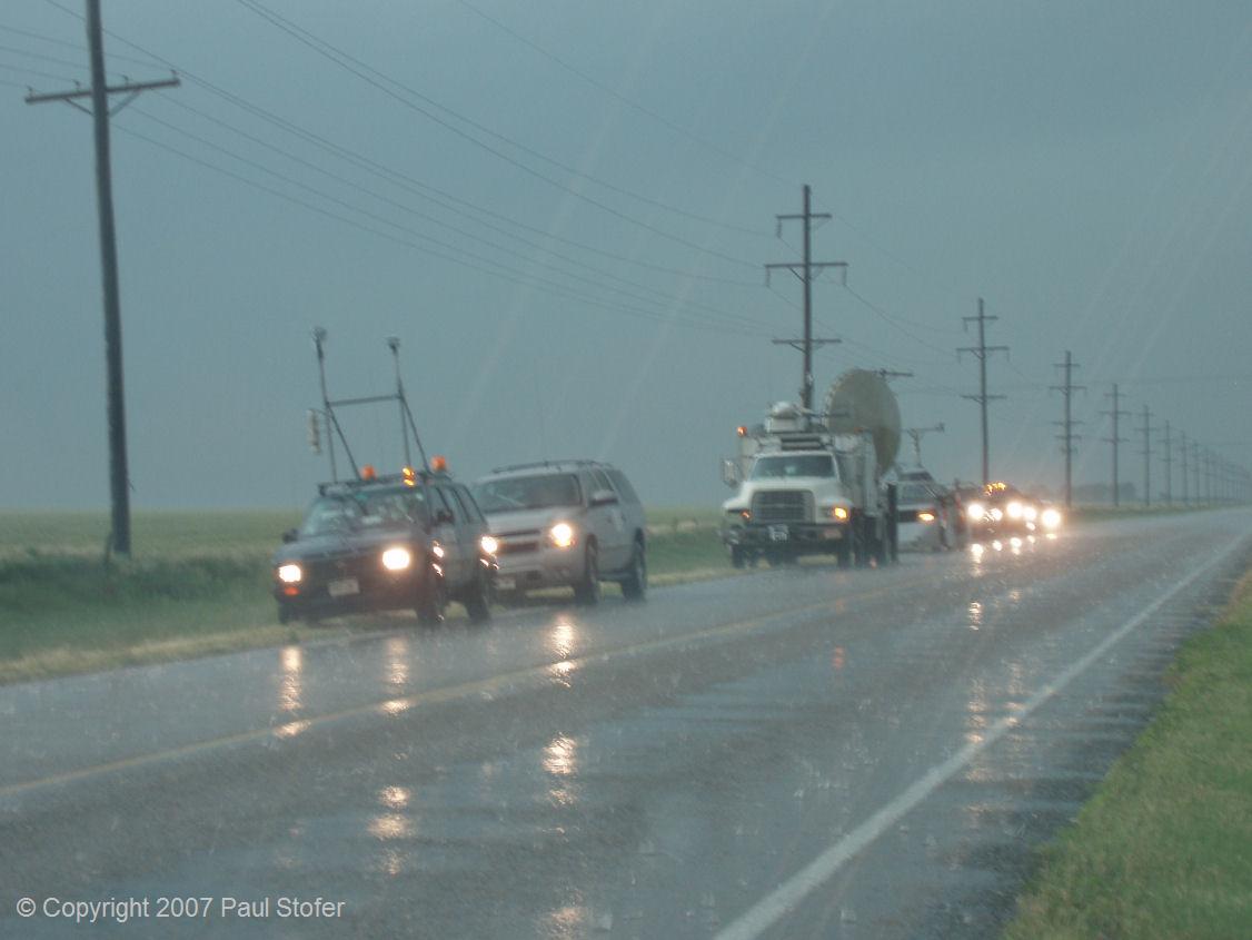
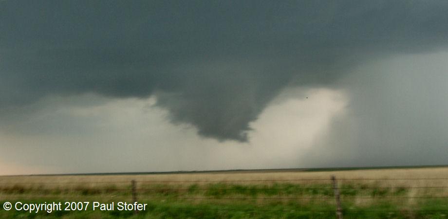
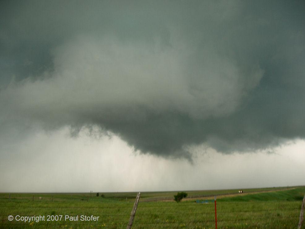
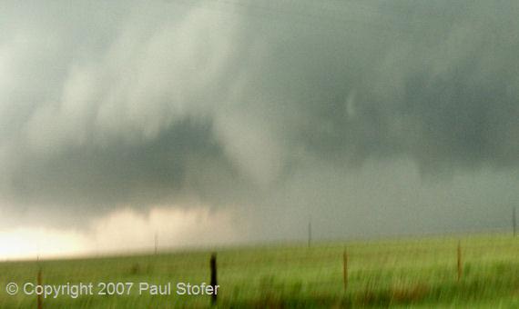
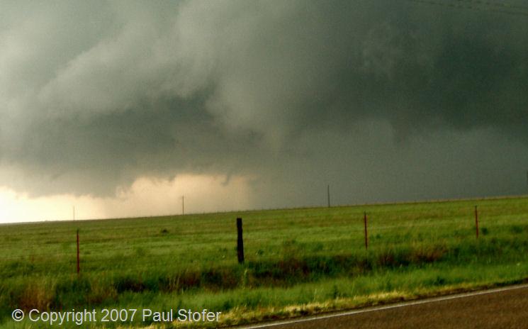
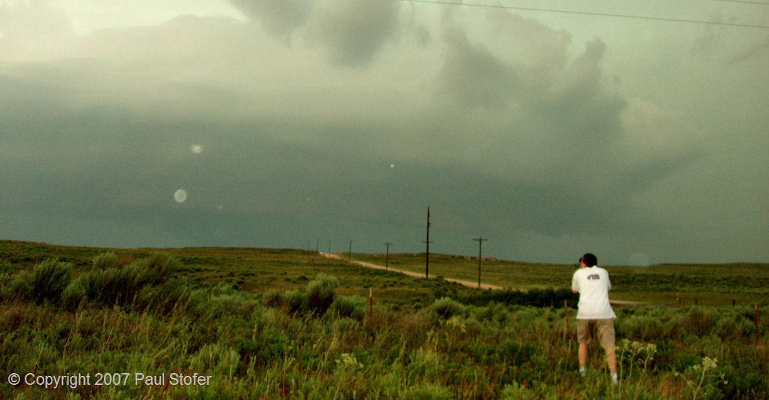
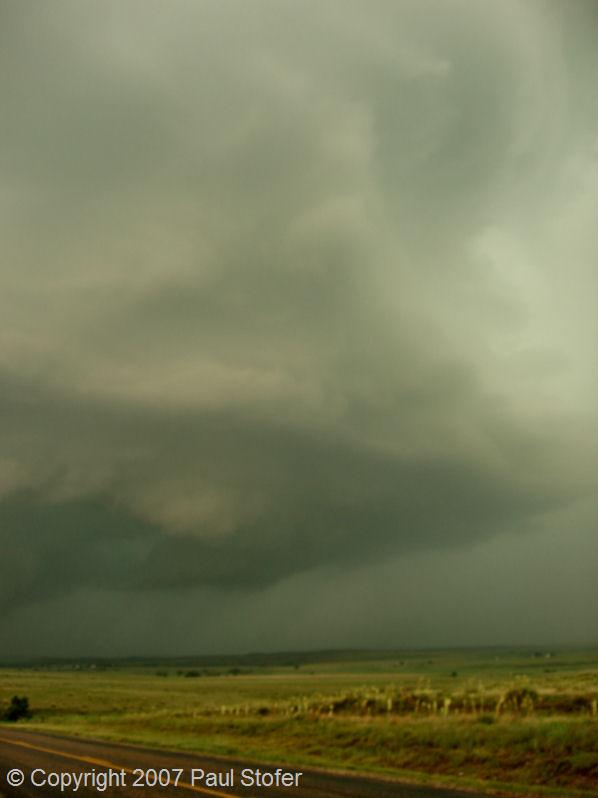
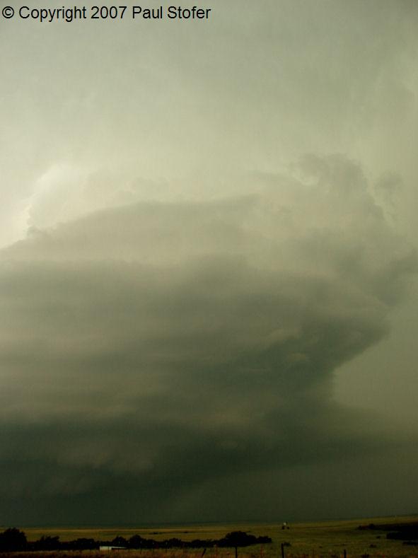
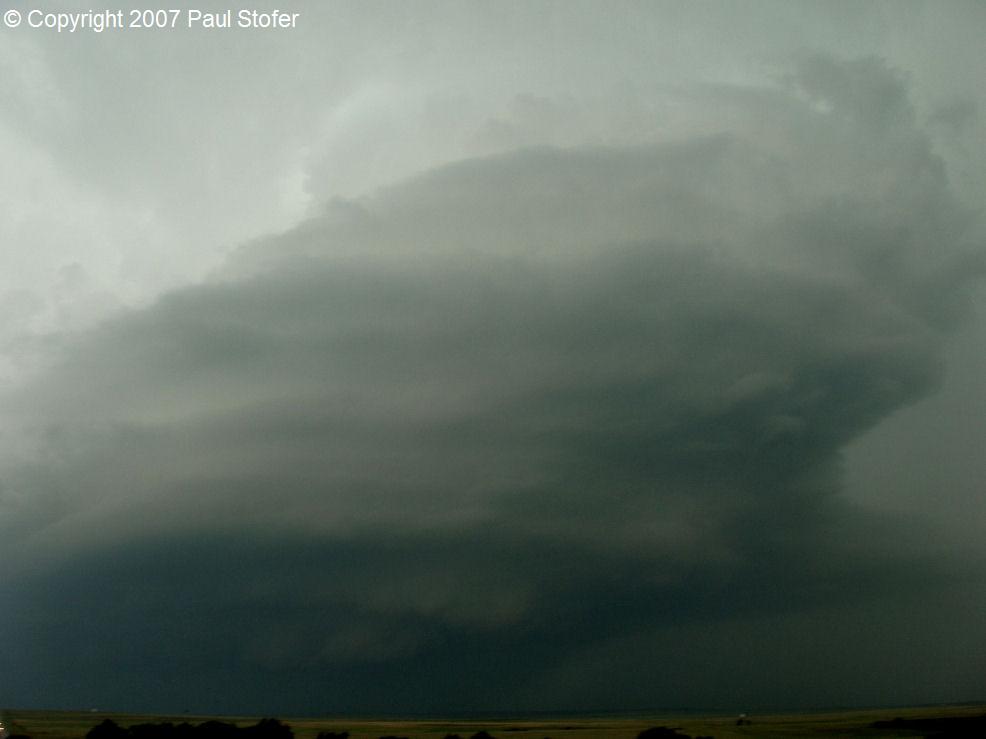
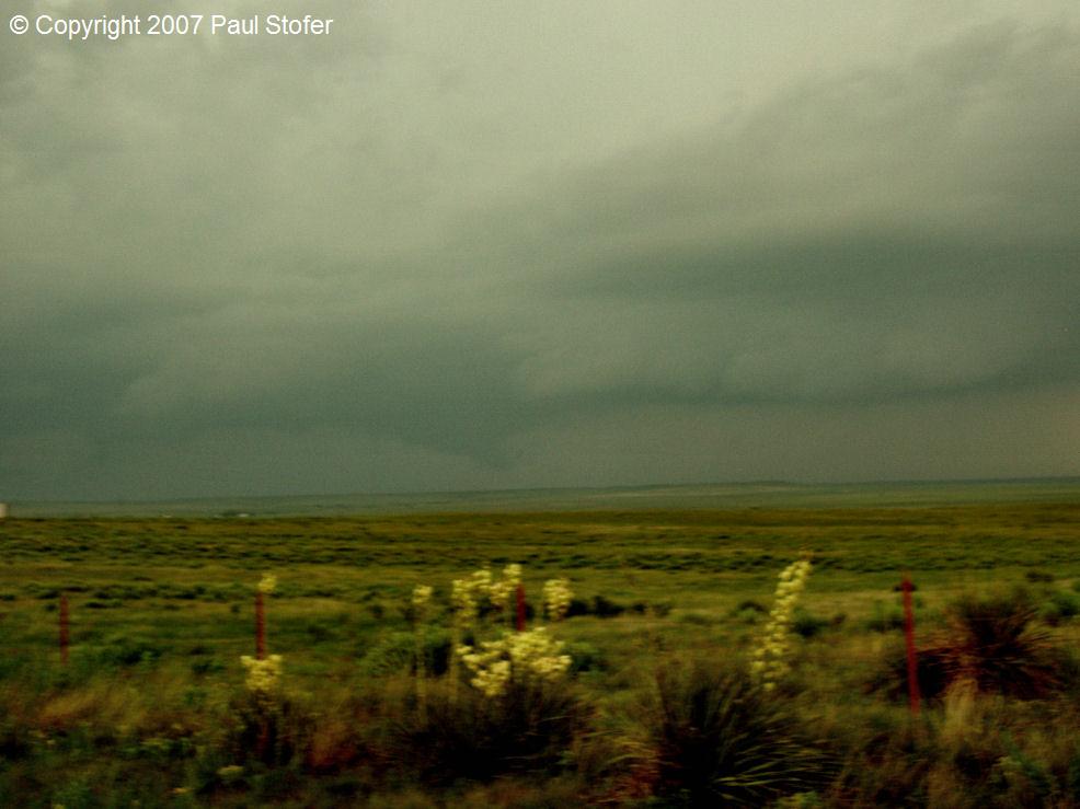
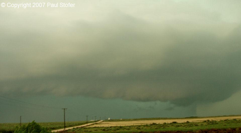
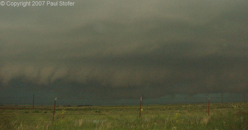
April 24th, 2007

Today’s outlook looked great. Based on the 07Z WRF model, the winds look awesome and shifted great between the 850's and 500mb with a narrow streak of 90 knots shooting right through Wichita Falls at 0Z. The WRF simulated reflectivity showed a nice supercell going up right over this target and moving to the Northeast. It also showed another supercell going up just Southwest of Dallas / Fort Worth and shooting up through the Metroplex. Dewpoints were in the 70's with temperatures in the 80s. Just a 10 degree dewpoint spread. Surface CAPE was near 3000 j/kg. With the dryline bulge supposed to push through between 23-01Z, the Red River and just Southwest of Dallas looked to be good target areas. I left Dallas at 9AM and headed to Thackerville, OK to meet up with my chase partner Jeremy Wilson. We left Thackerville around 10:30AM and headed West on 82 towards Wichita Falls. Around 11:30AM precipitation had already begun to break out just West of Wichita Falls. Very quickly, the dryline stalled west of Wichita Falls and the storms started to advance further and further South, so we moved towards Bowie, TX. At this time, the SPC issued a PDS Tornado Watch for North Texas. When we arrived in Bowie, storms began to get their act together near Brownwood. TX. We continued South, and met with the first storm that fired near Brownwood. We intercepted this storm South of Weatherford.  We watched the storm move in from our Southwest and noticed a lowering to our Southwest with a funnel getting close to the ground. We checked radar, which also showed an area of rotation. Very briefly we observed a very small debris cloud from this funnel, then the storm rapidly decayed and went outflow dominant. The storm at this time was close to Granbury, which had confirmed tornado damage by the National Weather Service. This cell became disorganized and a new one formed just West of Fort Worth. We followed it East on I-20, and it began to show signs of rotation. This storm became Tornado Warned and we followed it into Tarrant County. We observed a funnel with rain bands getting sucked into what I’m assuming was the inflow jet, but did not visually see a tornado on the ground. The National Weather Service can’t confirm tornado damage either, so at this time I will say there was not a tornado. For a high risk day, it was fairly disappointing. Everything went to a linear grunge fest very early on, and didn’t really recover. I managed to get some video and good still photographs as well as the 1 tornado, but it was overall a very disappointing day.

DATA AND PHOTOGRAPHS

Day 1 Tornado Outlook    Surface Dewpoints Left: Tornado Probabilities, Right: Dewpoints

Visible Satellite    Tornado Watch Left: Satellite, Right: Tornado Watch

Radar Image    Radar Grab Left and Right: Radar

Echo Tops    Tornado near Granbury, Texas Left: Radar, Right: Granbury Tornado

Rotating Lowering in Parker County    Rain and Hail core in Parker County, TX Left: Rotating Lowering, Right: Rain and hail Core

Impressive Roll Cloud near Weatherford, Texas    Storm Outflow Left: Roll Cloud, Right: Storm outflow

Rotating Lowering and Scud near Weatherford, Texas  Interesting street sign in Decatur, Tx  Left: Rotating scud bomb, Right; Street sign in Decatur, Tx


May 7th, 2007

Today wasn't a big day. I got off work and did more storm spotting than anything else. Around 7PM I noticed storms were firing West of Decatur, Texas. I headed North on I35 towards Denton and pulled to the side of the road at 380. Here I observed an incredible lightning show with a very nasty looking green, thick, rain and hail core to my North. As the storm crossed I35 I saw a little weak rotation and a lowered base cross the highway. It wasn't very organized, but at any rate I called in to Kristine Kahanek at the CBS studios to get an idea of what she thought about the recent radar scan. Mid and low level rotation wasn't very interesting so we weren't very concerned that it would produce a tornado. As it crossed the highway the lightning picked up and the wall-cloud decayed. Another storm fired Southwest of Decatur so I drove West on 380 and intercepted that storm. Again, a very mean looking core and incredible lightning. With the daytime heating going away, the storms went linear and then died out rapidly. The Denton storm moved into Sherman, TX around 9:30PM and went Tornado Warned but never produced a Tornado. Today was not a full fledged chase day, but more so a nice close-to-home severe weather observing day.

VIDEO CAPTURES

 Storm Updraft   Left: Storm updraft, Right: Storm Base

Storm base crossing I35    Core Left: Storm Base, Right: Core with lightning

Wall Cloud in Decatur, TX    Wall cloud in Denton, Texas Left and Right: Wall clouds in Decatur and Denton

Lightning storm in Denton, Texas     Left: Lightning storm in Denton


May 22nd, 2007

Eric Nguyen and I departed from his home in North Texas at 8AM for our target area around Hill City, Kansas. We went North on I35 until we reached Salina, KS around 1PM. We stopped in Salina and gathered data before making our way West on I70 towards WaKeeney. We stopped again and gathered more data in Hays and met up with Scott Currens, Brian Stertz and Eric Flescher. We conversed for a short while before departing. We continued West until we reached Quinter, Kansas. At this time storms began firing just to our Southwest. The initial storm began to get seeded by another storm to its South so we chose to play the tail-end Charlie. We sat in Quinter and watched storm initiation. Amos Magliocco and Scott Eubanks met up with us while we observed the storm develop a solid updraft along with an intense rain core. The storm produced a couple of downbursts as it slowly moved to the Northeast at 5MPH. After it crossed I70 we retreated back East and then drove North on Saint Peter Rd towards Saint Peter, Kansas. At this time we were 18 miles SW of Hill City, Kansas. The storm began to produce a very impressive base underneath a incredible vault. The vault was absolutely amazing, and the whole storm was spinning. At 7:02PM the storm produced a developing tornado 2 miles north of Saint Peter, Kansas. We called 911 and reported the imminent tornado. Very quickly, the storm produced a beautiful backlit cone tornado at 7:12PM. The tornado shifted between a cone and a tube a couple of times, but only briefly had a fully condensed funnel all the way to the ground. We didn't observe any structure damage, but did see a dust / debris cloud underneath the funnel. After 10 minutes of being on the ground the tornado quickly roped out and we drove East on a wet, rocky, and sandy CR406 to get some more structure shots. The storm began to move due East and followed us at a whopping 10MPH. Amos began his long trek back to Texas while Scott, Eric and I drove through an intense lightning storm with thunder that sounded like mortar fire. After about an hour of shooting structure photos we began to lose daylight and called it a day. We traveled to Hays, Kansas to stay the night before we left for the Texas panhandle for tomorrows chase. While in Hays, another storm moved into town that quickly went Tornado warned. While at the hotel, the sirens sounded as the storm moved into town. We ran into Tony Laubach, Tim Samaras, and some others. The fire department raced up and down the highway advising people to take shelter over their PA system. When the storm arrived, the tornado threat was gone and the storm appeared to be outflow dominant. We observed quarter to golf ball sized hail along with estimated winds of 60MPH associated with its passage. Unfortunately the data logger did not gather data during the event. We uploaded our photos and video, and got some rest before departing for Canadian, Texas at 9AM.

CHASE PHOTOS

Saint Peter, Kansas Storm Initiation    Saint Peter, Kansas thunderstorm base and core looking to the West Left and right: Storm initiation and core

Amos Magliocco and Scott Eubanks watching the Saint Peter, Kansas storm.    Saint Peter, Kansas storm intensifying Left: Amos and Scott, Right: Saint Peter, KS updraft

Saint Peter, Kansas Storm Base    Saint Peter, Kansas storm base with lowering Left: Storm base, Right: storm base

Saint Peter, Kansas storm vault    Saint Peter, Kansas Vault Left and Right: Saint Peter, KS vault

Saint Peter, Kansas vault    Saint Peter, Kansas vault Left and Right: Saint Peter, KS vault

Saint Peter, Kansas developing tornado    Saint Peter, Kansas storm on the verge of producing a tornado Left and right: Saint Peter, KS : Satellite, Right: Tornado Watch

Saint Peter, Kansas - Tornadic Thunderstorm producing a funnel / developing tornado    Saint Peter, Kansas tornado at touchdown Left: Developing tornado in Saint Peter, KS, Right: Tornado

Saint Peter, Kansas tornado    Saint Peter, Kansas tornado Left and Right: Saint Peter, KS Tornado

Saint Peter, Kansas - Tornado    Saint Peter, Kansas tornado Left and Right: Saint Peter, KS Tornado

Saint Peter, Kansas - Tornado prior to roping out  Left: Saint Peter, Kansas Tornado before roping out


May 23rd, 2007

Eric Nguyen, Scott Eubanks, and myself left Hays, Kansas around 9AM for our target just North of Canadian, Texas. Before we departed we met up with Jeff Snyder and Howie Bluestein's crew with the new Phased Array and UMass mobile radars. After conversing with them, taking a few photos, and some video we headed South on 183. We went through Woodward, then West on 60 through Arnett, OK and Glazier, TX. Storms began to fire NW of Canadian, Texas so we took 83 Northwest. We parked in the grass off of 83 and watched a very ragged wall cloud and funnel approach 83. Here we ran into Al Pietrycha whom stated that himself and a Sheriffs deputy observed a weak and brief circulation on the ground for about 20 seconds. Eric and I also observed this tornado before it lifted and the HP storm began to cross the highway. The Doppler on Wheels, scout, and TIV were on this tornado as well. The DOW was scanning the core, while the TIV attempted to punch it. Eric and I observed some small, quarter sized hail as the core passed. We turned back East and watched the core cross the highway and took some still photographs and video. We continued SE on 83, then North on 23 and observed what appeared to be another funnel reaching towards the ground. After shooting more structure we drove East on Perry Rd in an attempt to flank the storm so we could get some structure shots. By this time our road had become a 1 lane, dirt, mud, sandy mess. The structure was again amazing and the lightning was also intense. We continued to flank it by taking CR6 to Duke Rd all the way to SR305. We went North into Lipscomb on 305 and parked in the grass and watched an amazing shelf cross the highway just to our Northwest. Here we met up with Bob Fritchie and Rachel Sigler. We talked for about half an hour and watched the storm pass by before we called it a day and headed back home towards Dallas. Another tornado and incredible structure made this 2-day chase trip perfect.

CHASE PHOTOS

Phased Array Mobile radar in Hays, Kansas    Canadian, Texas tornadic thunderstorm core Left: Eric with the phased Array mobile Radar, Right: Storm core

Canadian, Texas hail and rain core    Doppler on Wheels, Scout, Tornado Intercept Vehicle (TIV) scanning the storm core Left: Canadian, TX storm core, Right: DOW, TIV, Scout

Canadian, Texas developing tornado    Canadian, Texas developing tornado Left and Right: Developing tornado in Canadian, TX

Canadian, Texas tornado    Canadian, Texas tornado Left and Right: Canadian, TX  tornado

Eric Nguyen taking storm photos    Canadian, Texas storm structure and vault Left: Eric taking stills, Right: storm vault

Canadian, Texas storm structure    Canadian, Texas Structure Left and right: Canadian, Texas structure

Canadian, Texas - Storm Structure    Canadian, Texas - Storm Structure Left and right: Canadian, TX structure

Canadian, Texas - Possible Tornado    Canadian, Texas - Storm Structure Left: Possible tornado, Right: Structure

Canadian, Texas - storm structure    Canadian, Texas - Storm Structure Left and Right: Canadian, TX Structure

Canadian, Texas - Storm Structure  Canadian, Texas - Storm Structure   Left and Right: Canadian, TX Structure


October 14th, 2007

Amos Magliocco and myself chased SW Oklahoma today. We started the day sitting in a motel parking lot getting data through WIFI in Altus, Oklahoma. We waited for convective initiation with Bob Fritchie and Rachel Sigler while listening to the Dallas Cowboys game. Around 22Z we observed some TCu forming to our WSW. We decided that this was the cap breaking and that we must play this option. We traveled through Blair, Roosevelt, and other small towns while we chased the strengthening cell. We observed mild to moderate rotation with this storm, along with some gustnadoes and a possible tornado. The third gustnado became fairly intense for a gustnado and did have motion above the ground circulation. After reviewing photos and video, I'm fairly confident this was a very weak EF0/EF1 tornado. The photos do show the dust swirl on the ground along with a dusty transparent tube extending into the cloud base in an S shape, and it looked very similar to the Attica tornado. My assumption is that somehow this gustnado rapidly intensified and somehow aided possible tornadogenesis. After observing this "gustornado" we stopped and observed the sunset behind the now outflow dominant storm. We set up for structure photos and got blasted by 69F outflow winds. We traveled back South to head home and managed to get a few lightning stills and called it an afternoon. 

CHASE PHOTOS

Storm Initiation    Bob, Rachel, and Amos all watching storm initation Left: Storm Initiation, Right: Amos, Bob and Rachel

Storm Structure in Oklahoma    Storm with Wall Cloud Left: Convection, Right: Maturing Storm Base

Linear Structure    Possible Tornado Left: Line approaching us, Right: Possible Tornado

Possible Tornado    End of the day Storm Structure Left: Possible Tornado, Right: Approaching Shelf

End of day storm structure  Left: End of day structure in the form of an amazing stacked shelf